WorldlyWorldlyMapsFacts
Play
FlagsWords
Sign inGet started
Sign up
Worldly
MapsFactsPlayFlagsWords
Sign inGet started
Sign up

Country guides

United KingdomSouth KoreaMexicoGermanyBrazilFrance

Maps

EuropeAsiaAfricaNorth AmericaSouth AmericaOceania

Flags

EuropeAsiaAfricaNorth AmericaSouth AmericaOceania

Facts

EuropeAsiaAfricaNorth AmericaSouth AmericaOceania

Words

EuropeAsiaAfricaNorth AmericaSouth AmericaOceania

Citizenship tests

United States 2025 editionUnited States 2008 editionDenmarkSweden

Worldly

BlogGet in touchPrivacy policyTerms
ยฉ 2026 worldly.academy
  1. Country guides
  2. Brazil
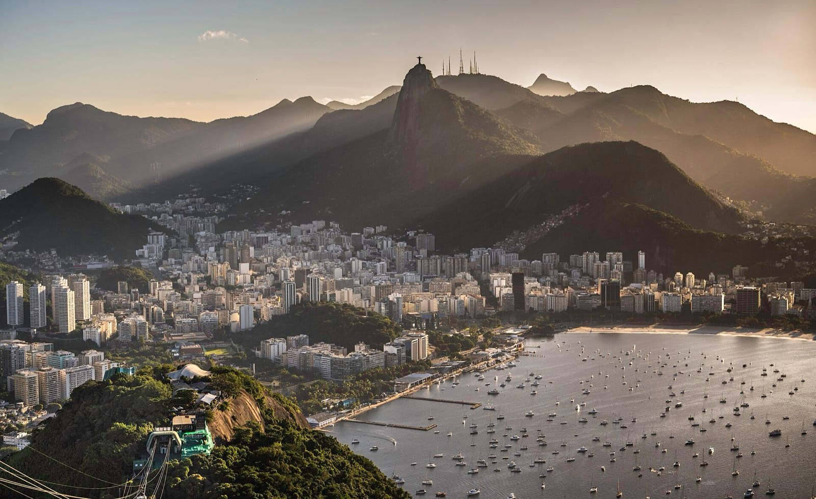
Rio de Janeiro at sunset seen from Sugarloaf, with Corcovado behind the city and Botafogo bay in front of it
Rio de Janeiro at sunset seen from Sugarloaf, with Corcovado behind the city and Botafogo bay in front of it. Wilfredor, CC0, via Wikimedia Commons
The Brazil guide

๐Ÿ‡ง๐Ÿ‡ทEverything you need to know about Brazil, all in one place

Brazil stretches from the Amazon basin to the grasslands of the south, with regional traditions that reach far beyond Rio. Explore its states and cities, then discover the history and daily life behind the places. The Portuguese lessons cover European usage, with some vocabulary and pronunciation that differ in Brazil.

๐Ÿ—บ๏ธ Maps 0/84๐Ÿ“š Facts 0/10๐Ÿ’ฌ Portuguese 0/10
Brazil ยท Facts

Read it, then make it stick

Choose a topic
Selected topic

Geography of Brazil

Follow the Amazon across the north, then explore the highlands and the long Atlantic coast. The state borders help make sense of a country that covers much of South America.

Open the full Brazil facts course โ†’
The Juruรก River meandering through the Amazon basin, photographed from the International Space Station
Topic 1 of 10
๐Ÿ—บ๏ธ
Geography of Brazil
2 rounds ยท 8 questions ยท 20 seconds each
1The Amazon & physical landscape2States, regions & coastline
โš”๏ธ

Plays right here, no account needed. Signing up is what keeps your progress.

Alexander Gerst, CC BY-SA 2.0, via Wikimedia Commons
Brazil ยท Maps

Know the shape of the country

Start with the twenty-six states and the Federal District. Then place the cities and explore the rivers and waters that connect different parts of the country.

Pick a map. It opens and plays right here.
  • See the complete list โ†’
  • See the complete list โ†’
  • See the complete list โ†’
Brazil ยท Words

Take Portuguese with you

Choose a Portuguese lesson
Lesson 1 of 10

Greetings and politeness

Hello, thanks, please: the ten openers everything else builds on.

Open all 10 Portuguese lessons โ†’
Two people shaking hands across a cafe table
๐Ÿ‡ต๐Ÿ‡น
Greetings and politeness
10 words ยท 20 seconds each ยท 8 of 10 to pass
๐Ÿ’ฌWhat it means๐Ÿ—ฃ๏ธHow to say it
โš”๏ธ

Plays right here. Choose another lesson when this one ends.

rawpixel.com, CC0, via Wikimedia Commons
Explore more country maps

Keep going one country deeper

When you have had your fill of Brazil, every country here has maps of its own.

๐Ÿ‡ธ๐Ÿ‡ช Sweden๐Ÿ‡ฉ๐Ÿ‡ฐ Denmark๐Ÿ‡ฎ๐Ÿ‡ณ India๐Ÿ‡ฒ๐Ÿ‡ฝ Mexico๐Ÿ‡บ๐Ÿ‡ธ United States๐Ÿ‡จ๐Ÿ‡ณ China๐Ÿ‡น๐Ÿ‡ท Turkey๐Ÿ‡ซ๐Ÿ‡ท France๐Ÿ‡ฏ๐Ÿ‡ต Japan๐Ÿ‡ฉ๐Ÿ‡ช Germany๐Ÿ‡ช๐Ÿ‡ธ Spain๐Ÿ‡ฌ๐Ÿ‡ง United Kingdom๐Ÿ‡ฎ๐Ÿ‡น Italy๐Ÿ‡ฐ๐Ÿ‡ท South Korea