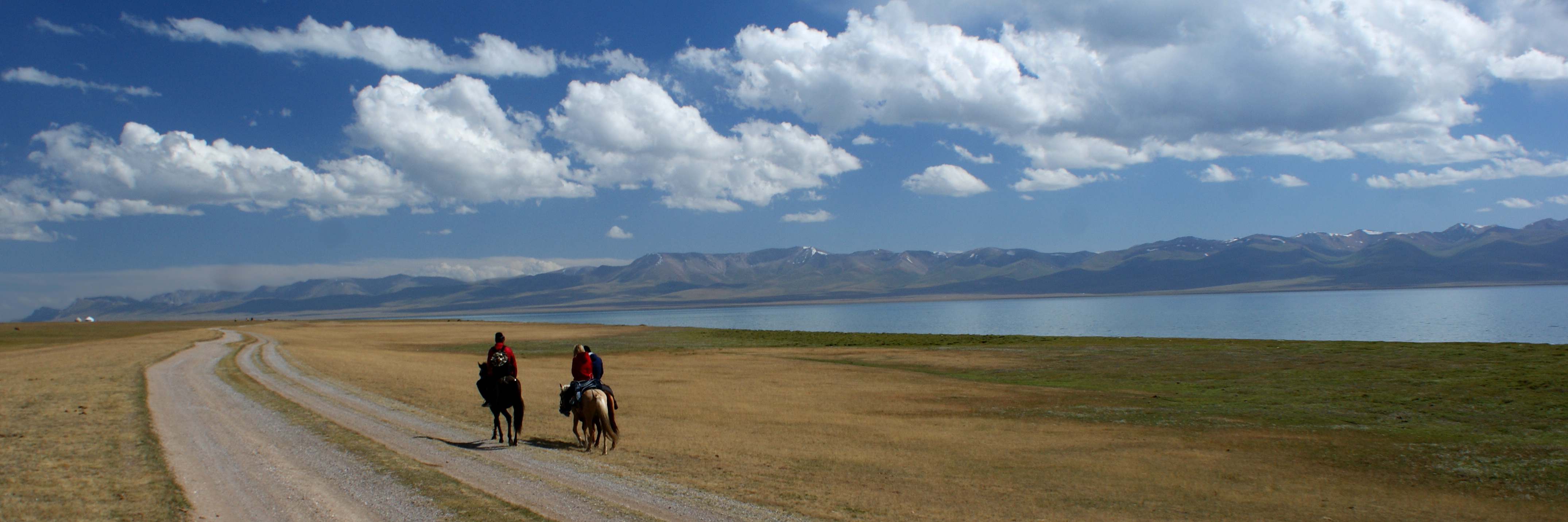
Everything you need to know about Kyrgyzstan
Explore Kyrgyzstan from Bishkek and Osh to Issyk-Kul, Silk Road towns and high summer pastures. Place sixteen cities and towns, find a lake and a reservoir, discover sixteen sights and ten illustrated topics with thirty answered questions, then begin Kyrgyz.
Read it, then make it stick
Geography of Kyrgyzstan
Tian Shan heights, Issyk-Kul and valleys that connect a landlocked country.
Know the shape of the country
Place sixteen city and town centres, including Manas, formerly Jalal-Abad. Then distinguish Issyk-Kul from Toktogul Reservoir. Pins identify settlement centres rather than municipal boundaries. The two water targets are a selection, not a complete network. Natural Earth outlines are generalised reference geometry and do not show current water levels or resolve border changes.
Places worth visiting
Essential · Archaeology
Burana Tower
The minaret marks the archaeological site of Balasagun. Surviving structures, earthworks and displays help explain an important Silk Road settlement. Burana is part of the Chang’an-Tianshan World Heritage property.
Sixteen reference places connect Silk Road archaeology, living religious sites, cities and mountain landscapes. Landscape pins are orientation points; check current access, weather and permit rules before visiting. Essential is our shortlist for a first trip, and worth a detour goes further. Select a pin to read about a place, then play the map and find them all.
Take Kyrgyz with you
Greetings and politeness
Hello, please, thank you, sorry: the ten openers everything else builds on.
Keep going one country deeper
When you have had your fill of Kyrgyzstan, the countries marked guide have a page like this one, and every other has maps of its own.
AfghanistanGuide AlbaniaGuide AlgeriaGuide AndorraGuide AngolaGuide ArgentinaGuide ArmeniaGuide AustraliaGuide AustriaGuide AzerbaijanGuide BahamasGuide BahrainGuide BangladeshGuide BelarusGuide BelgiumGuide BhutanGuide BoliviaGuide Bosnia and HerzegovinaGuide BotswanaGuide BrazilGuide BruneiGuide BulgariaGuide CambodiaGuide CanadaGuide ChadGuide ChileGuide ChinaGuide ColombiaGuide Costa RicaGuide Côte d’IvoireGuide CroatiaGuide CubaGuide CyprusGuide CzechiaGuide Democratic Republic of the CongoGuide DenmarkGuide Dominican RepublicGuide EcuadorGuide EgyptGuide El SalvadorGuide EstoniaGuide EthiopiaGuide FijiGuide FinlandGuide FranceGuide GeorgiaGuide GermanyGuide GhanaGuide GreeceGuide GuatemalaGuide GuyanaGuide HaitiGuide HondurasGuide HungaryGuide IcelandGuide IndiaGuide IndonesiaGuide IranGuide IraqGuide IrelandGuide IsraelGuide ItalyGuide JamaicaGuide JapanGuide JordanGuide KazakhstanGuide KenyaGuide KosovoGuide KuwaitGuide LaosGuide LatviaGuide LebanonGuide LibyaGuide LiechtensteinGuide LithuaniaGuide LuxembourgGuide MadagascarGuide MalaysiaGuide MaldivesGuide MaliGuide MaltaGuide MauritaniaGuide MexicoGuide MoldovaGuide MonacoGuide MongoliaGuide MontenegroGuide MoroccoGuide MozambiqueGuide MyanmarGuide NamibiaGuide NepalGuide NetherlandsGuide New ZealandGuide NicaraguaGuide NigerGuide NigeriaGuide North KoreaGuide North MacedoniaGuide Northern CyprusGuide NorwayGuide OmanGuide PakistanGuide PalestineGuide PanamaGuide Papua New GuineaGuide ParaguayGuide PeruGuide PhilippinesGuide PolandGuide PortugalGuide QatarGuide RomaniaGuide RussiaGuide San MarinoGuide Saudi ArabiaGuide SenegalGuide SerbiaGuide SingaporeGuide SlovakiaGuide SloveniaGuide SomaliaGuide South AfricaGuide South KoreaGuide SpainGuide Sri LankaGuide SudanGuide SurinameGuide SwedenGuide SwitzerlandGuide SyriaGuide TaiwanGuide TajikistanGuide TanzaniaGuide ThailandGuide Timor-LesteGuide TunisiaGuide TürkiyeGuide TurkmenistanGuide UkraineGuide United Arab EmiratesGuide United KingdomGuide United StatesGuide UruguayGuide UzbekistanGuide Vatican CityGuide VenezuelaGuide VietnamGuide YemenGuide ZambiaGuide ZimbabweGuide