Everything you need to know about Belarus
Explore Belarus from Minsk and the castles of Mir and Nesvizh to northern lakes, western forests and the wetlands of Polesia. Place sixteen cities and towns, discover sixteen heritage and nature sights and read ten illustrated topics.
Read it, then make it stick
Low uplands, northern lakes and the rivers of Polesia
Belarus is a landlocked country in eastern Europe, bordering Poland, Lithuania, Latvia, Russia and Ukraine. Its 207,600 square kilometres are mostly plains and gently rolling uplands. The Belarusian Ridge crosses the interior, and Dzyarzhynskaya Hill near Minsk reaches about 345 metres. Glacial landscapes and numerous lakes distinguish the north; Polesia, also written Polesie or Palesse, is a wider cross-border lowland region extending across the south.
Know the shape of the country
Place sixteen cities and towns in two learning groups: Minsk and the west, and the north, east and southern interior. These groups are separate from the six administrative regions and Minsk city. Pins mark curated settlement centres on a generalised Natural Earth outline; zoom in to distinguish nearby places.
Heritage and landscapes
Essential · World Heritage castle
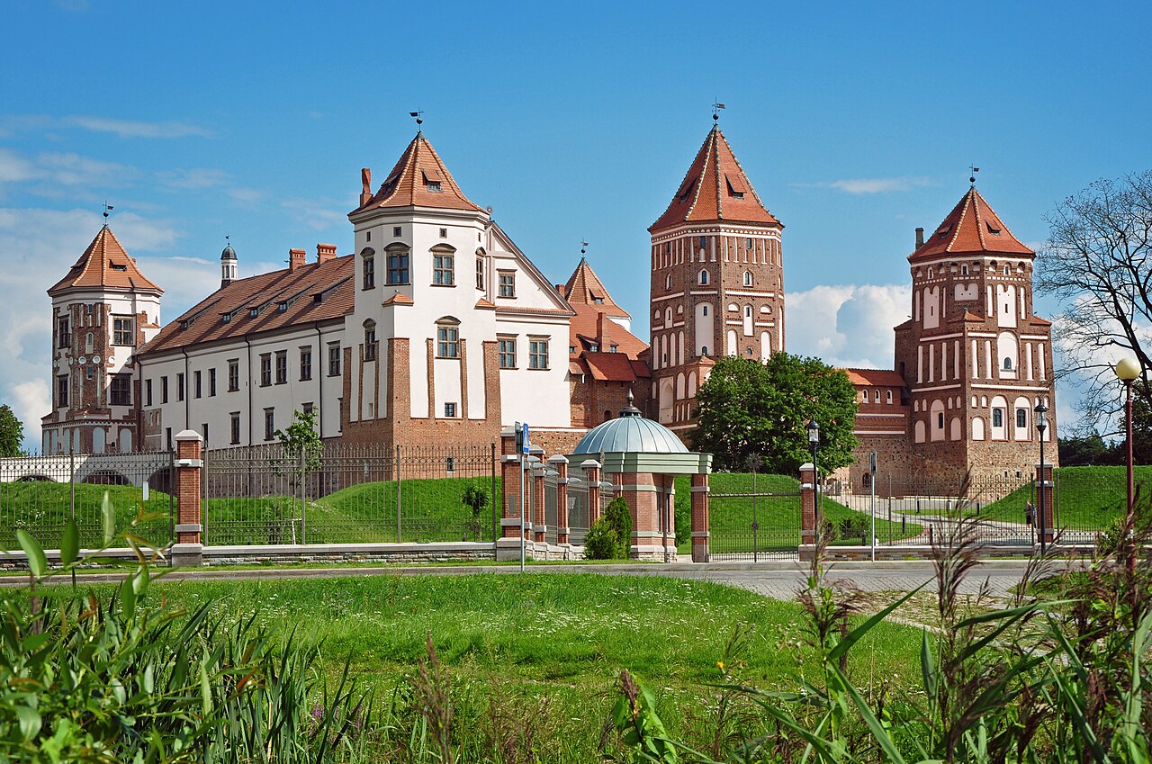
Mir Castle
The towers and courtyard combine Gothic, Renaissance and Baroque elements. Mir is a UNESCO World Heritage property in its own right, separate from the Radziwiłł complex at Nesvizh.
Locate sixteen places connecting castle towns, religious history, remembrance, northern lakes and old-growth woodland. Essential and Worth a detour indicate learning priorities. The UK FCDO advises against all travel to Belarus, checked on 20 October 2026. Pins identify representative locations rather than entrances, trails or confirmed public access. Consult current official advice before planning travel. Select a pin to read about a place, then play the map and find them all.
Take Russian with you
Greetings and politeness
Hello, please, thank you, sorry: the ten openers everything else builds on.
Keep going one country deeper
When you have had your fill of Belarus, the countries marked guide have a page like this one, and every other has maps of its own.
AfghanistanGuide AlbaniaGuide AlgeriaGuide AndorraGuide AngolaGuide ArgentinaGuide ArmeniaGuide AustraliaGuide AustriaGuide AzerbaijanGuide BahamasGuide BahrainGuide BangladeshGuide BelgiumGuide BhutanGuide BoliviaGuide Bosnia and HerzegovinaGuide BotswanaGuide BrazilGuide BruneiGuide BulgariaGuide CambodiaGuide CanadaGuide ChadGuide ChileGuide ChinaGuide ColombiaGuide Costa RicaGuide Côte d’IvoireGuide CroatiaGuide CubaGuide CyprusGuide CzechiaGuide Democratic Republic of the CongoGuide DenmarkGuide Dominican RepublicGuide EcuadorGuide EgyptGuide El SalvadorGuide EstoniaGuide EthiopiaGuide FijiGuide FinlandGuide FranceGuide GeorgiaGuide GermanyGuide GhanaGuide GreeceGuide GuatemalaGuide GuyanaGuide HaitiGuide HondurasGuide HungaryGuide IcelandGuide IndiaGuide IndonesiaGuide IranGuide IraqGuide IrelandGuide IsraelGuide ItalyGuide JamaicaGuide JapanGuide JordanGuide KazakhstanGuide KenyaGuide KosovoGuide KuwaitGuide KyrgyzstanGuide LaosGuide LatviaGuide LebanonGuide LibyaGuide LiechtensteinGuide LithuaniaGuide LuxembourgGuide MadagascarGuide MalaysiaGuide MaldivesGuide MaliGuide MaltaGuide MauritaniaGuide MexicoGuide MoldovaGuide MonacoGuide MongoliaGuide MontenegroGuide MoroccoGuide MozambiqueGuide MyanmarGuide NamibiaGuide NepalGuide NetherlandsGuide New ZealandGuide NicaraguaGuide NigerGuide NigeriaGuide North KoreaGuide North MacedoniaGuide Northern CyprusGuide NorwayGuide OmanGuide PakistanGuide PalestineGuide PanamaGuide Papua New GuineaGuide ParaguayGuide PeruGuide PhilippinesGuide PolandGuide PortugalGuide QatarGuide RomaniaGuide RussiaGuide San MarinoGuide Saudi ArabiaGuide SenegalGuide SerbiaGuide SingaporeGuide SlovakiaGuide SloveniaGuide SomaliaGuide South AfricaGuide South KoreaGuide SpainGuide Sri LankaGuide SudanGuide SurinameGuide SwedenGuide SwitzerlandGuide SyriaGuide TaiwanGuide TajikistanGuide TanzaniaGuide ThailandGuide Timor-LesteGuide TunisiaGuide TürkiyeGuide TurkmenistanGuide UkraineGuide United Arab EmiratesGuide United KingdomGuide United StatesGuide UruguayGuide UzbekistanGuide Vatican CityGuide VenezuelaGuide VietnamGuide YemenGuide ZambiaGuide ZimbabweGuide