Facts about Kyrgyzstan
Explore Kyrgyzstan from Bishkek and Osh to Issyk-Kul, Silk Road ruins and high summer pastures. Place sixteen cities and towns, find a lake and a reservoir, discover sixteen sights and ten illustrated topics, then begin Kyrgyz.
- Capital
- Bishkek
- Population
- 7.4 million, start of 2026
- Currency
- Som (KGS)
- State language
- Kyrgyz
- Official language
- Russian
- Highest peak
- Jengish Chokusu, 7,439 m
Kyrgyzstan · 0 of 20 rounds passed
Two timed rounds per topic, 20 seconds a question
Kyrgyzstan sits in the heart of Central Asia between Kazakhstan, Uzbekistan, Tajikistan and China. The northern Chuy valley holds Bishkek and Tokmok; Issyk-Kul anchors the northeast; Naryn and its high valleys occupy much of the interior. Talas lies in a separate northwestern valley. Osh, Manas and Batken connect the southwest with the Fergana basin.
Seven regions and the separately administered cities of Bishkek and Osh form the top-level administrative structure. The learning maps below focus on settlement centres and two major water bodies, rather than administrative boundaries. Summer pasture life, Silk Road archaeology, modern cities and several language communities offer different starting points for understanding the country.
Geography of Kyrgyzstan
Tian Shan heights, Issyk-Kul and valleys that connect a landlocked country.
- Which countries border Kyrgyzstan?
- Kazakhstan, Uzbekistan, Tajikistan and China. Kyrgyzstan is landlocked; its mountain valleys link very different northern, interior and southwestern landscapes.
- Are Issyk-Kul and Song-Kol the same lake?
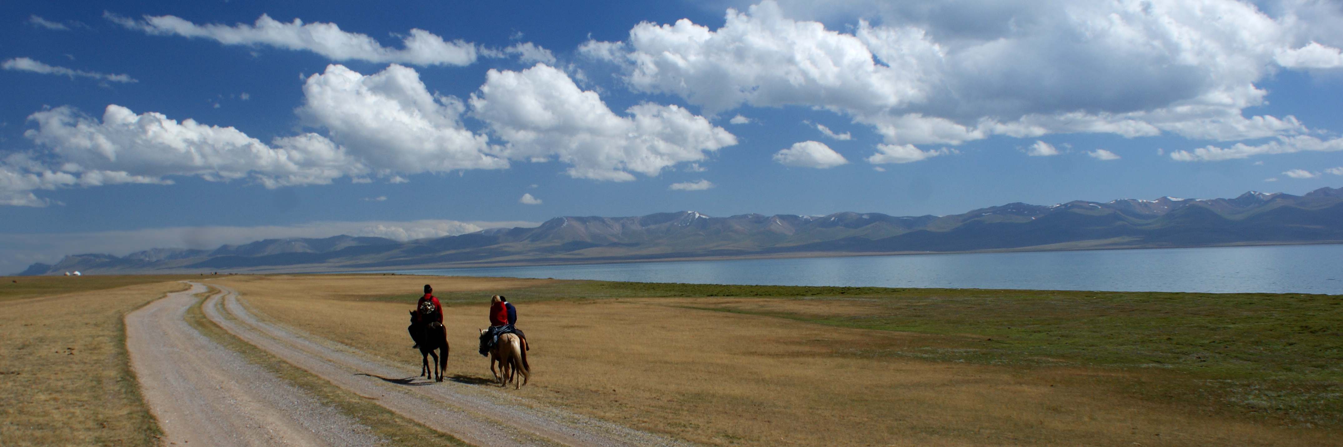
- No. Issyk-Kul is the much larger, slightly saline lake in the northeast. Song-Kol is a higher freshwater lake surrounded by summer pastures in the interior.
- Is Toktogul a natural lake?
- No. Toktogul is a reservoir on the Naryn River, important for hydropower and water regulation. Its water level changes with operating decisions and seasonal inflows.
More about Kyrgyzstan: geography
Kyrgyzstan is landlocked between Kazakhstan, Uzbekistan, Tajikistan and China. The Tian Shan dominates the country, while the Pamir-Alay rises in the southwest. Jengish Chokusu, also called Victory Peak, reaches 7,439 metres on the Chinese border. Bishkek lies in the northern Chuy valley; Osh stands at the eastern edge of the Fergana Valley. Mountain passes make distance on a map a poor guide to journey time.
Issyk-Kul is a large, slightly saline lake in a basin between mountain ranges. It normally remains unfrozen even in winter; this does not mean every part can never freeze. Song-Kol is a higher freshwater lake surrounded by summer pastures, or jailoo. The Naryn feeds the Syr Darya system, while the Chu flows north into Kazakhstan. Toktogul is a reservoir on the Naryn, not a natural lake.
History of Kyrgyzstan
Silk Road towns, the trauma of 1916, Soviet rule and independence in 1991.
- When did Kyrgyzstan become independent?
- On 31 August 1991, during the breakup of the Soviet Union. It had become a separate Soviet republic in 1936, after earlier forms of Soviet regional administration.
- What does Urkun refer to?
- The mass flight and suffering associated with the 1916 uprising against Russian imperial rule and its repression. Many people fled across mountain passes towards China.
- What were Balasagun, Suyab and Nevaket?
- Silk Road cities in the Chuy valley. Their remains are associated with Burana, Ak-Beshim and Krasnaya Rechka respectively, three distinct archaeological sites.
More about Kyrgyzstan: history
The Chuy valley preserves Silk Road settlements including Balasagun, Suyab and Nevaket. Their archaeological remains connect the region with trade, migration and several religious traditions. The history of Kyrgyz-speaking communities also reaches beyond modern borders, including the Yenisei region of Siberia. The Manas epic belongs to a living oral tradition, not a literal chronicle from which every early event can be reconstructed.
Kokand and then the Russian Empire extended power over parts of today’s Kyrgyzstan in the nineteenth century. The 1916 uprising and imperial repression led to mass death and flight towards China, remembered as Urkun. Soviet administration brought new borders, schooling, industry and coercive social change. A separate Kyrgyz Soviet republic was established in 1936. Kyrgyzstan declared independence on 31 August 1991; later political upheavals in 2005, 2010 and 2020 reshaped its institutions.
Language of Kyrgyzstan
A Turkic language written in Cyrillic, in a society with several working languages.
- What is the legal status of Kyrgyz and Russian?
- The constitution names Kyrgyz as the state language and Russian as an official language. These are different constitutional designations; both languages play important roles in public life.
- Which alphabet does Kyrgyz use in Kyrgyzstan?
- The standard written language uses Cyrillic, including the additional letters ң, ө and ү. The linked lessons show Kyrgyz spelling alongside pronunciation guidance.
- Does everyone in Kyrgyzstan speak the same home language?
- No. Kyrgyz, Russian, Uzbek, Dungan, Uyghur and other languages are used in different communities and households. The linked course teaches Kyrgyz rather than all of these languages.
More about Kyrgyzstan: language
Kyrgyz belongs to the Kipchak branch of the Turkic language family. Its standard alphabet in Kyrgyzstan is Cyrillic, with the additional letters ң, ө and ү. The constitution distinguishes Kyrgyz as the state language from Russian as an official language. Russian remains widely used in cities, education and commerce, but language use differs by household, generation and setting.
Uzbek is important in many southern communities; Dungan, Uyghur, Tajik and other languages also form part of the country’s linguistic life. Related Turkic languages share some features without being interchangeable. Salam is an informal greeting; salamatsyzby is a polite hello, and rakhmat means thank you. The linked Kyrgyz lessons introduce everyday phrases with Cyrillic spelling and pronunciation guidance.
Culture of Kyrgyzstan
Manas recitation, felt craft, komuz music and the changing life of the jailoo.
- What is a Manaschi?
- A performer of the Manas epic tradition. Recitation combines words, rhythm and gesture, and different performers transmit different versions of the epic trilogy.
- What is a jailoo?
- A summer pasture, often at higher elevations, used by herding households. Yurts may be set up there seasonally, but this does not describe every household’s way of life.
- Are shyrdak and ala-kiyiz identical?
- No. Both are felt-carpet traditions, but shyrdak uses stitched contrasting pieces while ala-kiyiz forms designs during felting. Craft knowledge passes through families and workshops.
More about Kyrgyzstan: culture
Manaschi perform versions of the epic trilogy Manas, Semetey and Seytek through recitation, gesture and rhythm. Akyns are improvising poets and singers, often associated with the three-stringed komuz. These roles overlap in wider cultural life but are not identical. Contemporary literature, film, theatre and popular music belong beside oral traditions in any picture of Kyrgyz culture.
Craftspeople make shyrdak and ala-kiyiz felt carpets using different techniques. The white felt ak-kalpak is an important form of men’s headwear, with variations in shape and decoration. A boz üy, or yurt, can serve pastoral households and host visitors on summer pastures. Many people live in permanent towns and villages; pastoral heritage does not mean the whole population follows a nomadic way of life.
Economy of Kyrgyzstan
Gold, farming, trade and migrant earnings, with hydropower linking water and electricity.
- What currency does Kyrgyzstan use?
- The Kyrgyz som, abbreviated KGS. It is a different currency from the Uzbek soʻm and the Tajik somoni, despite related names.
- Why do remittances matter in Kyrgyzstan?
- Earnings sent home by people working abroad support many households. Russia is a major destination, so changes in employment, migration rules and exchange rates can affect family incomes.
- Are Toktogul and Kambarata-1 the same dam?
- No. Toktogul is an existing hydropower and reservoir complex on the Naryn. Kambarata-1 is a separate development project involving regional cooperation and environmental and social planning.
More about Kyrgyzstan: economy
The currency is the Kyrgyz som, abbreviated KGS. Gold mining, including Kumtor, contributes to exports and public revenue, alongside services, trade, garments, construction and agriculture. Livestock, fruit, vegetables and other crops support livelihoods in very different ecological settings. Bishkek’s bazaars and transport corridors connect the economy with Kazakhstan, China and other trading partners.
Remittances from people working abroad, especially in Russia, support many households and expose them to changing employment and exchange rates. Hydropower supplies most domestic electricity, but winter demand and water availability create pressure on the system. Toktogul regulates the Naryn; Kambarata-1 is a separate hydropower development project. Decisions about dams involve financing, resettlement, ecosystems and downstream water needs as well as electricity.
Politics of Kyrgyzstan
The 2021 presidential constitution, parliament and the difference between rules and practice.
- Is Kyrgyzstan still a parliamentary republic?
- The 2021 constitution established a presidential system. The Jogorku Kenesh remains the national parliament, but describing the present system as parliamentary would be outdated.
- Was Jalal-Abad city renamed?
- Yes. A September 2025 law renamed the city Manas. Older maps and sources often still use Jalal-Abad; the city and the region are different administrative entities.
- What did observers report about the 2025 election?
- OSCE-led observers said the early parliamentary election was efficiently administered, while a restrictive campaign environment limited engagement and fundamental freedoms were increasingly constrained in practice.
More about Kyrgyzstan: politics
The 2021 constitution established a presidential system. The president heads the executive; the Jogorku Kenesh is the national, single-chamber parliament. Kyrgyzstan has seven regions and the separately administered cities of Bishkek and Osh. These statuses should not be collapsed into nine ordinary provinces. Constitutional rights and institutional names describe formal arrangements, while their operation requires separate scrutiny.
After the November 2025 early parliamentary elections, OSCE-led observers described efficient administration alongside a restrictive campaign environment and increasing limitations on fundamental freedoms. This guide therefore does not repeat the outdated description of Kyrgyzstan as a parliamentary democracy. Names change too: a September 2025 law renamed Jalal-Abad city Manas. The city’s former name remains useful for finding older maps and references; the regional name is a separate designation.
Nature & Wildlife of Kyrgyzstan
Snow leopards, walnut-fruit forests and water stored in mountain ice.
- What is special about Arslanbob?
- The area is associated with extensive walnut-fruit forests, mountain scenery and a settled community. Claims that a precise forest boundary is the world’s largest depend on definitions and are avoided here.
- Is Western Tien-Shan entirely in Kyrgyzstan?
- No. The World Heritage property is shared with Kazakhstan and Uzbekistan. Its Kyrgyz components include Sary-Chelek, Besh-Aral and Padysha-Ata.
- Why do glaciers matter to people downstream?
- Snow and ice affect the timing and supply of river water used by households, farms and hydropower. Changing glaciers can also alter hazards and seasonal water availability.
More about Kyrgyzstan: nature & wildlife
Snow leopards inhabit high mountain ecosystems, alongside ibex, argali and other wildlife. Arslanbob is associated with extensive walnut-fruit forests; the Western Tien-Shan World Heritage property protects important mountain biodiversity across Kyrgyzstan, Kazakhstan and Uzbekistan. Its Kyrgyz components include Sary-Chelek, Besh-Aral and Padysha-Ata. The reserve around Sary-Chelek combines lakes and wooded slopes rather than simply barren alpine terrain.
Glaciers and seasonal snow help regulate river flows used by farms, settlements and hydropower. Rising temperatures and changing ice affect water timing and mountain hazards. Earthquakes, landslides and severe weather also shape access. Ala-Archa near Bishkek offers mountain landscapes close to a city, but high-altitude routes and remote pastures still require appropriate preparation. Reserve boundaries and entry arrangements differ from a landscape pin on a learning map.
Food & Cuisine of Kyrgyzstan
Beshbarmak, boorsok and kymyz, alongside Dungan and Uyghur food traditions.
- What is beshbarmak?
- A meat and noodle dish commonly served with broth, with different recipes and serving customs across Central Asia. It is strongly associated with Kyrgyz cuisine but is not exclusive to it.
- What is ashlyan-fu?
- A cold noodle dish associated with Dungan cooking and particularly well known in Karakol. It illustrates the country’s varied culinary communities alongside pastoral foods.
- Does kymyz contain alcohol?
- It can. Kymyz is fermented mare’s milk, and fermentation produces alcohol. Ayran is a different fermented dairy drink; asking about ingredients is useful when choosing food and drink.
More about Kyrgyzstan: food & cuisine
Beshbarmak combines boiled meat with noodles and broth, with recipes and serving customs that vary. Boorsok are pieces of fried dough; manty are steamed dumplings, often filled with meat and onions. Plov, grilled meat and lagman noodles are also common. These foods belong to overlapping Central Asian culinary worlds rather than to one country alone.
Karakol is particularly associated with ashlyan-fu, a cold noodle dish connected with Dungan cooking. Kymyz is fermented mare’s milk and can contain alcohol; ayran is a different fermented dairy drink. Tea, bread and seasonal fruit often accompany meals. Ingredients, dietary choices and hospitality customs differ among families, so asking about a dish is more useful than assuming every household serves the same food.
Landmarks of Kyrgyzstan
Burana, Sulaiman-Too and Tash Rabat connect mountain routes with Silk Road history.
- Where is Burana Tower?
- Near Tokmok at the archaeological site of Balasagun in the Chuy valley. It belongs to the Chang’an-Tianshan Silk Roads property alongside other distinct sites.
- Why is Sulaiman-Too important?
- The mountain within Osh is a sacred landscape with long-standing traditions that combine different historical layers. UNESCO inscribed it as a World Heritage property in 2009.
- Do mountain and border-area pins prove that access is open?
- No. They identify reference places for learning. Weather, roads, protected-area rules and border-zone permits need current checks, particularly around remote routes and sensitive border areas.
More about Kyrgyzstan: landmarks
Burana Tower stands at the archaeological site of Balasagun near Tokmok. Along with Ak-Beshim, associated with Suyab, and Krasnaya Rechka, associated with Nevaket, it forms part of the transnational Chang’an-Tianshan Silk Roads property. These are distinct sites. Sulaiman-Too rises within Osh and is a separate World Heritage property, recognised for its sacred landscape and continuing traditions.
Tash Rabat is a stone caravanserai in a mountain valley south of Naryn. Karakol’s Dungan Mosque and wooden Holy Trinity Cathedral show different religious and architectural histories. Ala-Too Square and the State History Museum offer an urban starting point in Bishkek. The sights map also reaches Jeti-Ögüz, Skazka Canyon, Song-Kol and Sary-Chelek. Landscape pins are reference locations; opening times, permits and road access need current checks.
People & Society of Kyrgyzstan
Many communities, a modern literary tradition and families connected by migration.
- How many people live in Kyrgyzstan?
- The National Statistical Committee reports about 7.4 million residents at the start of 2026. The date matters: this is a rounded statistical figure, not a live population count.
- Who was Chinghiz Aitmatov?
- A major writer who worked in Kyrgyz and Russian. His internationally read books include Jamila and The Day Lasts More Than a Hundred Years.
- Who was Kurmanjan Datka?
- A nineteenth-century political leader associated with the Alay. Her life forms part of the history of local leadership, Kokand and Russian imperial expansion.
More about Kyrgyzstan: people & society
The National Statistical Committee reports about 7.4 million residents at the start of 2026. Kyrgyz form the majority, alongside Uzbeks, Russians, Dungans, Uyghurs, Tajiks and other communities. Sunni Islam is the largest religious tradition; Orthodox Christianity and other beliefs are also present. Ethnicity, home language and religious practice do not determine one another, and individual lives differ within every community.
Chinghiz Aitmatov wrote in Kyrgyz and Russian and brought works such as Jamila and The Day Lasts More Than a Hundred Years to international readers. Sayakbay Karalaev is remembered as a major Manaschi. Kurmanjan Datka was a nineteenth-century political leader in the Alay, while Bubusara Beishenalieva helped establish a modern ballet tradition. Education, migration, city life and rural work all contribute to contemporary society.