Facts about Western Sahara
Explore Western Sahara from the Atlantic coast and Dakhla Bay to the Saguia el Hamra and Saharan interior. Ten illustrated topics introduce its landscapes, history, culture and unresolved status.
- Capital
- Laayoune
- Largest city
- Laayoune
- UN listing
- Non-Self-Governing Territory
- Coast
- Atlantic Ocean
- Sahrawi language
- Hassaniya Arabic
- Currency in Moroccan-administered areas
- Moroccan dirham
Western Sahara · 0 of 20 rounds passed
Two timed rounds per topic, 20 seconds a question
Laayoune is the largest city and Dakhla lies on a peninsula farther south. Smara and the eastern settlements connect the coast with the arid interior. The maps include Tarfaya and the Sous River in neighbouring Morocco as regional context.
The UN lists Western Sahara as a Non-Self-Governing Territory. Morocco administers most of it, while the Polisario Front seeks independence. Worldly’s outline is a learning convention and does not show control lines or resolve sovereignty.
Geography of Western Sahara
A desert coast and seasonal channels
- Where is Western Sahara?
- On the Atlantic coast of northwest Africa, between Morocco, Algeria and Mauritania.
- Is the Saguia el Hamra always flowing?
- No. It is an intermittent watercourse whose flow varies with rainfall.
- Why does the water map extend north?
- The Sous is included as regional context and its mapped course is not clipped at a political border.
More about Western Sahara: geography
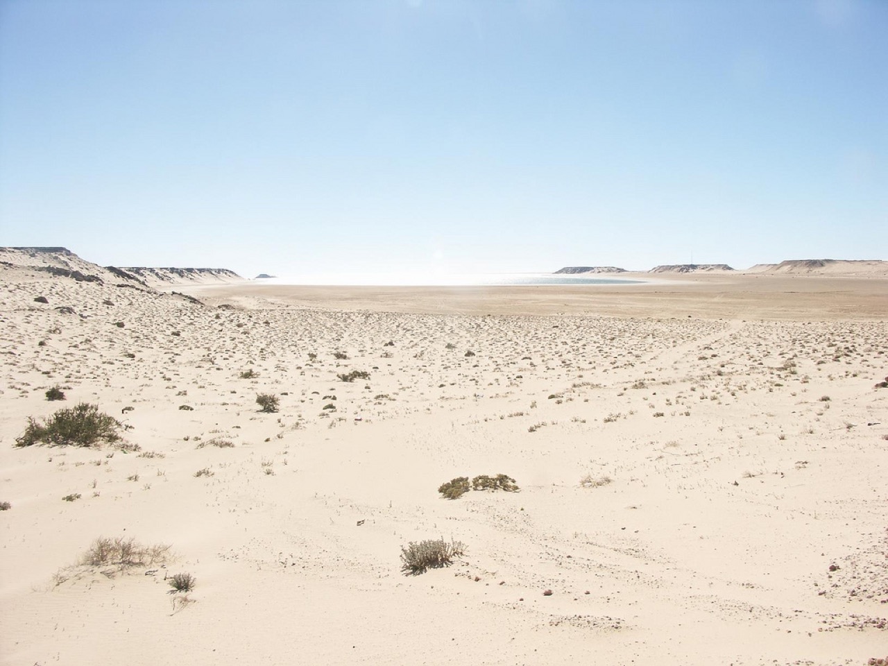
Western Sahara lies on the Atlantic edge of the Sahara, south of Morocco and west of Algeria and Mauritania. Its largest city, Laayoune, stands near the Saguia el Hamra; Dakhla occupies a peninsula beside a long bay. Broad rocky plains, dunes and dry valleys contrast with the productive ocean.
Rainfall is scarce and uneven. The Saguia el Hamra is an intermittent watercourse, not a permanently flowing river. NASA describes its lower water disappearing into a lake and sand before the sea. The waters map also follows the Sous River in neighbouring Morocco and the North Atlantic far beyond the territory.
History of Western Sahara
Spanish rule and an unfinished decolonisation
- Who administered Spanish Sahara?
- Spain administered the territory until 1976.
- When did Mauritania withdraw its claim?
- In 1979.
- What is MINURSO?
- The United Nations Mission for the Referendum in Western Sahara, established in 1991.
More about Western Sahara: history
Saharan trade and pastoral movement long connected the Atlantic coast with communities across the desert. Spain administered the territory as Spanish Sahara until 1976. In 1975 Morocco and Mauritania asserted claims, opposed by the Polisario Front; fighting followed the Madrid accords.
Mauritania withdrew its claim in 1979. Morocco came to administer the area it vacated, while war continued with the Polisario Front. A UN peacekeeping mission, MINURSO, was established in 1991 as part of a settlement plan. A referendum envisaged under the plan has not taken place.
Language of Western Sahara
Hassaniya, Arabic and Spanish
- What language is central to Sahrawi oral culture?
- Hassaniya Arabic.
- Why is Spanish present?
- It reflects the period of Spanish administration and later connections with Spanish-speaking communities.
- Do the linked Arabic lessons teach Hassaniya?
- No. They introduce general Arabic, not a dedicated Hassaniya course.
More about Western Sahara: language
Hassaniya Arabic is an important language of Sahrawi communities and carries a rich oral tradition of poetry and storytelling. Its use crosses modern boundaries into Mauritania and neighbouring parts of the Sahara. Other Arabic varieties, Amazigh languages, Spanish and French are also used by different communities.
Spanish reflects the history of Spanish administration and links with the diaspora; French and Moroccan Arabic have roles in Moroccan-administered areas. Worldly’s Arabic lessons teach general Arabic rather than the Hassaniya dialect, whose everyday vocabulary and pronunciation have distinctive forms.
Culture of Western Sahara
Poetry, music and hospitality
- How is Sahrawi history shared?
- Poetry, storytelling and music carry memories and cultural expression.
- What role can tea play?
- Preparing and sharing tea is a social gesture of hospitality.
- Where do these traditions continue?
- In the territory, refugee camps and diaspora communities.
More about Western Sahara: culture
Oral poetry and music are ways of preserving memory, conveying news and expressing identity among Sahrawi communities. Traditions developed in pastoral settings and continue in cities, refugee camps and diaspora communities, changing with the circumstances of each generation.
Tea preparation is an important gesture of hospitality and a social occasion. Clothing, song and storytelling vary between families and places; no single account captures the experiences of all Sahrawis or all residents of the territory.
Economy of Western Sahara
Fishing, phosphate and livelihoods
- What mineral is mined at Boucraa?
- Phosphate.
- What supports coastal livelihoods?
- Fishing and related trade are important along the Atlantic coast.
- Why are resources politically contested?
- Their use and benefits are connected to the unresolved status of Western Sahara and the rights of its people.
More about Western Sahara: economy
The Atlantic supports fishing and related activity, while phosphate is mined at Boucraa. Trade, public services and construction also support livelihoods in Moroccan-administered towns. The dry climate makes water supply a central concern for settlement and agriculture.
Natural resources are politically contested because the territory’s final status is unresolved. The presence of a mine or fishery does not by itself answer questions about consent, distribution of benefits or sovereignty.
Politics of Western Sahara
Competing claims and the UN process
- How does the UN list Western Sahara?
- As a Non-Self-Governing Territory.
- What does the Polisario Front seek?
- Independence for Western Sahara through the Sahrawi Arab Democratic Republic.
- Does the map decide sovereignty?
- No. Its outline is a learning convention and does not show current control.
More about Western Sahara: politics
The UN lists Western Sahara as a Non-Self-Governing Territory. Morocco claims the territory and administers most of it. The Polisario Front seeks independence and proclaimed the Sahrawi Arab Democratic Republic, which is a member of the African Union.
A long defensive berm separates Moroccan-controlled areas from areas to its east associated with the Polisario Front. The situation remains contested and the UN seeks a political settlement. Worldly’s separate outline is an educational convention: it neither settles sovereignty nor depicts current lines of control.
Nature & Wildlife of Western Sahara
Wetlands beside arid desert
- What habitats are found in Dakhla Bay?
- Seagrass beds, tidal flats and other coastal wetland habitats.
- Why are wetlands important to birds?
- They provide feeding and resting habitat, including for migratory waterbirds.
- Why can a mapped shoreline change?
- Tides, rainfall and other environmental changes alter water coverage.
More about Western Sahara: nature & wildlife
The land is arid, but the Atlantic supports marine life and coastal wetlands. Dakhla Bay contains seagrass beds, tidal flats and habitat used by fish and migratory birds. Ramsar records the bay as a wetland of international importance.
Inland plants and animals are adapted to scarce and irregular rainfall. Seasonal watercourses and shallow groundwater matter for people and wildlife, while wetland boundaries and water levels change over time. A map is a reference, not a measure of today’s conditions.
Food & Cuisine of Western Sahara
Tea, grain, dates and coastal fish
- Which drink is associated with hospitality?
- Tea.
- What food connects coastal communities to the ocean?
- Fish.
- Do all families eat the same way?
- No. Food varies with family traditions, local markets and available ingredients.
More about Western Sahara: food & cuisine
Sahrawi food traditions reflect pastoral livelihoods and desert trade. Tea, dates, bread and dishes with meat appear in many households, with preparation and ingredients varying by family and occasion.
Fish is also important in coastal communities. In refugee camps and towns alike, access to ingredients, markets and assistance shapes everyday meals; food traditions adapt to changing circumstances.
Landmarks of Western Sahara
Bay, desert and historic Smara
- Where is Dakhla?
- On a peninsula beside a bay in southern Western Sahara.
- What does the historic Smara zawiya represent?
- A connection with religious learning and the town’s history.
- Are the map pins travel routes?
- No. They are approximate learning locations.
More about Western Sahara: landmarks
Dakhla’s long peninsula shelters a bay with extensive intertidal habitat. Farther north, Laayoune and its port sit near the lower Saguia el Hamra. Smara’s historic zawiya connects the inland town with religious learning and Saharan history.
The map’s landscape and settlement pins are approximate starting points for learning. They are not routes, park entrances or evidence that a place can safely be visited; conditions and access can change.
People & Society of Western Sahara
Lives across borders
- Where are the Sahrawi refugee camps?
- Near Tindouf in southwestern Algeria.
- How has displacement affected families?
- It has separated many families across the territory and international borders.
- Are all residents’ experiences alike?
- No. Residents and displaced communities have diverse backgrounds and perspectives.
More about Western Sahara: people & society
Sahrawi communities live in Western Sahara, refugee camps near Tindouf in Algeria, and diaspora communities abroad. Decades of displacement and the division of the territory have separated families, while communities have maintained connections through language, memory and family networks.
The population of the territory includes people with varied backgrounds and experiences. General descriptions cannot represent every resident’s identity or political view. The refugee camps near Tindouf are in Algeria, outside Western Sahara.