Facts about Angola
Explore Angola from Cabinda and the Atlantic coast to the central highlands, eastern river basins and the Namib Desert. Ten illustrated topics connect landscapes with history, languages, music, food and everyday life.
- Capital
- Luanda
- Official language
- Portuguese
- Currency
- Kwanza (AOA)
- Provinces
- 21
- Highest point
- Mount Moco, about 2,620 m
- Independence
- 11 November 1975
Angola · 0 of 20 rounds passed
Two timed rounds per topic, 20 seconds a question
Luanda faces the Atlantic in the northwest. Farther north, Soyo lies near the Congo estuary and Mbanza Kongo recalls the Kingdom of Kongo. Cabinda is an Angolan exclave separated from the main territory by the DRC. The city map includes both territories.
Benguela and Lobito connect the coast with Huambo, Cuito and Luena along the railway corridor. Lubango stands in the southern highlands above Moçâmedes and the desert coast. Twelve city pins and ten landmark locations introduce the country; the map does not depict provincial boundaries.
Geography of Angola
Atlantic shores, a high interior plateau and Cabinda’s separate northern territory.
- Where is Cabinda?
- North of the Congo River’s mouth, separated from Angola’s main territory by the DRC. It is part of Angola, not a separate country.
- What is Angola’s highest mountain?
- Mount Moco, about 2,620 metres high, in the central highlands.
- Which countries border Angola?
- The DRC, Zambia and Namibia border the main territory. Cabinda also borders the Republic of the Congo.
More about Angola: geography
Angola lies on the Atlantic coast of southwestern Africa. Its main territory borders the Democratic Republic of the Congo, Zambia and Namibia. Cabinda is an Angolan exclave north of the Congo River’s mouth, separated from the main territory by a strip of the DRC; it also borders the Republic of the Congo. Luanda, the capital, stands on the northwestern coast. The country covers about 1.25 million square kilometres.
A coastal plain rises through an escarpment to the central highlands, where Huambo and the Bié Plateau sit. Mount Moco reaches about 2,620 metres. The cold Benguela Current helps keep the southwest dry, and the Namib Desert continues north from Namibia. The Cuanza, also written Kwanza, flows entirely within Angola to the Atlantic. Rivers in the southeast feed the Okavango system beyond Angola’s borders. The map marks cities rather than provincial boundaries.
History of Angola
Kongo, Ndongo and Matamba, Portuguese rule, independence in 1975 and a civil war ending in 2002.
- When did Angola become independent?
- On 11 November 1975, after centuries of Portuguese rule and an armed liberation struggle.
- Who was Queen Njinga?
- A seventeenth-century ruler of Ndongo and Matamba who used diplomacy and military resistance against Portuguese expansion.
- When did the main Angolan civil war end?
- In 2002. Independence in 1975 did not bring an immediate end to armed conflict.
More about Angola: history
Angola’s history includes the kingdoms of Kongo, Ndongo and Matamba, as well as many other African societies. Mbanza Kongo was the capital of the Kingdom of Kongo, whose territory crossed several present-day national borders. Portuguese contact began in the late fifteenth century; Luanda was founded in 1576. Atlantic slave trading and later colonial forced labour caused immense suffering. Queen Njinga, also written Nzinga, ruled Ndongo and Matamba in the seventeenth century and negotiated and fought to defend her power against Portuguese expansion.
The armed struggle against Portuguese colonial rule began in 1961. Angola became independent on 11 November 1975, after Portugal’s 1974 revolution. Rival liberation movements fought over the new state, and the civil war drew in foreign governments and armies, including Cuban support for the MPLA and South African intervention against it. The main civil war ended in 2002. Reconstruction has rebuilt roads, railways and cities, while displacement, inequality and the legacy of landmines remain part of the country’s history and present.
Portuguese and Angola’s languages
Portuguese is official; Umbundu, Kimbundu, Kikongo and other Angolan languages shape everyday life.
- What is Angola’s official language?
- Portuguese. It is widely used alongside Angolan languages in homes and communities.
- Are Umbundu and Kimbundu the same language?
- No. They are distinct Bantu languages, associated especially with the central highlands and the northwestern region respectively.
- What language does the linked course teach?
- General Portuguese phrases. It is an introduction, not a course in every language spoken in Angola.
More about Angola: language
Portuguese is Angola’s official language and an important shared language in education, government, media and urban life. Angolan Portuguese has its own patterns of pronunciation and vocabulary. Many people use Portuguese as a home language, while others move between it and one or more Angolan languages. Portuguese should not be treated as the country’s only language, nor should all Angolan languages be described as Portuguese creoles.
Umbundu is associated especially with Ovimbundu communities in the central highlands, Kimbundu with Mbundu communities in the northwest, and Kikongo varieties with Kongo communities in the north. Chokwe, Nyaneka, Kwanyama and many others belong to a wider linguistic landscape that crosses national borders. The linked Worldly course introduces general Portuguese phrases; it does not teach Umbundu or Kimbundu, and regional usage can differ from the examples.
Culture of Angola
Semba, kizomba, kuduro, Carnival and Chokwe art connect local traditions with changing urban life.
- What is semba?
- An Angolan music and dance tradition associated especially with Luanda; it is distinct from Brazilian samba.
- Where did kizomba develop?
- In Angola, drawing on local music and wider Atlantic influences before spreading internationally.
- Does one art tradition represent all of Angola?
- No. Chokwe carving, urban music, oral traditions and contemporary writing belong to a diverse cultural landscape.
More about Angola: culture
Angolan music includes semba, a song and dance tradition linked especially with Luanda, and kizomba, which developed in Angola through local music and wider Atlantic influences. Kuduro combines electronic production, rhythm and energetic dance. These forms continue to change through performers, neighbourhoods and diaspora communities. Carnival groups bring dance, costume, percussion and satire into public life, with Luanda’s Carnival among the best-known celebrations.
Angola also has varied carving, weaving, oral storytelling and literary traditions. Chokwe masks and figures belong to specific artistic and social settings; one object cannot stand for every community. The seated figure known as O Pensador has become a national cultural symbol. Writers such as Pepetela and Ondjaki explore history, memory, power and everyday life. Cultural exchange with Brazil and Portugal reflects Atlantic connections shaped by slavery, colonialism, migration and contemporary collaboration.
Economy of Angola
Oil, diamonds, farming and the Lobito railway corridor link Angola to regional and global markets.
- What is Angola’s currency?
- The kwanza, abbreviated AOA.
- Why do oil prices matter to Angola?
- Oil provides a large share of export earnings and government revenue, so price and production changes affect public finances and foreign exchange.
- What is the Lobito Corridor?
- A regional transport and trade initiative centred on Lobito’s port and railway connections inland toward the DRC, with further links to Zambia being developed.
More about Angola: economy
Petroleum is central to Angola’s exports and public revenue, with important production offshore, including near Cabinda. Diamonds are another major export, especially from the northeast. Reliance on oil exposes the economy to changes in global prices and production. The currency is the kwanza, with the code AOA. Angola joined OPEC in 2007 and announced its departure in December 2023; its withdrawal took effect on 1 January 2024.
Farming, fishing, construction, services and small businesses support livelihoods beyond the extractive industries. Cassava, maize, beans and coffee connect rural producers with markets, while the coastal cities handle imports and exports. The Benguela Railway runs inland from Lobito through the central highlands toward the DRC. The wider Lobito Corridor aims to strengthen regional transport and trade, including links with Zambia; proposed extensions should not be confused with already operating rail lines.
Politics of Angola
A presidential republic with a 220-seat National Assembly and a provincial structure expanded to 21.
- How is Angola’s president chosen?
- The first candidate on the national list of the party or coalition receiving the most votes in the general election becomes president.
- How many members sit in the National Assembly?
- 220 members in a unicameral, or single-chamber, legislature.
- Does Angola still have 18 provinces?
- No. The territorial reorganisation expanded the total to 21; older maps and learning material may still show 18.
More about Angola: politics
Angola is a presidential republic. Under the 2010 constitution, the president is both head of state and head of the executive. The National Assembly is a single chamber with 220 seats. In general elections, voters choose party lists; the first candidate on the national list of the party or coalition receiving the most votes becomes president. This differs from holding a separate direct presidential ballot. The constitution sets presidential terms at five years, with a two-term limit.
The MPLA has governed since independence, while UNITA is the main opposition party. José Eduardo dos Santos was president from 1979 to 2017; João Lourenço first became president in 2017. Angola’s territorial reorganisation expanded the provincial total from 18 to 21, introducing Icolo e Bengo, Moxico Leste and the separate provinces of Cuando and Cubango in place of Cuando Cubango. The government’s current province directory lists 21. The city pins in this guide do not reproduce either the old or the new provincial boundaries.
Nature & Wildlife of Angola
Miombo woodlands, Cabinda’s forests, desert plants and the rare giant sable antelope.
- What is the palanca negra gigante?
- The giant sable antelope, an endemic subspecies of sable antelope and a national symbol of Angola.
- What kind of landscape does Iona protect?
- Desert, semi-desert and mountain landscapes in southwestern Angola, within the wider Namib region.
- Why are southeastern Angola’s rivers important beyond its borders?
- They feed the Okavango system, linking Angolan headwaters with downstream ecosystems in Namibia and Botswana.
More about Angola: nature & wildlife
Angola spans humid forests in Cabinda and the north, broad savannas and miombo woodlands inland, highland grasslands and the arid southwest. This range supports distinctive wildlife and plants. The giant sable antelope, palanca negra gigante, is an endemic subspecies and a national symbol. Its surviving populations are associated with Cangandala and the Luando reserve landscape. Welwitschia, a long-lived desert plant with two persistent leaves, occurs in the Namib region shared with Namibia.
Kissama, also written Quiçama, lies south of Luanda near the lower Cuanza, while Iona National Park protects desert and mountain landscapes in the far southwest. Conservation involves habitat protection, wildlife recovery and the livelihoods of surrounding communities. War damaged infrastructure and wildlife populations; landmines and unexploded ordnance make established local guidance essential in affected areas. The southeast’s headwaters also matter beyond Angola because rivers feed the Okavango system across Namibia and Botswana.
Food & Cuisine of Angola
Funge, calulu, chicken muamba and grilled-fish mufete, with recipes that vary by place and household.
- What is funge made from?
- Cassava flour or maize flour cooked with water into a thick paste, usually eaten with a sauce or stew.
- What is muamba de galinha?
- An Angolan chicken dish with a palm-based sauce; recipes vary by household and region.
- What is mufete?
- A grilled-fish meal associated especially with Luanda, served with several starchy sides, beans and an onion dressing.
More about Angola: food & cuisine
Funge is a staple made by stirring cassava flour or maize flour into a thick, smooth paste, then serving it with sauces or stews. Muamba de galinha combines chicken with a palm-based sauce; calulu can use fish or meat with vegetables and leafy greens. These dishes have regional and household variations. Red palm oil, okra, beans and chilli appear in many preparations, but ingredients and cooking methods differ across Angola.
Mufete is associated especially with Luanda’s coastal food culture: grilled fish served with accompaniments such as beans in palm oil, cassava, sweet potato, plantain and an onion dressing. Fishing communities supply fresh and preserved fish, while markets connect them with inland producers. The photograph shows collected macossos caterpillars, an edible food source in parts of Angola. Portuguese and Brazilian connections sit alongside African food traditions; there is no single menu shared by every family.
Landmarks of Angola
Mbanza Kongo’s royal history, Luanda’s fortress, Kalandula Falls and the southern escarpment.
- What makes Mbanza Kongo historically important?
- It was the capital of the Kingdom of Kongo. Its historic centre was inscribed on UNESCO’s World Heritage List in 2017.
- Which river flows over Kalandula Falls?
- The Lucala River, a tributary of the Cuanza.
- Where is the Tundavala escarpment?
- Near Lubango in the southern highlands, overlooking lower terrain to the west.
More about Angola: landmarks
Mbanza Kongo was the capital of the Kingdom of Kongo. Its archaeological remains, royal spaces and Christian monuments reflect an African political centre transformed through contact with Europe. UNESCO inscribed Mbanza Kongo on the World Heritage List in 2017. In Luanda, São Miguel Fortress overlooks the bay and connects the city’s built heritage with Portuguese colonial rule and Atlantic history. Historic places are also lived-in settings, cared for by local communities.
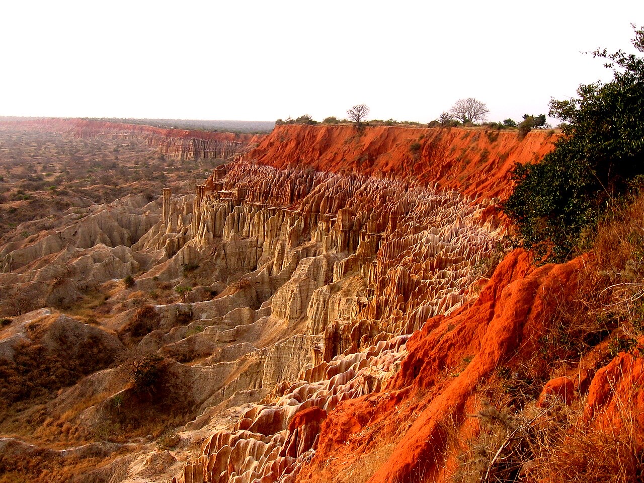
Kalandula Falls drop over a broad escarpment on the Lucala River near Malanje. The nearby region includes the great rock formations of Pedras Negras de Pungo Andongo. South of Luanda, Miradouro da Lua’s eroded cliffs contrast with the southern highlands around Lubango, where Tundavala and the Serra da Leba road reveal dramatic changes in elevation. Iona’s desert landscape adds another setting. Map pins are approximate learning locations, not driving routes, entrances or confirmation of safe access.
People & Society of Angola
A young, multilingual population whose lives link growing cities, rural communities and the diaspora.
- Is Angola culturally uniform?
- No. It includes many languages, regions and communities, with identities that cross national borders and overlap within families.
- How did the civil war affect settlement?
- Displacement and the search for safety and work helped cities, especially Luanda, expand rapidly.
- Which cities connect the interior and coast?
- Huambo and Lubango are important inland centres; Benguela and Lobito connect coastal trade with the interior, alongside the capital Luanda.
More about Angola: people & society
Angola is home to many communities, including Ovimbundu, Mbundu, Kongo, Chokwe, Nyaneka and others, with identities that overlap language, region and family history. Borders do not contain these identities neatly: related communities also live in neighbouring countries. Portuguese often connects people across linguistic backgrounds, while Angolan languages remain important in family and community life. Christianity is widespread, alongside other religious practices and beliefs.
The civil war displaced many people and helped reshape the settlement pattern. Luanda grew rapidly, and other urban centres such as Huambo, Benguela, Lobito and Lubango connect education, trade and services with surrounding rural areas. Angola has a young population, and access to schooling, health care, employment and basic services varies between places and households. Diaspora communities maintain ties through family, music, business and literature. Statistics and broad group labels should not replace the experiences of individuals.