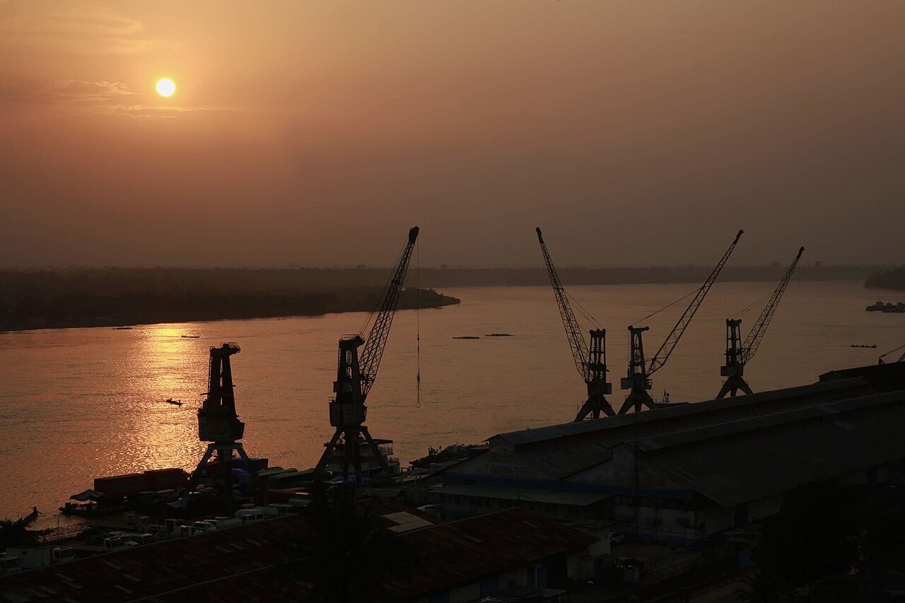
Facts about DR Congo
Explore the Democratic Republic of the Congo from Kinshasa and the lower Congo to the central rainforest, Kasai, the Copperbelt and the eastern Great Lakes. Twelve city locations, ten heritage and landscape pins and ten illustrated topics connect geography with history, languages and everyday life.
- Capital
- Kinshasa
- Area
- About 2.345 million km²
- Official language
- French
- National languages
- Kikongo, Lingala, Swahili, Tshiluba
- Currency
- Congolese franc (CDF)
- Independence
- 30 June 1960
DR Congo · 0 of 20 rounds passed
Two timed rounds per topic, 20 seconds a question
Kinshasa faces Brazzaville across the Congo River, but the two capitals belong to different countries. Matadi and Boma orient the western corridor toward the Atlantic. Mbandaka lies near the equator, while Kisangani and Kindu connect with the Congo–Lualaba river system. Kananga and Mbuji-Mayi lie in the Kasai region.
Lubumbashi and Kolwezi introduce the southeastern Copperbelt. Goma and Bukavu sit at opposite ends of Lake Kivu in the east. City pins mark settlement centres, not provincial boundaries or territorial control. The country’s distances and regional differences are central to understanding it.
Geography of the Democratic Republic of the Congo
A vast river basin, a short Atlantic coast and mountains beside the Great Lakes.
- Are the two Congos the same country?
- No. The DRC has Kinshasa as its capital; the Republic of the Congo has Brazzaville.
- Is the DRC landlocked?
- No. A narrow corridor in the west gives it an Atlantic coastline.
- Why can a barge not travel directly from Kisangani to the Atlantic?
- Rapids downstream of Kinshasa interrupt the otherwise extensive inland navigation system.
More about DR Congo: geography
The Democratic Republic of the Congo, often shortened to DRC or DR Congo, covers about 2.345 million square kilometres in central Africa. It is Africa’s second-largest country by area, after Algeria, and crosses the equator. Its nine neighbours are the Republic of the Congo, Central African Republic, South Sudan, Uganda, Rwanda, Burundi, Tanzania, Zambia and Angola. A narrow western corridor reaches the Atlantic Ocean. Kinshasa faces Brazzaville, the capital of the separate Republic of the Congo, across Pool Malebo on the Congo River.
The Congo and its tributaries connect a low central basin with surrounding plateaus. The Lualaba is the upper river’s name before it reaches Kisangani. Forest and swamp dominate much of the basin, while savannas extend across southern regions. Eastern highlands rise beside lakes Albert, Edward, Kivu and Tanganyika. Margherita Peak on Mount Stanley reaches about 5,109 metres on the Uganda border. Rapids below Kinshasa interrupt navigation between the inland river network and the sea.
History of the Democratic Republic of the Congo
Kongo, Luba and Lunda histories, colonial exploitation and independence in 1960.
- When did the DRC become independent?
- On 30 June 1960, from Belgium.
- Was the Congo Free State simply another name for Belgian colonial government?
- No. It was under Leopold II’s personal rule from 1885 to 1908; Belgium then annexed it.
- When was the country called Zaire?
- From 1971 to 1997. Mobutu’s rule began earlier, in 1965.
More about DR Congo: history
The kingdoms of Kongo, Luba and Lunda developed different political, artistic and trading traditions across parts of today’s DRC and neighbouring countries. Their territories did not follow modern borders. In 1885, Leopold II of Belgium established personal rule over the Congo Free State. Forced labour, hostage-taking and violence accompanied rubber and ivory extraction. International campaigning helped bring this regime to an end in 1908, when Belgium annexed the territory as the Belgian Congo; colonial rule and exploitation continued.
Independence came on 30 June 1960, with Joseph Kasa-Vubu as president and Patrice Lumumba as prime minister. Political crisis, secession and foreign intervention followed; Lumumba was killed in January 1961. Mobutu took power in 1965 and renamed the country Zaire in 1971. Laurent-Désiré Kabila’s forces overthrew him in 1997, restoring the DRC name. The wars beginning in 1996 and 1998 involved Congolese and foreign actors. A formal transition began in 2003, but armed conflict continued, especially in the east.
French and the DRC’s national languages
French is official; four national languages connect many more local languages.
- What is the official language?
- French. The constitution separately recognises four national languages.
- Which four languages have national status?
- Kikongo, Lingala, Swahili and Tshiluba.
- Does everyone speak the same language at home?
- No. Home languages and multilingual practices vary greatly between regions, communities and households.
More about DR Congo: language
Article 1 of the constitution names French as the official language and Kikongo, Lingala, Swahili and Tshiluba as national languages. French is used in government, education, publishing and communication between regions. Lingala is prominent in Kinshasa, along much of the river and in popular music. Swahili, also called Kiswahili, connects many communities in the east and southeast. Tshiluba is important in the Kasai region; Kikongo and related varieties are associated with the west.
Hundreds of languages and varieties are spoken across the country, and a person may use several in different settings. Kituba, also called Kikongo ya Leta, functions as a regional lingua franca and should be distinguished from individual Kikongo varieties. Congolese Swahili also has regional forms that differ from the standard taught in many introductory courses. Worldly links its existing general French and Swahili lessons as starting points; they do not cover Lingala, Tshiluba or the full range of Congolese language use.
Culture of the Democratic Republic of the Congo
Rumba, soukous, urban fashion and regional traditions of performance and art.
- Why is rumba associated with both Congos?
- Musicians and audiences in Kinshasa and Brazzaville helped shape a shared tradition recognised jointly by UNESCO.
- What is soukous?
- A guitar-driven dance music associated with the development of Congolese rumba.
- What is La Sape?
- A culture of elegant dress and self-presentation, particularly associated with cities in the two Congos.
More about DR Congo: culture
Congolese rumba grew through exchanges between central African musical traditions, Cuban records and the urban dance bands of Kinshasa and Brazzaville. UNESCO inscribed it as intangible cultural heritage in 2021 through a joint nomination by the two Congos. Soukous developed with bright guitar lines and dance rhythms, reaching audiences across Africa. Joseph Kabasele, Franco, Tabu Ley Rochereau and Papa Wemba belong to different chapters of this musical history.
La Sape turns dress and presentation into a distinctive urban practice shared across the two Congos and their diasporas. Cultural life also includes sculpture, woven textiles, storytelling, contemporary painting, theatre and film. Kuba textiles and Luba and Kongo artistic traditions have their own histories and meanings. The photograph shows a particular dance performance in the Ituri forest region; it does not stand for every community’s ceremonies or musical traditions.
Economy of the Democratic Republic of the Congo
Copper and cobalt exports alongside farming, river trade and urban enterprise.
- Which metals are especially associated with the southeastern Copperbelt?
- Copper and cobalt.
- What is the national currency?
- The Congolese franc, with currency code CDF.
- Does mineral wealth describe every household’s work?
- No. Farming, fishing, trade, transport, services and many small enterprises support livelihoods.
More about DR Congo: economy
Copper and cobalt from the southeastern Copperbelt link the DRC with global metal and battery industries. Lubumbashi and Kolwezi are important centres in this mining region. Coltan, a mineral mixture containing tantalum-bearing ores, gold and tin are associated with other mining areas, including the east. Industrial mines and artisanal operations differ in scale and conditions. Mineral income can coexist with dangerous work, environmental damage and limited local access to electricity and public services.
Farming, fishing, markets, transport and small businesses support livelihoods across the country. Cassava, maize and plantains are important food crops, with production varying by region. The Congolese franc, currency code CDF, is the national currency; US dollars also circulate widely. River transport links inland settlements, while roads and railways connect particular corridors. Hydroelectric projects at Inga use the lower Congo’s flow, but generating potential is different from dependable electricity reaching homes.
Politics of the Democratic Republic of the Congo
A constitution, provincial institutions and the effects of continuing armed conflict.
- What are the two chambers of parliament?
- The National Assembly and the Senate.
- How many province-level units are there?
- Twenty-six: Kinshasa and 25 provinces.
- What is MONUSCO?
- The UN peacekeeping mission established in 2010 as the successor to MONUC.
More about DR Congo: politics
The 2006 constitution, amended in 2011, establishes a republic with a president, a prime minister and government, and a parliament consisting of the National Assembly and Senate. The president is head of state; the prime minister leads the government, within a constitutional division of executive responsibilities. The country comprises Kinshasa, which has provincial status, and 25 provinces. The present territorial division was implemented in 2015, replacing the former structure of 11 province-level units.
Félix Tshisekedi succeeded Joseph Kabila in January 2019, the first peaceful transfer between presidents since independence; the election result was disputed. Elections and constitutional institutions are only part of political life. Armed groups, regional intervention and displacement have deeply affected eastern communities. MONUSCO is the United Nations peacekeeping mission established in 2010, succeeding MONUC. Security conditions, territorial control and the mission’s deployment change over time; this guide’s maps show learning locations rather than control lines.
Nature & Wildlife of the Democratic Republic of the Congo
Bonobos, okapis, forest ecosystems and the eastern gorillas.
- Where do wild bonobos live?
- Only in the DRC, in forests south of the Congo River.
- Is an okapi a kind of zebra?
- No. It is a relative of the giraffe, despite its striped legs.
- Are Grauer’s gorillas and mountain gorillas the same population?
- No. They are different subspecies of eastern gorilla, with distinct ranges.
More about DR Congo: nature & wildlife
Wild bonobos occur only in the DRC, in forests south of the Congo River. Okapis, relatives of giraffes with striped legs, are also native only to the country. Grauer’s gorillas live in eastern DRC forests; mountain gorillas inhabit the Virunga region, shared with Rwanda and Uganda. These are different gorilla populations and habitats. The Congo peafowl is another distinctive forest species. Central basin wetlands and peatlands store carbon and support ecosystems shaped by seasonal water levels.
Salonga protects a vast area of tropical forest, while Garamba includes northeastern savannas and woodlands. Virunga spans lake, forest, mountain and volcanic environments, and Kahuzi-Biega protects both highland and lowland forest. The Okapi Wildlife Reserve lies in the Ituri forest. Conservation depends on local and Indigenous communities, rangers and functioning institutions. Hunting pressure, forest loss, mining and armed conflict can affect both wildlife and people; park designation alone does not remove those pressures.
Food & Cuisine of the Democratic Republic of the Congo
Cassava roots and leaves, palm-fruit sauce, plantains and river fish.
- What is pondu made from?
- Prepared and cooked cassava leaves.
- What is kwanga?
- A fermented cassava preparation cooked in leaf wrappers.
- What gives moambé sauce its base?
- The pulp of oil-palm fruit; recipes and accompaniments vary.
More about DR Congo: food & cuisine
Cassava is important in many Congolese meals, both as a source of starch and through its leaves. Fufu is a firm preparation made from cassava, maize or blends of flours and served with sauces. Kwanga, also called chikwangue, is a fermented cassava preparation cooked in leaf wrappers. Pondu uses cassava leaves, which require proper preparation and cooking. These foods vary between households and regions, and related preparations are shared with neighbouring countries.
Chicken in moambé sauce is associated with the pulp of oil-palm fruit. Fish from the Congo system and eastern lakes may be fresh, smoked, dried or cooked in leaf parcels known as liboké. Plantains, rice, beans, leafy vegetables and chilli accompany different meals. The photograph shows fruit for sale in Kinshasa rather than a particular prepared dish. Markets connect growers, traders and urban customers, making food a useful way to understand regional environments and everyday exchange.
Landmarks of the Democratic Republic of the Congo
Five natural World Heritage properties, volcanic landscapes and river landmarks.
- How many inscribed World Heritage properties does the DRC have?
- Five, all natural properties: four national parks and the Okapi Wildlife Reserve.
- Where is Mount Nyiragongo?
- Near Goma in eastern DRC, within the Virunga volcanic landscape.
- Is Boyoma Falls one single waterfall?
- No. It is a series of cataracts near Kisangani.
More about DR Congo: landmarks
The DRC’s five inscribed UNESCO World Heritage properties are Virunga, Garamba, Kahuzi-Biega and Salonga national parks and the Okapi Wildlife Reserve. They protect very different landscapes, from northeastern savannas to lowland rainforest and eastern mountains. Mount Nyiragongo is an active volcano within the Virunga landscape near Goma. Its eruptions, including in 2002 and 2021, affected surrounding communities. The lava-lake photograph records a past view, rather than promising that the crater looks the same today.
Boyoma Falls is a series of cataracts near Kisangani, where the Lualaba meets the navigable middle Congo. Zongo Falls lies on the Inkisi River in Kongo Central. In Kinshasa, the National Museum introduces histories and material culture, while Lola ya Bonobo near the city rehabilitates rescued bonobos. Map pins identify representative places for learning. They do not mark travel routes, guarantee openings or establish safe access; current official advice and local conditions must be checked separately.
People & Society of the Democratic Republic of the Congo
River cities, farming communities, mining centres and connections across borders.
- Do community identities stop at the DRC’s borders?
- No. Many language, family and cultural networks extend into neighbouring countries.
- Why did Denis Mukwege receive the Nobel Peace Prize?
- For work to end sexual violence as a weapon of war and armed conflict, sharing the 2018 prize with Nadia Murad.
- How are towns and rural areas connected?
- Through family ties, migration, food markets, transport, education and flows of money and goods.
More about DR Congo: people & society
Congolese society includes many communities, including Kongo, Luba, Mongo, Mangbetu, Zande and numerous others, with identities and languages that overlap and cross national borders. Indigenous forest peoples include Mbuti and Twa communities with distinct histories. A broad community label does not determine an individual’s occupation, beliefs or politics. Christianity is widely practised, alongside other faiths and local religious traditions. Kinshasa’s metropolitan life is one part of a country with many different regional experiences.
Families connect cities, rural homes and a far-reaching diaspora through work, education, trade and culture. Conflict has forced many people to leave their homes, especially in the east, placing pressures on displaced and host communities. Congolese public life also reaches global audiences through music, literature, sport and advocacy. Physician Denis Mukwege shared the 2018 Nobel Peace Prize for work against wartime sexual violence. Basketball player Dikembe Mutombo became known for sport and humanitarian work, including support for a hospital in Kinshasa.