Facts about Uruguay
Uruguay connects grassland country, river ports and Atlantic beaches with the streets of Montevideo and Colonia. Explore its 19 departments, discover the histories and communities behind the places, and begin Spanish.
- Capital
- Montevideo
- Currency
- Uruguayan peso (UYU)
- Departments
- 19
- Main language
- Spanish
- Western river
- Uruguay River
- Eastern coast
- Atlantic Ocean
Uruguay · 0 of 20 rounds passed
Two timed rounds per topic, 20 seconds a question
Montevideo looks over the Río de la Plata, with the Ciudad Vieja and a long waterfront rambla. Colonia del Sacramento preserves a historic port to the west. Farther north, Fray Bentos, Paysandú and Salto face the Uruguay River. The Negro River crosses the interior through reservoirs, while Tacuarembó, Durazno, Trinidad and Florida connect the map with inland life.
To the east, Maldonado and Punta del Este lead towards Rocha’s Atlantic coast, lagoons and dunes. Rivera and Chuy connect with Brazilian border communities. Three maps cover all 19 departments, 24 cities and towns and six selected waters. Ten illustrated topics introduce candombe, mate, history, nature and society. The Spanish course teaches everyday phrases, while the reading explains local voseo and border language traditions.
Geography of Uruguay
Rolling grasslands between Brazil, the Uruguay River, the Río de la Plata and the Atlantic.
- Which countries border Uruguay?
- Uruguay borders Brazil to the north and east and Argentina across the Uruguay River and Río de la Plata to the west and southwest.
- How many departments does Uruguay have?
- Uruguay has 19 departments. Montevideo is one of them, as well as the name of the national capital.
- Is Montevideo on the Atlantic Ocean?
- Montevideo faces the Río de la Plata estuary. Uruguay’s open Atlantic coast lies farther east, beyond the Punta del Este area.
More about Uruguay: geography
Uruguay lies in southeastern South America between Argentina and Brazil. The Uruguay River runs along its western border, the Río de la Plata opens along the south and the Atlantic borders the east. Montevideo stands on the estuary. Inland, grasslands and low ranges called cuchillas replace the high mountains found in western South America.
The Negro River crosses the interior towards the Uruguay River, with reservoirs along its course. Laguna Merín is shared with Brazil and is called Lagoa Mirim in Portuguese. Uruguay has 19 departments; Montevideo is both a department and the national capital. The map’s departments are administrative divisions, while coastal resorts, river ports and inland capitals help explain how the country is connected.
History of Uruguay
The Banda Oriental, Artigas and independence, followed by reform, dictatorship and the return of democracy.
- When did Uruguay become independent?
- Uruguay commemorates the declaration of 25 August 1825. Independence was recognised through the 1828 peace convention, and the first constitution followed in 1830.
- Who was José Artigas?
- Artigas led a major independence and federalist movement in the Río de la Plata region. He is a central figure in Uruguay’s national history.
- When did Uruguay’s last dictatorship end?
- Civilian democratic government returned in 1985, after the dictatorship that began in 1973.
More about Uruguay: history
Indigenous peoples, including Charrúa communities, lived here before European colonisation. Spanish and Portuguese powers contested the Banda Oriental, the land east of the Uruguay River. José Artigas became a central independence leader. The declaration in Florida on 25 August 1825, the 1828 peace convention recognising an independent state and the first constitution in 1830 are distinct milestones.
The new republic carried out violence against Indigenous people, including the 1831 massacre at Salsipuedes. Descendants and Indigenous identities remain part of Uruguay today. Later immigration and reforms associated with José Batlle y Ordóñez reshaped society. A civilian-military dictatorship ruled from 1973 to 1985, with imprisonment, torture and disappearances. Elected civilian government returned in 1985; memory and accountability remain important public questions.
Languages of Uruguay
Spanish with vos, regional accents and long-standing Portuguese-speaking border communities.
- What language is mainly spoken in Uruguay?
- Spanish is the main language. Portuguese varieties also have long-established communities along the Brazilian border.
- What does vos mean?
- Vos is an informal singular “you”. In Uruguay it is often used with forms such as vos tenés, meaning “you have”.
- Do Uruguayans all use the same accent?
- No. Speech varies by region and community, including between the capital, inland towns and the border with Brazil.
More about Uruguay: language
Spanish is the main language of public life. Much Uruguayan speech belongs to the Rioplatense family also heard around Buenos Aires. Vos is widely used for informal singular “you”, with forms such as vos tenés. Tú also occurs, sometimes with voseo verb forms. Many speakers pronounce ll and y with sounds resembling English “sh” or the middle sound in “measure”, with regional variation.
Along the Brazilian border, Uruguayan Portuguese reflects generations of contact between neighbouring communities. Calling every border variety simply mistaken Spanish misses that history. Vocabulary and pronunciation vary between Montevideo, inland towns and the northern border. The linked Spanish lessons introduce general everyday phrases; they are a starting point for listening to local speech rather than a dedicated Uruguayan dialect course.
Culture of Uruguay
Candombe drums, carnival murga, shared tango traditions and a strong place for football.
- What is candombe?
- Candombe is an Afro-Uruguayan musical and community tradition centred on drumming, with dance and street processions.
- Is tango only Argentine?
- No. Tango developed in the Río de la Plata region, including Montevideo and Buenos Aires, and is shared Uruguayan and Argentine heritage.
- What is a carnival murga?
- A murga is a performance group combining choral singing, theatrical presentation and satire, often commenting on contemporary society.
More about Uruguay: culture
Candombe is rooted in Afro-Uruguayan communities. Groups of drummers and dancers bring it into Montevideo’s streets, especially in neighbourhoods associated with its history, including Barrio Sur and Palermo. UNESCO recognises candombe and its community spaces as intangible heritage. Carnival also includes murga, which brings choral singing, costumes and social or political satire to the stage.
Tango developed on both sides of the Río de la Plata and is shared heritage with Argentina. Montevideo has its own tango history, while writers such as Juan Carlos Onetti, Mario Benedetti and Idea Vilariño shaped distinct literary traditions. Football connects neighbourhood clubs with the national team. Uruguay hosted and won the first men’s FIFA World Cup in 1930 and won again in 1950.
Economy of Uruguay
Agricultural exports, pulp, services and a power system with a large renewable share.
- What does Uruguay export?
- Important goods exports include cellulose pulp, beef, soybeans and dairy products. Uruguay also exports services.
- Does Uruguay run entirely on renewable energy?
- No. Renewables supplied 99% of electricity generation in 2024, according to official figures. Electricity generation is only part of total energy use.
- What currency does Uruguay use?
- Uruguay uses the Uruguayan peso, with the international currency code UYU.
More about Uruguay: economy
Cattle raising, crop farming and forestry connect Uruguay’s countryside to overseas markets. Beef, cellulose pulp, soybeans and dairy products are important goods exports. Ports and transport link these industries with Montevideo and river settlements. Tourism connects the country with neighbouring Argentina and Brazil, while software, professional services and logistics also contribute to the economy.
Hydropower, wind, biomass and solar generation have transformed the electricity system. Official figures put renewable sources at 99% of electricity generation in 2024. That dated electricity figure does not describe all energy use: transport and other activities still use fossil fuels. Rainfall changes hydropower output between years. Uruguay uses the Uruguayan peso, whose code is UYU, rather than Argentina’s peso or Brazil’s real.
Politics of Uruguay
A presidential republic with 19 departments, a two-chamber legislature and direct-democracy mechanisms.
- Is Uruguay a federal country?
- No. It is a unitary republic divided into 19 departments, each with its own elected departmental government.
- How long is Uruguay’s presidential term?
- The presidential term is five years. A president cannot be immediately re-elected for the next consecutive term.
- Does Uruguay have a state religion?
- The constitution protects religious freedom and provides that the state supports no religion. Uruguay has a strong secular tradition.
More about Uruguay: politics
Uruguay is a unitary presidential republic. The president leads the executive, and the General Assembly has a Senate and a Chamber of Representatives. Presidential terms last five years, without immediate consecutive re-election. The vice-president presides over the Senate. Uruguay’s departments have elected departmental governments; they are not sovereign states in a federation.
The constitution protects freedom of religion and separates the state from religious institutions. Elections and constitutional mechanisms for referendums and plebiscites provide different ways for citizens to participate. The Electoral Court oversees electoral matters. The democratic framework has operated since the return of civilian government in 1985, following the 1973–1985 dictatorship. Party competition and public debate remain part of political life.
Nature and wildlife of Uruguay
Native grasslands, river wetlands, coastal lagoons and wooded ravines.
- What is a carpincho?
- Carpincho is the local name for the capybara, a large rodent associated with rivers, marshes and other wet habitats.
- Where is Quebrada de los Cuervos?
- The protected landscape lies in Treinta y Tres Department, in Uruguay’s eastern uplands.
- Is Uruguay mainly tropical rainforest?
- No. Grasslands dominate much of the landscape, alongside wetlands, native woods, low hills and coastal habitats.
More about Uruguay: nature & wildlife
Uruguay’s native grasslands support wildlife adapted to open country, including greater rheas and pampas deer. Capybaras inhabit rivers and wetlands. Native woods occur beside watercourses and in sheltered uplands; commercial tree plantations are a different habitat. Farming, land conversion and invasive species can put pressure on these ecosystems.
Rocha’s coast combines dunes, rocky shores and lagoons used by waterbirds. Cabo Polonio protects a coastal landscape associated with sea lions and fur seals. Inland, Quebrada de los Cuervos and the Sierras del Yerbal preserve wooded ravines in Treinta y Tres. Northern valleys such as Lunarejo add another landscape. Protected areas safeguard different habitats, so Uruguay’s nature extends well beyond its beaches.
Food of Uruguay
Chivito sandwiches, asado, mate and sweets with dulce de leche.
- Is a chivito made with goat meat?
- The familiar Uruguayan chivito sandwich uses beef steak, despite its name. Toppings vary.
- What is a bombilla?
- A bombilla is a filtered drinking straw used for mate. The filter keeps the yerba leaves out of the drink.
- What is chajá?
- Chajá is a dessert associated with Paysandú, typically made with sponge cake, cream, meringue and fruit such as peaches.
More about Uruguay: food & cuisine
A chivito is usually built around a thin beef steak in bread, with toppings such as ham, cheese, egg and vegetables. Despite the name’s reference to a small goat, the familiar sandwich uses beef. Asado brings people together around grilled food. Milanesa, pasta and pizza reflect the country’s connections with European migration and the wider Río de la Plata region.
Mate is an infusion of yerba mate leaves, drunk through a filtered metal straw called a bombilla. Carrying a flask of hot water makes it part of everyday routines as well as social gatherings. Dulce de leche fills many alfajores and pastries. Chajá, associated with Paysandú, combines sponge cake, cream, meringue and fruit. Uruguay’s food traditions are varied and share many ingredients with neighbouring countries.
Landmarks of Uruguay
Colonia’s port history, Fray Bentos’ industrial landscape and Dieste’s brick church near Atlántida.
- Why is Colonia del Sacramento a World Heritage site?
- Its historic quarter preserves a distinctive urban landscape shaped by Portuguese and Spanish colonial settlement beside the Río de la Plata.
- What is the Fray Bentos Industrial Landscape?
- It is a former meat-processing industrial complex whose buildings and setting show Uruguay’s connections with global food production and trade.
- Where is Eladio Dieste’s Church of Atlántida?
- It is in Estación Atlántida in Canelones Department, inland from the coastal city of Atlántida.
More about Uruguay: landmarks
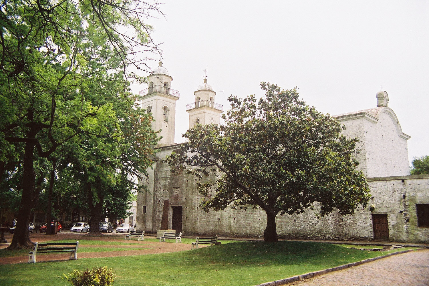
Colonia del Sacramento’s historic quarter preserves a street pattern and buildings shaped by Portuguese and Spanish rule. Farther north, the Fray Bentos Industrial Landscape records how meat processing linked the Uruguay River to global food markets. Both are UNESCO World Heritage properties, illustrating different chapters in the country’s economic and cultural history.
The Church of Atlántida, designed by engineer Eladio Dieste, uses curved brick walls and a vaulted roof. It stands in Estación Atlántida, inland from the seaside city, and is also a World Heritage property. Montevideo’s Teatro Solís, Ciudad Vieja and waterfront rambla provide other starting points. On the Atlantic coast, Cabo Polonio and Santa Teresa connect built landmarks with dunes, rocky headlands and protected landscapes.
People and society of Uruguay
An urban society with rural traditions, Afro-Uruguayan communities and living Indigenous identities.
- How many people live in Uruguay?
- Final results of the 2023 census estimated about 3.5 million residents. This is a dated census estimate, not a live population count.
- Does all of Uruguay’s population live in Montevideo?
- No. Montevideo is the largest population centre, but people live throughout the country in other cities, towns and rural areas.
- Are Indigenous identities part of Uruguay today?
- Yes. People identify with Indigenous ancestry and communities, despite the historic violence and displacement experienced by Indigenous peoples.
More about Uruguay: people & society
Uruguay’s final 2023 census results estimated about 3.5 million residents. Montevideo is the most populous department, and the wider metropolitan area extends into neighbouring Canelones and San José. River cities, border towns and coastal settlements have their own identities. A national population figure should not be confused with the population of the capital or its surrounding urban area.
European migration, Afro-Uruguayan communities, Indigenous ancestry and more recent immigration all contribute to society. People may identify with more than one ancestry in the census, so these categories overlap. Accounts that portray Uruguay as exclusively European erase part of its population and history. Rural traditions, neighbourhood life, football clubs and shared mate connect people in different ways across a highly urbanised country.