Facts about Bolivia
Explore Bolivia from the Altiplano and Lake Titicaca to inter-Andean valleys, Amazonian rivers and the Chiquitano east. Learn how its nine departments connect with the histories, food, languages and communities behind the places.
- Capital
- Sucre
- Constitutional capital
- Sucre
- Seat of government
- La Paz
- Departments
- 9
- Currency
- Boliviano (BOB)
- Languages
- Spanish and Indigenous languages
- Shared lake
- Titicaca, with Peru
Bolivia · 0 of 20 rounds passed
Two timed rounds per topic, 20 seconds a question
La Paz sits below El Alto near the western plateau, while Copacabana faces Lake Titicaca. Oruro and Potosí connect highland mining history with living urban traditions. Sucre is Bolivia’s constitutional capital; La Paz is the seat of government. Cochabamba links the central valleys with routes towards the eastern lowlands.
Santa Cruz de la Sierra anchors the east, Trinidad lies in Beni’s seasonally flooded plains, and Cobija is Pando’s northern capital. In the south, Tarija’s valleys lead towards the Chaco and Argentine border. Three maps cover nine departments, 24 cities and towns and nine waters. Ten illustrated topics connect these places with everyday life, and the Spanish lessons sit alongside context about Bolivia’s Indigenous languages.
Geography of Bolivia
A landlocked country linking the Andes, Amazonian lowlands and Gran Chaco.
- Which countries border Bolivia?
- Peru, Brazil, Paraguay, Argentina and Chile. Bolivia has no ocean coastline.
- Is all of Bolivia high in the Andes?
- No. The Altiplano is in the west, but extensive tropical lowlands stretch across the north and east.
- Who shares Lake Titicaca?
- Bolivia and Peru share the lake. Its full outline on the learning map includes both countries’ portions.
More about Bolivia: geography
Bolivia borders Peru, Brazil, Paraguay, Argentina and Chile. The western Andes enclose the Altiplano, a high plateau with Lake Titicaca and extensive salt flats. Farther east, valleys and the forested Yungas descend towards broad tropical lowlands. Santa Cruz de la Sierra and Trinidad have very different surroundings from highland La Paz, Oruro and Potosí.
Nine departments divide the country. Sucre, in Chuquisaca, is the constitutional capital, while La Paz is the national seat of government. El Alto is a separate city on the plateau above La Paz. Northern rivers drain towards the Amazon through the Madeira system; the Pilcomayo and Bermejo belong to the Paraguay–Paraná basin. Lake Titicaca is shared with Peru.
History of Bolivia
Tiwanaku, colonial mining, independence in 1825 and struggles over land and citizenship.
- When did Bolivia become independent?
- Bolivia declared independence on 6 August 1825. Its name honours Simón Bolívar.
- Why is Bolivia landlocked?
- Bolivia lost its Pacific coastal territory to Chile following the War of the Pacific.
- What changed in 1952?
- The National Revolution began a period of major reforms, including universal adult suffrage and redistribution of agricultural land.
More about Bolivia: history
Tiwanaku developed a powerful society near Lake Titicaca long before the Inca Empire expanded into the region. Spanish colonial rule incorporated these territories into the area known as Upper Peru. Silver from Cerro Rico at Potosí helped finance an imperial economy through labour systems that imposed severe burdens on Indigenous communities. Resistance and independence movements challenged colonial authority.
Bolivia declared independence on 6 August 1825 and took its name from Simón Bolívar. It lost its Pacific coastal territory in the War of the Pacific, which began in 1879. The 1952 National Revolution brought major changes, including universal adult suffrage and land reform. The 2009 constitution later established the framework of the Plurinational State.
Languages of Bolivia
Spanish and constitutionally recognised Indigenous languages, including Aymara, Quechua and Guaraní.
- Is Spanish Bolivia’s only official language?
- No. The constitution recognises Spanish and the listed languages of Indigenous nations and peoples as official.
- Are Aymara and Quechua varieties of Spanish?
- No. They are distinct Indigenous languages with their own histories.
- Which language do these lessons teach?
- The linked course introduces general Spanish, with context about Bolivia’s wider linguistic life.
More about Bolivia: language
Spanish is widely used in public life and communication across regions. The 2009 constitution also recognises the languages of Indigenous nations and peoples as official. These include Aymara and Quechua, strongly associated with highland and valley communities, and Guaraní in the southeast. Bolivia’s linguistic heritage extends far beyond these best-known examples.
Language use varies by community, generation and setting. Official recognition does not mean that every language has the same number of speakers or the same access to education and media. The linked Spanish lessons introduce greetings, food, directions and everyday conversation. They provide a useful starting point, while learning local place names and respecting speakers’ own language preferences deepens an understanding of the country.
Culture of Bolivia
Carnival dance, community music, textiles and traditions that continue to change.
- What is Oruro’s carnival known for?
- Large dance processions, music and elaborate costumes, including the diablada tradition.
- What does intangible heritage mean here?
- It means living practices, knowledge and skills transmitted by communities, rather than a physical World Heritage property.
- What is Alasita?
- A La Paz tradition involving miniatures associated with people’s hopes and the figure of Ekeko.
More about Bolivia: culture
Oruro’s carnival brings elaborate costumes, music and dance into the streets. Its traditions connect Andean beliefs with Catholic devotion to the Virgin of the Socavón. The diablada is one of its best-known dances. UNESCO recognises the carnival as intangible cultural heritage: a living practice passed between people, rather than a monument or archaeological site.
Cultural life differs across highland, valley and lowland communities. In La Paz, Alasita involves miniature objects associated with hopes for the future and the figure of Ekeko. Textiles, brass bands, contemporary music and regional festivals express identities that travel with people between countryside and city. Indigenous, Afro-Bolivian and other communities contribute distinct traditions; no single costume or dance represents everyone.
Economy of Bolivia
Mining, gas, farming, urban markets and the challenge of developing salt-flat resources.
- What is Bolivia’s currency?
- The boliviano, with currency code BOB.
- What does YLB do?
- Yacimientos de Litio Bolivianos is the state company responsible for developing Bolivia’s evaporitic mineral resources.
- Does having lithium resources mean high production?
- No. Commercial production also requires workable extraction, processing, infrastructure and environmental management.
More about Bolivia: economy
Mining has shaped Bolivia from Potosí’s colonial silver economy to later tin and zinc production. Natural gas has also played an important role in exports. Eastern lowlands support agriculture and food processing, including soya around Santa Cruz. Markets, transport, services and small businesses connect rural production with cities such as El Alto and Cochabamba.
Salt-flat brines contain lithium and other minerals. Yacimientos de Litio Bolivianos, or YLB, is the state company responsible for developing these evaporitic resources. Mineral resources underground are different from production that can be sold: extraction, processing, infrastructure and environmental management all matter. Water use and the interests of nearby communities are central to debates about how these landscapes should develop. The national currency is the boliviano.
Politics of Bolivia
The Plurinational State, nine departments and different roles for Sucre and La Paz.
- Is Sucre or La Paz Bolivia’s capital?
- Sucre is the constitutional capital. La Paz is the national seat of government.
- How many departments does Bolivia have?
- Nine. El Alto is a city in La Paz department, rather than a tenth department.
- What are the two legislative chambers?
- The Chamber of Deputies and the Chamber of Senators form the Plurinational Legislative Assembly.
More about Bolivia: politics
Bolivia’s 2009 constitution defines a unitary Plurinational State with autonomies. National government includes a president and the two chambers of the Plurinational Legislative Assembly: the Chamber of Deputies and Chamber of Senators. Indigenous peoples’ rights, representation and forms of self-government are important parts of the constitutional framework.
Sucre is the constitutional capital, while the executive and legislature work in La Paz. The nine departments are La Paz, Oruro, Potosí, Cochabamba, Chuquisaca, Tarija, Santa Cruz, Beni and Pando. Departments are distinct from their capital cities, even when they share a name. Regional autonomy, land, access to public services and the management of natural resources have shaped political debates across different governments.
Nature and wildlife of Bolivia
High Andean wetlands, cloud forests, Amazonian habitats and tropical savannas.
- Where is Noel Kempff Mercado National Park?
- In northeastern Santa Cruz department, beside the Brazilian border.
- Why is Madidi so diverse?
- It spans a wide range of elevations and habitats, linking Andean environments with tropical forest.
- Do lake outlines show today’s water level?
- No. The maps use generalised reference geometry; shallow lakes and wetlands can change greatly over time.
More about Bolivia: nature & wildlife
Changes in elevation and rainfall create sharply different habitats. High Andean wetlands support flamingos, while mountain forests shelter spectacled bears and tropical lowlands support jaguars and many birds. Madidi protects a remarkable transition from high mountains to Amazonian forest. Its landscapes are also home to Indigenous communities, whose histories and knowledge are part of the area.
Noel Kempff Mercado National Park in northeastern Santa Cruz is a UNESCO World Heritage Site with forests, savannas and wetlands. Elsewhere, seasonal flooding shapes the Llanos de Moxos in Beni. Drought, fire, forest clearance and mining can damage habitats and water systems. A reference map is only a snapshot: water levels and wetland conditions can change substantially, especially in shallow highland basins such as Lake Poopó.
Food of Bolivia
Juicy salteñas, Andean crops and distinct valley and lowland kitchens.
- What is a salteña?
- A baked pastry with a juicy savoury filling, often eaten in the morning.
- What is chuño?
- A preserved potato made using freezing and drying, associated with Andean food traditions.
- What is majadito?
- A rice-and-meat dish associated with eastern Bolivia. Ingredients and preparation vary.
More about Bolivia: food & cuisine
Salteñas are baked pastries with a juicy savoury filling, commonly eaten during the morning. Potatoes, maize and quinoa connect highland meals with long farming traditions. Chuño is a preserved potato made through a process of freezing and drying. Sopa de maní, or peanut soup, is another widely known dish, with recipes that vary between cooks and regions.
Valley and lowland cooking makes the country’s food much broader than a single Andean menu. Cochabamba is associated with substantial shared meals and dishes such as pique macho. In the east, majadito combines rice with meat, while yuca and plantains appear in local cooking. Markets reveal these regional differences through ingredients and prepared meals. Household recipes, migration and contemporary restaurants continue to change how familiar dishes are made.
Landmarks of Bolivia
Uyuni’s salt crust, Tiwanaku’s stone monuments and the historic cities of Sucre and Potosí.
- Is Salar de Uyuni a lake?
- It is a salt flat. Rain can temporarily cover its crust with a shallow layer of water.
- Was Tiwanaku an Inca city?
- Tiwanaku was the centre of an important civilisation that developed before the Inca expansion.
- What is Cerro Rico?
- The mountain above Potosí whose silver mines shaped the city’s colonial history.
More about Bolivia: landmarks
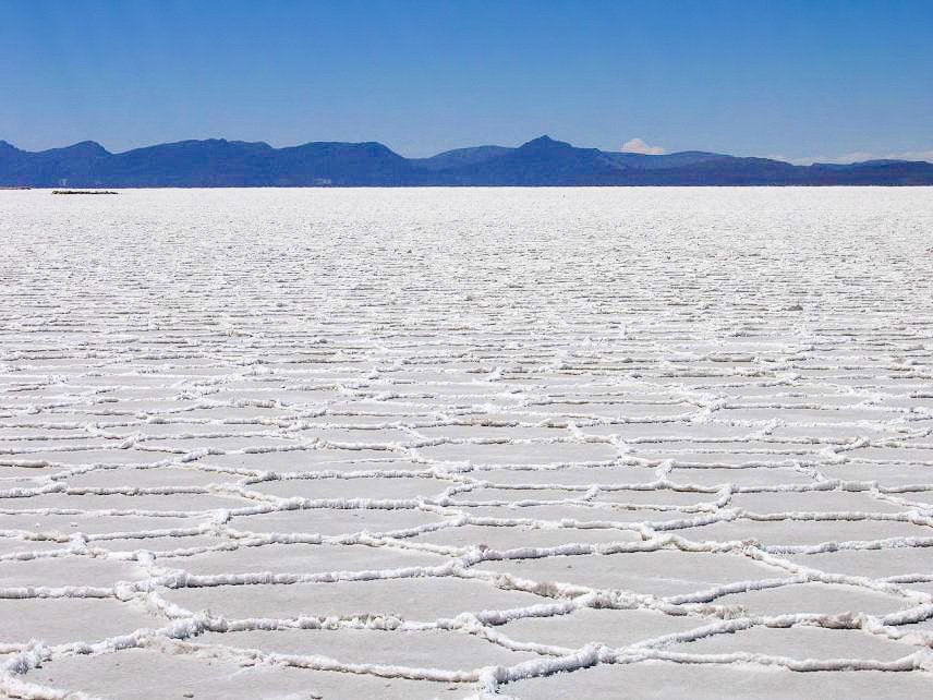
Salar de Uyuni is an immense salt flat in southwestern Potosí. Rainwater can cover its crust with a shallow reflective surface; in dry conditions the landscape looks very different. It is a salt flat rather than a permanent freshwater lake. Near Lake Titicaca, Tiwanaku preserves monumental stonework from a major pre-Inca society. UNESCO recognises Tiwanaku as a World Heritage Site.
Sucre’s historic centre and Potosí’s city and mining landscape are also World Heritage properties. In the east, the Jesuit Missions of the Chiquitos preserve a different history of settlement, architecture and music. El Fuerte de Samaipata is a separate archaeological property near Samaipata town. The La Paz–El Alto cable cars add a modern landmark, carrying passengers across steep changes in elevation.
People and society of Bolivia
Indigenous nations, Afro-Bolivian communities and changing connections between countryside and city.
- Are Indigenous communities only rural?
- No. Indigenous people live in cities, towns and rural areas, and often maintain connections between them.
- Is El Alto part of La Paz city?
- El Alto is a separate city and municipality, closely connected with La Paz. Both lie in La Paz department.
- Why do city population figures differ?
- A municipality, a wider metropolitan area and a department cover different territories and populations.
More about Bolivia: people & society
Aymara, Quechua, Guaraní and many other Indigenous peoples are central to Bolivia’s society. Communities in the highlands, valleys, Amazon and Chaco have distinct histories and languages. Afro-Bolivian communities, particularly associated with the Yungas, contribute their own cultural heritage. These identities cannot be reduced to a single appearance, occupation or place of residence.
La Paz and El Alto form a closely connected urban area, while Santa Cruz de la Sierra anchors a large lowland metropolitan region. Cochabamba also connects surrounding towns and rural districts. Migration carries family networks, languages and regional food into growing cities. The 2024 census documents this changing settlement pattern; figures for a municipality, a continuous urban area and an entire department describe different populations and should not be treated as interchangeable.