Facts about Ecuador
Follow Ecuador from Pacific ports and Andean market towns to Amazonian rivers and the Galápagos. Learn its places through maps, then discover the food, languages and community traditions behind them.
- Capital
- Quito
- Currency
- US dollar (USD)
- Provinces
- 24, including Galápagos
- National official language
- Spanish
- Natural regions
- Coast, Andes, Amazon and Galápagos
- Ocean
- Pacific
Ecuador · 0 of 20 rounds passed
Two timed rounds per topic, 20 seconds a question
Quito sits high in the Andes, Guayaquil faces the tidal Guayas River and Cuenca occupies a southern mountain valley. Esmeraldas, Manta and Machala connect with the Pacific coast, while Tena, Puyo and Coca open onto Amazonian river systems. Far west, Puerto Baquerizo Moreno and Puerto Ayora belong to the Galápagos, shown at their real location on the maps.
Explore all 24 provinces, selected cities and towns, and rivers and coastal waters. The ten illustrated topics introduce geography, history, language, culture, economy, government, nature, food, landmarks and people. General Spanish lessons accompany the guide, while the reading recognises the distinct place of Kichwa, Shuar and other ancestral languages.
Geography of Ecuador
The equator crosses a country of Pacific lowlands, Andean highlands, Amazonian forest and volcanic islands.
- What are Ecuador’s four natural regions?
- The Pacific coast or Costa, the Andean Sierra, the Amazonía and the Galápagos Islands. They describe broad landscapes, rather than four administrative provinces.
- Is Guayaquil Ecuador’s capital?
- Quito is the national capital, high in the Andes. Guayaquil is a major coastal city and port beside the Guayas River.
- Are the Galápagos close to the mainland?
- They lie roughly 1,000 kilometres west of continental Ecuador in the Pacific. They form an Ecuadorian province, despite their considerable distance from the mainland.
More about Ecuador: geography
Ecuador lies in northwestern South America, between Colombia and Peru, with the Pacific Ocean to its west. Its name refers to the equator. Four broad natural regions help explain the landscape: the Costa along the coast, the Sierra in the Andes, the Amazonía east of the mountains and the Galápagos Islands offshore. These natural regions are different from the country’s 24 administrative provinces.
Quito occupies a high Andean valley, while Guayaquil stands beside the tidal Guayas River near the coast. Cuenca lies farther south in the highlands. Rivers west of the Andean divide reach the Pacific; eastern rivers feed the Amazon system. The Galápagos lie roughly 1,000 kilometres from the continent. Their distance is preserved on this guide’s maps, so zoom in to explore the islands and smaller mainland provinces.
History of Ecuador
Cañari and Inca sites, independence struggles and the creation of a republic connect the country’s historic places.
- What happened at Pichincha in 1822?
- Forces led by Antonio José de Sucre defeated Spanish royalist troops on the slopes above Quito. The battle was a decisive step in the territory’s independence from Spain.
- Why is 1830 another important date?
- Ecuador separated from Gran Colombia and became a republic in its own right. This followed the earlier independence campaigns against Spanish rule.
- Does Ingapirca represent only Inca history?
- No. The site preserves both Cañari and Inca heritage. Ecuador’s history before Spanish conquest includes many societies beyond the Inca.
More about Ecuador: history
Long before Spanish conquest, societies across the coast, highlands and Amazon developed distinct ways of farming, trading and governing. Ingapirca preserves Cañari and Inca heritage in the southern Andes. The Inca expanded into parts of what is now Ecuador before Spanish conquest in the sixteenth century. Colonial Quito became an administrative and religious centre, while Guayaquil grew as a Pacific port.
Quito’s uprising of 10 August 1809 began an independence process with several turning points. Guayaquil declared independence on 9 October 1820, and Antonio José de Sucre’s forces won the Battle of Pichincha above Quito on 24 May 1822. The territory became part of Gran Colombia. Ecuador emerged as a separate republic in 1830, so independence from Spain and separation from Gran Colombia refer to different events.
Languages of Ecuador
Spanish is used nationally, alongside Kichwa, Shuar and other living ancestral languages.
- What is Ecuador’s official language?
- Spanish is official nationally. The constitution also gives Spanish, Kichwa and Shuar official roles in intercultural relations, and recognises other ancestral languages in their communities’ territories.
- Are Kichwa and Shuar the same language?
- No. Kichwa is part of the Quechuan family. Shuar belongs to a different language family and has its own linguistic tradition.
- Do the lessons teach every Ecuadorian language?
- They teach general Spanish phrases. Ecuador also has Indigenous languages and regional Spanish varieties that these introductory lessons do not cover.
More about Ecuador: language
Article 2 of the constitution identifies Spanish as Ecuador’s official language and Spanish, Kichwa and Shuar as official languages for intercultural relations. Other ancestral languages have official use among Indigenous peoples in the areas where they live, under the terms of the law. This gives languages different constitutional roles rather than making Spanish the country’s only recognised language.
Kichwa belongs to the wider Quechuan language family and has varieties spoken in highland and Amazonian communities. Shuar is a different language, associated with communities in the southeastern Amazon. Everyday Spanish also varies between coastal and highland regions. This guide links to general Spanish lessons for useful phrases; those lessons are an introduction to one part of Ecuador’s linguistic life.
Culture of Ecuador
Pasillo songs, Andean celebrations and toquilla weaving express different community traditions.
- What is pasillo?
- It is a musical and poetic tradition associated with Ecuador, performed by singers and instrumental ensembles. Guitars and the requinto commonly accompany the songs.
- Where do the hats called Panama hats come from?
- The traditional toquilla straw hats described here are woven in Ecuador. Their international name can obscure the Ecuadorian communities that maintain the craft.
- Is one festival tradition shared identically everywhere?
- No. Inti Raymi, local patronal festivals and coastal celebrations take different forms in different communities. Regional traditions remain varied and continue to change.
More about Ecuador: culture
Pasillo brings poetry and music together, often with guitars and a requinto, a higher-pitched guitar. Its songs explore love, memory, homeland and daily life. UNESCO recognises pasillo as intangible cultural heritage. Andean Inti Raymi celebrations honour the sun and harvest, with practices that differ between communities. Esmeraldas has Afro-Ecuadorian marimba music, singing and dance traditions shared across the Pacific border with Colombia.
The finely woven hats often sold abroad as Panama hats have an Ecuadorian toquilla-weaving tradition. Families cultivate and prepare the fibre, weave the crown and brim, then finish the hat. Manabí’s coastal communities and the southern highlands are associated with this craft. UNESCO’s recognition concerns the knowledge and social practices of weaving, including how skills pass between generations.
Economy of Ecuador
A dollarised economy links Pacific ports, agricultural exports, oil production and urban services.
- What currency does Ecuador use?
- The United States dollar, with the code USD. Ecuador adopted dollarisation in 2000 after a banking and currency crisis.
- Is the sucre still Ecuador’s everyday currency?
- No. The dollar replaced it. Ecuadorian centavo coins are fractional coins used at the same values as corresponding US cents.
- Does Ecuador export more than petroleum?
- Yes. Shrimp, bananas, cacao and cut flowers are among its other exports. Services, manufacturing and domestic commerce also matter to the economy.
More about Ecuador: economy
Ecuador adopted the United States dollar in 2000 after a severe banking and currency crisis. The dollar replaced the sucre as the main currency. Ecuadorian centavo coins circulate alongside US coins at corresponding values. Dollarisation shapes everyday payments and limits the country’s ability to adjust a national exchange rate.
Exports include petroleum, bananas, shrimp, cacao and cut flowers. Coastal farming and aquaculture connect with ports around Guayaquil, while flower growing is associated with highland areas. Oil production is concentrated in the Amazonian region. Commerce, public services, manufacturing and tourism also provide livelihoods. These activities bring questions about employment, regional opportunities and the effects of resource use on ecosystems and communities.
Government and politics of Ecuador
A presidential republic whose constitution recognises a plurinational state and rights of nature.
- Is Ecuador a federation?
- No. It is a unitary republic with local governments. Its provinces do not have the status of federal states.
- Does Ecuador have two chambers of parliament?
- The National Assembly is unicameral, meaning it has one chamber. It performs the legislative function.
- What does the constitution say about nature?
- It recognises nature as having rights, including respect for the existence and regeneration of ecosystems. This is a constitutional principle, not a claim that environmental pressures have ended.
More about Ecuador: politics
Ecuador is a unitary republic with a president as head of state and government and a single-chamber National Assembly. The constitutional framework adopted in 2008 describes the state as intercultural and plurinational. Its organisation distinguishes five state functions: executive, legislative, judicial, electoral, and transparency and social oversight.
The constitution recognises rights of nature, including respect for ecosystems and their natural cycles. Provincial, municipal and parish authorities carry out local government roles, while the Galápagos has a special administrative regime. Provinces are not federal states. Debates about development, public services and environmental protection are part of the country’s political life; this introduction focuses on institutions rather than changing officeholders.
Nature and wildlife of Ecuador
Marine iguanas, cloud forests and Amazonian wildlife thrive in very different environments.
- Why are the Galápagos important to the history of evolution?
- Darwin visited in 1835. The islands’ distinctive animals and their variation between places contributed to the observations behind his later work on evolution.
- Does Ecuador have Amazon rainforest?
- Yes. The eastern mainland forms part of the upper Amazon basin. Yasuní is one of its best-known forest landscapes and an Indigenous homeland.
- Is all Ecuadorian wildlife tropical rainforest wildlife?
- No. Coastal, mountain and island habitats support different species. Marine iguanas are associated with the Galápagos, while cloud forest and páramo have their own communities of plants and animals.
More about Ecuador: nature & wildlife
The Galápagos are volcanic islands where isolation and ocean currents helped shape distinctive wildlife. Giant tortoises, marine iguanas and several finch species are closely associated with the archipelago. Charles Darwin visited in 1835, and his observations later contributed to his thinking about evolution. The islands and surrounding marine reserve form a UNESCO World Heritage property.
Mainland Ecuador has mangroves, dry coastal forest, Andean cloud forest, high páramo and Amazon rainforest. Yasuní’s humid forests support extraordinary biological diversity and are also Indigenous homelands. Conservation involves people as well as wildlife: land use, introduced species, pollution and resource extraction affect different habitats. An island marine ecosystem and an Amazonian river forest require different forms of protection.
Food of Ecuador
Fish soups, potato dishes and plantains connect meals with coast, highland and forest.
- What is encebollado?
- An Ecuadorian fish soup, usually with cassava and onion, especially associated with coastal cooking. The preparation and accompaniments vary.
- What are llapingachos?
- Potato patties associated with the highlands, often filled with cheese and served with accompaniments such as peanut sauce, egg or sausage.
- What is maito?
- A way of cooking food wrapped in leaves, associated with Amazonian traditions. Fish is a familiar filling, though preparations vary between communities.
More about Ecuador: food & cuisine
Encebollado is a fish soup commonly made with albacore, cassava and pickled onion, strongly associated with the coast. Coastal ceviches bring seafood together with citrus and other seasonings. Green plantains appear in dishes such as bolón, a mashed plantain ball often combined with cheese or pork. Recipes and accompaniments vary between cooks and regions.
Highland cooking includes locro de papa, a potato soup often served with cheese and avocado, and llapingachos, potato patties commonly filled with cheese. Hornado is slow-roasted pork served with regional accompaniments. Amazonian maito wraps fish or other ingredients in leaves for cooking. Cacao, maize, cassava and potatoes connect contemporary dishes with much older agricultural traditions.
Landmarks of Ecuador
Quito’s churches, Cuenca’s river valley and Ingapirca’s stonework reveal different layers of history.
- Why is Quito’s historic centre recognised by UNESCO?
- Its urban fabric and religious buildings preserve a major Andean colonial centre, including artistic work combining several European traditions with Indigenous influences.
- Where is Ingapirca?
- In Cañar province in the southern Andes, north of Cuenca. It is an archaeological complex with Cañari and Inca heritage.
- Is Cuenca also a World Heritage city?
- Yes. UNESCO recognises its historic centre, including its planned street grid and architecture in an Andean river valley.
More about Ecuador: landmarks
Quito’s historic centre stands high in the Andes and contains churches, convents and public squares shaped during the colonial period. La Compañía and San Francisco show the artistic traditions often called the Quito school, bringing European and Indigenous influences together. Quito and the Galápagos were among the first places inscribed on UNESCO’s World Heritage List in 1978.
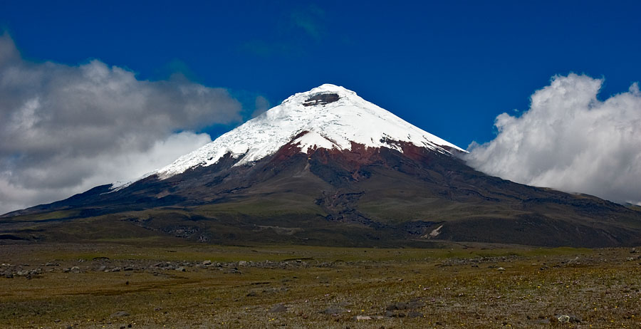
Cuenca’s historic centre preserves a planned street grid in a southern Andean valley, with architecture shaped by several periods of prosperity. Ingapirca, in Cañar, preserves Cañari and Inca remains, including the oval Temple of the Sun. Cotopaxi’s volcanic landscape and Sangay National Park offer another kind of landmark, where geology and changing habitats shape the view.
People and society of Ecuador
Indigenous, Afro-Ecuadorian, Montubio and mestizo identities are part of a varied society.
- Who are the Montubio people?
- Montubio is a recognised cultural identity associated with rural coastal communities and traditions. It is not simply a label for everyone living on the coast.
- Do all Indigenous Ecuadorians share one language and culture?
- No. Ecuador has distinct peoples and nationalities with different languages, territories and histories. Even a broad name such as Kichwa includes varied communities.
- What does census self-identification mean?
- It means people identify their own cultural or ethnic affiliation in the census. These categories should not be treated as fixed assumptions about an individual’s language, occupation or daily life.
More about Ecuador: people & society
Ecuadorian society includes many Indigenous peoples and nationalities, Afro-Ecuadorian communities, Montubio communities and people who identify as mestizo, white or with other backgrounds. Census categories record self-identification through culture and customs; they do not describe a single way of living. Kichwa communities themselves have distinct highland and Amazonian histories.
Esmeraldas and the Chota valley are important places in Afro-Ecuadorian history. Montubio identity is associated with rural coastal traditions, especially in provinces such as Manabí, Los Ríos and Guayas. Quito, Guayaquil and other cities bring people from many regions together. Family networks and migration connect rural areas, cities and Ecuadorian communities abroad, so local identities extend beyond fixed boundaries on a map.