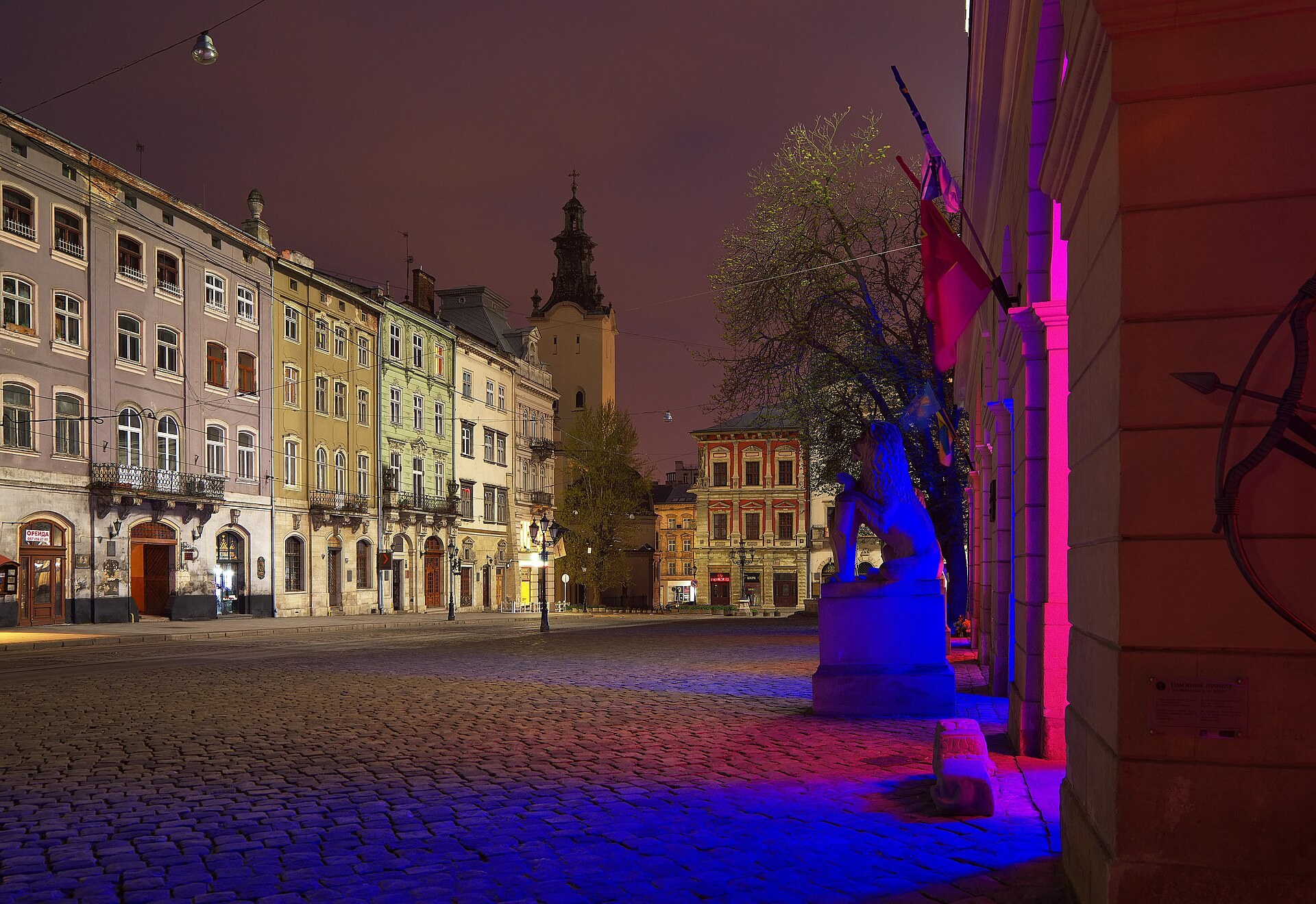
Facts about Ukraine
Explore Ukraine from the Carpathian Mountains and the forests of Polissia to Kyiv, the southern steppe and Crimea. Connect its regions, cities and rivers with the literature, food and communities behind them, then practise Ukrainian. This guide includes Crimea and Sevastopol within Ukraine’s internationally recognised borders.
- Capital
- Kyiv
- Area, including Crimea
- 603,628 km²
- Currency
- Ukrainian hryvnia (UAH)
- Official language
- Ukrainian
- Administrative units
- 24 oblasts, Crimea + 2 special cities
- Highest point
- Hoverla, 2,061 m
Ukraine · 0 of 20 rounds passed
Two timed rounds per topic, 20 seconds a question
The Dnipro links Kyiv with Cherkasy, Dnipro, Zaporizhzhia and the Black Sea. Lviv anchors the west, Kharkiv the northeast and Odesa the southwestern coast. The Carpathians rise along the western frontier, while the Crimean Mountains overlook the peninsula’s southern shore. Ukraine borders Poland, Slovakia, Hungary, Romania, Moldova, Belarus and Russia.
Ukraine has 24 oblasts, the Autonomous Republic of Crimea and two cities with special status: Kyiv and Sevastopol. Kyiv City is separate from surrounding Kyiv Oblast, and Sevastopol is separate from the autonomous republic. Russia has occupied Crimea and Sevastopol since 2014 and launched its full-scale invasion of Ukraine in 2022. The maps teach internationally recognised Ukrainian geography; they do not show current military control or visitor access.
Geography of Ukraine
The Dnipro connects northern forests and central plains with the Black Sea and Crimea.
- Is Crimea part of Ukraine?
- Yes. The Autonomous Republic of Crimea and the separate city of Sevastopol are part of Ukraine within its internationally recognised borders. Russia has occupied both since 2014. The guide’s maps include them as Ukrainian territory.
- How many regions does Ukraine have?
- Ukraine has 24 oblasts, the Autonomous Republic of Crimea and two cities with special status: Kyiv and Sevastopol. That gives 27 first-level administrative units. Kyiv City is separate from Kyiv Oblast.
- Which river runs through Kyiv?
- The Dnipro, also called the Dnieper. It continues through central Ukraine towards the Black Sea. Hoverla, in the western Carpathians, is Ukraine’s highest mountain at 2,061 metres.
More about Ukraine: geography
Ukraine covers 603,628 square kilometres within its internationally recognised borders, including Crimea. Much of the country consists of plains and uplands. Polissia in the north has forests and wetlands; the centre includes extensive agricultural land; and steppe landscapes extend across the south and east. The Carpathians rise in the west, reaching 2,061 metres at Hoverla. A separate mountain range runs along southern Crimea.
The Dnipro flows through Kyiv and the central cities towards the Black Sea. The Dniester crosses western Ukraine and Moldova, while the Southern Bug runs through Vinnytsia towards Mykolaiv. The Desna joins the Dnipro near Kyiv. The Prut passes Chernivtsi, the Siverskyi Donets drains parts of the northeast and Ukraine reaches the Danube in the far southwest. The Kerch Strait connects the Black Sea with the shallower Sea of Azov.
The regional map includes 24 oblasts, the Autonomous Republic of Crimea and the special-status cities of Kyiv and Sevastopol. Dnipro and Kropyvnytskyi are current city names, while their oblasts retain the constitutional names Dnipropetrovsk and Kirovohrad. Crimea and Sevastopol are Ukrainian territory under Russian occupation; international borders and administrative units do not describe who currently controls each place.
History of Ukraine
Kyivan Rus, Cossack communities and the independence declaration of 24 August 1991.
- When did Ukraine become independent?
- Ukraine declared independence on 24 August 1991. A nationwide referendum endorsed independence on 1 December 1991. The declaration preceded the referendum.
- What was the Holodomor?
- The Holodomor was the catastrophic famine of 1932–33 in Soviet Ukraine, caused by Stalinist policies. It killed millions and remains central to Ukraine’s historical memory.
- When did Russia’s invasion of Ukraine begin?
- Russia occupied Crimea and Sevastopol in 2014, and war began in eastern Ukraine that year. The full-scale invasion began on 24 February 2022. The dates describe different stages of the war.
More about Ukraine: history
Medieval Kyiv was a major centre of Kyivan Rus, a state whose legacy is shared across several modern countries. The Mongol conquest of Kyiv in 1240 marked a turning point. Over later centuries, different Ukrainian lands came under Lithuanian, Polish, Ottoman, Habsburg and Russian rule. Cossack communities became influential along the Dnipro, and the seventeenth-century Hetmanate developed its own political institutions.
The Ukrainian People’s Republic emerged during the upheavals after 1917, before Soviet rule was established across much of modern Ukraine. The Holodomor of 1932–33 was a catastrophic famine caused by Stalinist policies. Nazi occupation during the Second World War brought mass murder, including the Holocaust. In Crimea, Soviet authorities deported the Crimean Tatars in 1944. Crimea was transferred from the Russian to the Ukrainian Soviet republic in 1954.
Ukraine declared independence on 24 August 1991, and voters endorsed independence in the referendum of 1 December. The Orange Revolution followed the disputed 2004 presidential election. The Revolution of Dignity grew from the 2013–14 Maidan protests. Russia occupied Crimea and Sevastopol in 2014, and war began in eastern Ukraine that year. Russia’s full-scale invasion began on 24 February 2022. Crimea remains part of Ukraine within its internationally recognised borders.
Language of Ukraine
A distinct East Slavic language, written in Cyrillic and used alongside other community languages.
- Is Ukrainian a dialect of Russian?
- No. Ukrainian is a distinct East Slavic language with its own standard, literature and regional varieties. Ukrainian and Russian are related languages; neither is simply the other with a different accent.
- How do you say thank you in Ukrainian?
- Дякую, transliterated diakuiu. Добрий день, dobryi den, is a polite daytime greeting. The Ukrainian lessons pair these and other everyday phrases with pronunciation guidance.
- What language do Crimean Tatars speak?
- Crimean Tatar is a Turkic language rooted in Crimea. It belongs to a different language family from Ukrainian. Crimean Tatar and other community languages are part of Ukraine’s linguistic life.
More about Ukraine: language
Ukrainian is Ukraine’s official state language and belongs to the East Slavic branch of the Indo-European family. Its Cyrillic alphabet has 33 letters, including ґ, є, і and ї. Nouns change their endings according to grammatical case, and verbs distinguish ongoing or repeated actions from completed actions. Ukrainian has its own standard, literature and regional varieties.
Добрий день, dobryi den, is a polite daytime greeting. Дякую, diakuiu, means thank you, and будь ласка, bud laska, can mean please or you’re welcome. The linked lessons teach useful phrases with pronunciation guidance. English spellings such as Kyiv, Odesa and Kharkiv reflect Ukrainian forms; older spellings found in historical sources often came through Russian.
Russian is also spoken, alongside Crimean Tatar, Hungarian, Romanian and other languages. Crimean Tatar belongs to the Turkic family and has a distinct history rooted in Crimea. Language use varies within families and across regions, and bilingualism is common. A person’s preferred language should not be treated as a simple test of citizenship, identity or political views.
Culture of Ukraine
Pysanky, embroidered shirts, Petrykivka painting and Crimean Tatar ornament.
- What is a vyshyvanka?
- An embroidered shirt. Colours, motifs and stitching techniques vary by region and maker. Vyshyvanky are worn for celebrations and also in everyday settings.
- What are pysanky?
- Decorated eggs made using a wax-resist process. Designs can carry regional and family meanings. They are one of several Ukrainian egg-decorating traditions.
- What is Ornek?
- A Crimean Tatar ornamental tradition recognised by UNESCO. Its motifs and associated knowledge appear in embroidery, ceramics and other crafts, connecting decoration with community memory and practice.
More about Ukraine: culture
A vyshyvanka is an embroidered shirt, with motifs and techniques that vary by region. Pysanky are decorated eggs made using a wax-resist process. Petrykivka decorative painting uses floral and plant motifs and is recognised by UNESCO as living heritage. These traditions sit alongside contemporary literature, cinema, visual art and music.
Taras Shevchenko’s poetry and art helped shape modern Ukrainian cultural life. Lesia Ukrainka and Ivan Franko are other major literary figures. Mykola Leontovych arranged Shchedryk, the Ukrainian song whose melody became known internationally through Carol of the Bells. The bandura combines musical performance with a long tradition of sung storytelling.
Crimean Tatar culture is part of Ukraine’s cultural landscape. UNESCO recognises Ornek, an ornamental tradition used in embroidery, ceramics and other crafts. Hutsul communities in the Carpathians have their own music, dress and craft traditions. Religious festivals and family customs vary by community; calendar changes mean Christmas traditions cannot be reduced to one date for every household.
Economy of Ukraine
Agriculture, iron ore, industry and software connect Ukraine with international trade.
- What is Ukraine’s currency?
- The Ukrainian hryvnia, abbreviated UAH. It was introduced in 1996. Historical references to the karbovanets concern an earlier currency.
- Why is Ukraine important in agriculture?
- Extensive farmland and fertile black-earth soils support crops such as wheat, maize and sunflowers. Grain and sunflower oil connect Ukraine with international food markets.
- What is Kryvyi Rih known for?
- Iron-ore mining and metallurgy. The city extends along the Saksahan and Inhulets rivers in a major mining basin, west of Dnipro in Dnipropetrovsk Oblast.
More about Ukraine: economy
Ukraine’s fertile chernozem, or black-earth soils, support wheat, maize and sunflower cultivation. Grain and sunflower oil are important exports. Iron-ore mining around Kryvyi Rih, metallurgy and manufacturing have shaped industrial regions. Kyiv, Lviv, Kharkiv and other cities also support software, engineering, education and business services.
The national currency is the hryvnia, abbreviated UAH, introduced in 1996. Black Sea ports and Danube ports around Izmail and Reni connect agriculture and industry with overseas markets. Railways and overland routes also link Ukraine with neighbouring European countries. Trade patterns change, so comparisons of partners and exports need a clear reference year.
Russia’s full-scale invasion has damaged infrastructure, displaced workers and disrupted production and shipping. Energy security, reconstruction and the clearance of mines are major economic concerns. A pre-war factory, port or farmland map cannot establish present operating conditions. The guide explains the economic geography while current figures and recovery assessments are available through the World Bank and Ukraine’s public institutions.
Politics of Ukraine
The constitution, Verkhovna Rada and the distinction between sovereignty and occupation.
- What is Ukraine’s parliament called?
- The Verkhovna Rada. Ukraine’s constitutional system also includes a president as head of state and a government led by the prime minister.
- What does Ukraine’s constitution say about Crimea?
- Article 134 defines the Autonomous Republic of Crimea as an inseparable constituent part of Ukraine. Article 133 also names Crimea and the separate city of Sevastopol among Ukraine’s administrative units.
- When did EU accession negotiations with Ukraine open?
- They formally opened in June 2024, after Ukraine received candidate status in 2022. Accession involves negotiations and reforms; opening negotiations is one stage in that process.
More about Ukraine: politics
Ukraine is a unitary republic under the constitution adopted in 1996. The president is head of state, the prime minister leads the government and the Verkhovna Rada is the national parliament. Constitutional powers are shared between the presidency, parliament and Cabinet of Ministers. Local and regional institutions operate within this national framework.
Article 133 names the country’s first-level administrative units, including the Autonomous Republic of Crimea and the cities of Kyiv and Sevastopol. Article 134 defines Crimea as an inseparable constituent part of Ukraine. UN General Assembly resolution 68/262 affirmed Ukraine’s territorial integrity and rejected the validity of the 2014 Crimean referendum. Russian occupation does not change how this guide identifies Ukrainian territory.
War and martial law affect public administration, elections and daily life. Ukraine received EU candidate status in 2022, and accession negotiations formally opened in June 2024. Negotiations are a process involving reforms and agreement with EU members. For changes in wartime rules or negotiations, consult current official sources alongside this introduction to the constitutional system.
Nature of Ukraine
Carpathian forests, northern wetlands, southern steppe and the Crimean Mountains.
- What landscapes are found in Ukraine?
- Northern forests and wetlands, central plains and uplands, southern and eastern steppe, the Carpathians, the Crimean Mountains and coastal lagoons. These support different habitats within one country.
- Which countries share the Danube Delta?
- Ukraine and Romania. Ukraine’s part lies in the far southwest of Odesa Oblast, where river channels and wetlands meet the Black Sea.
- Does wildlife returning to Chornobyl mean it is safe to visit?
- No. Wildlife recovery does not remove radiation hazards, wartime risks or access restrictions. The disaster occurred in 1986, and current official guidance governs access.
More about Ukraine: nature & wildlife
Ukraine’s habitats range from the forests and wetlands of Polissia to Carpathian mountain forests, grassland steppe and coastal lagoons. The Carpathian region supports brown bears and other forest wildlife. Parts of its ancient beech forests belong to a wider European UNESCO World Heritage property. The Shatsk lakes in Volyn and Lake Synevyr in Zakarpattia illustrate different freshwater landscapes.
The Danube Delta, shared with Romania, supports extensive wetland and bird habitats. The Askania-Nova reserve in Kherson Oblast is associated with steppe conservation. Crimea has mountain forests, rocky coasts and lagoons such as the Syvash near the Sea of Azov. These places belong to Ukraine’s natural geography even where occupation prevents normal conservation work.
The Chornobyl nuclear disaster occurred in 1986. Reduced human settlement later allowed wildlife to return to parts of the exclusion zone, but that does not remove radiation hazards. War has damaged ecosystems through fires, mines, pollution and destruction of water infrastructure, including the Kakhovka dam in 2023. Protected-area descriptions explain ecological importance and should not be read as statements about current access.
Food of Ukraine
Borscht, varenyky, holubtsi and the regional traditions behind shared meals.
- Is there one recipe for Ukrainian borscht?
- No. Ingredients vary by household and region. UNESCO recognises the cooking culture, including shared knowledge, hospitality and meals, rather than one compulsory recipe.
- What are varenyky and holubtsi?
- Varenyky are filled dumplings, with savoury or sweet fillings. Holubtsi are cabbage rolls. Pampushky are small bread rolls often served with garlic beside borscht.
- What are chebureky?
- Fried pastries often filled with meat, associated with Crimean Tatar cuisine. Crimean Tatar food traditions are part of Ukraine’s regional cultural landscape.
More about Ukraine: food & cuisine
Ukrainian borscht commonly combines beetroot with vegetables, stock and other ingredients that vary by household and region. Some versions use beans or mushrooms; others include meat. UNESCO recognises the culture of Ukrainian borscht cooking as a living practice, including knowledge, hospitality and shared meals. There is no single fixed recipe for the whole country.
Varenyky are filled dumplings, with savoury fillings such as potato, cabbage or cheese and sweet versions using fruit. Holubtsi are cabbage rolls, while deruny are potato pancakes. Pampushky are small bread rolls often served with garlic beside borscht. A decorated korovai loaf is associated with weddings, and uzvar is a drink made from dried fruit.
Regional cuisines add further variety. Banosh, made from cornmeal with dairy, is associated with Hutsul cooking in the Carpathians. Crimean Tatar traditions include chebureky, fried pastries often filled with meat, and yantyq, a related preparation cooked without deep-frying. Food histories cross borders, while the communities that prepare and share them give dishes local meaning.
Landmarks of Ukraine
Kyiv’s monasteries, Lviv’s historic centre and Chersonese in Ukrainian Crimea.
- Which major landmarks in Kyiv are UNESCO-listed?
- Saint Sophia Cathedral and its related monastic buildings, together with the Kyiv-Pechersk Lavra, form a World Heritage property. The cathedral preserves medieval mosaics and frescoes; the Lavra includes monastic buildings and caves.
- Where is Chersonese?
- Near Sevastopol on Ukraine’s Crimean peninsula. The ancient city and its surrounding agricultural landscape are a UNESCO World Heritage Site in Ukraine, in territory occupied by Russia since 2014.
- Why is Lviv’s historic centre important?
- It preserves an urban landscape shaped by centuries of religious, commercial and cultural contact. Its architecture and street pattern record several historical periods, and UNESCO recognises the historic centre as World Heritage.
More about Ukraine: landmarks
Kyiv’s Saint Sophia Cathedral and the Kyiv-Pechersk Lavra form a UNESCO World Heritage property. Saint Sophia preserves medieval mosaics and frescoes, while the Lavra is known for its monastic buildings and caves. The Golden Gate recalls medieval city fortifications. Maidan Nezalezhnosti, or Independence Square, is associated with the Orange Revolution and the Revolution of Dignity.
Lviv’s historic centre reflects centuries of contact between religious, commercial and cultural communities. Chernivtsi’s former residence of the Bukovinian and Dalmatian metropolitans is now associated with its university. Odesa’s historic centre connects architecture with Black Sea port history. Wooden tserkvas in the Carpathian region form a World Heritage property shared with Poland.
Ancient Chersonese and its surrounding agricultural landscape near Sevastopol are a UNESCO-listed site in Ukraine. Bakhchysarai connects Crimea with Crimean Tatar history, while Yalta and Kerch illustrate other parts of the peninsula’s heritage. Crimea and Sevastopol have been occupied by Russia since 2014. War threatens cultural sites across Ukraine; significance and historic descriptions do not establish present safety or visitor access.
People and society of Ukraine
Regional communities, Crimean Tatars, civic life and a diaspora shaped by displacement.
- Who are the Crimean Tatars?
- An Indigenous people of Crimea with a distinct Turkic language and cultural traditions. Soviet authorities deported them in 1944; many families returned in the late twentieth century. Russian occupation has renewed pressures on their community life.
- How should Ukraine’s population figures be read?
- Check the date, territorial coverage and treatment of displaced people. War has caused large-scale movement within Ukraine and abroad, so a pre-war total should not be presented as the current resident population.
- Who was Taras Shevchenko?
- A nineteenth-century poet and artist whose work helped shape modern Ukrainian culture. Lesia Ukrainka and Ivan Franko are other major literary figures, and contemporary cultural life extends far beyond the historical canon.
More about Ukraine: people & society
Ukraine’s people include ethnic Ukrainians, Crimean Tatars, Russians, Jews, Poles, Hungarians, Romanians, Roma and other communities. Religious life includes Orthodox, Greek Catholic, Roman Catholic, Protestant, Jewish and Muslim traditions, alongside secular identities. Kyiv, Kharkiv, Odesa, Lviv and Dnipro have distinct urban histories, while smaller towns and rural communities are equally part of the country.
Crimean Tatars are an Indigenous people of Crimea. The Soviet deportation of 1944 uprooted their communities, and many families returned in the late twentieth century. Russia’s occupation has brought renewed pressures on community life and cultural rights. Their language, food, music and ornament traditions belong within an account of Ukraine’s people and culture.
Russia’s war has caused large-scale internal displacement and refugee movements abroad, adding to older Ukrainian diasporas. Population figures depend on their date, territorial coverage and whether displaced people are counted. This guide avoids presenting a pre-war total as a current resident count. Civil society, volunteering, schools, cultural institutions and family networks help communities maintain ties across these disruptions.