Facts about South Sudan
Follow the White Nile through South Sudan, from Juba to the Sudd, and explore Equatoria’s highlands, western towns and the Boma–Badingilo migration landscape. Three map games, twelve sights and ten illustrated topics connect the country’s geography with its history, languages and everyday life.
- Capital
- Juba
- Region
- East Africa
- Neighbours
- 6 countries
- Working language
- English
- Currency
- South Sudanese pound (SSP)
- Independence
- 9 July 2011
South Sudan · 0 of 20 rounds passed
Two timed rounds per topic, 20 seconds a question
Juba stands on the White Nile, with Yei to the southwest, Torit and Kapoeta to the east and Nimule near Uganda. Yambio and Maridi introduce Western Equatoria. Wau, Aweil and Kuajok orient the western and northwestern interior; Rumbek lies in Lakes State. Bor, Bentiu, Malakal, Pibor and Renk connect different parts of the central and eastern plains.
The map distinguishes ten states from Greater Pibor and Ruweng administrative areas. Disputed Abyei is excluded. River courses continue beyond national borders, including the White Nile through Uganda and Sudan. Parks and wetlands use representative sight pins; historical photographs and map locations do not establish current access.
Geography of South Sudan
The White Nile, seasonal wetlands and southern mountain ranges.
- How many countries border South Sudan?
- Six countries: Sudan, Ethiopia, Kenya, Uganda, the DRC and the Central African Republic.
- Where does the White Nile go beyond South Sudan?
- It continues through Sudan to meet the Blue Nile at Khartoum.
- Is the Sudd a lake with a fixed shoreline?
- No. It is a changing network of channels, swamps and seasonal floodplains.
More about South Sudan: geography
South Sudan is landlocked, bordering Sudan, Ethiopia, Kenya, Uganda, the Democratic Republic of the Congo and the Central African Republic. Juba, the capital, stands on the White Nile in the south. Equatoria includes woodland, farming areas and the Imatong Mountains, where Mount Kinyeti is the country’s highest peak. Farther north, broad plains and seasonal floodwaters shape settlement and movement. Equatoria, Bahr el Ghazal and Upper Nile are historical regional names, distinct from the present states.
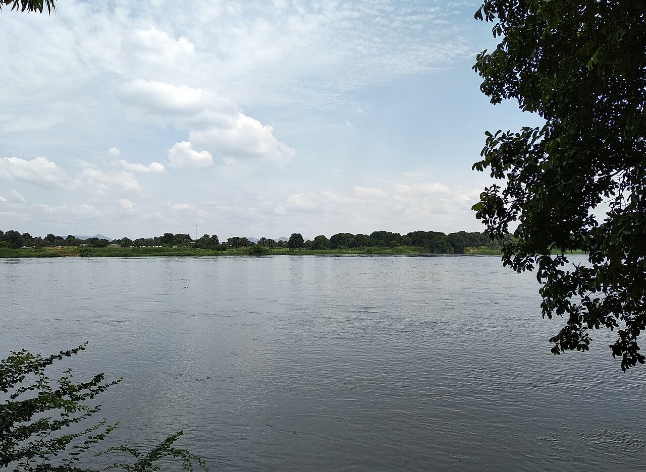
The White Nile enters from Uganda, where its upper reach is called the Albert Nile. In South Sudan it is also known as the Bahr el Jebel. It spreads through the Sudd before continuing into Sudan, where it meets the Blue Nile at Khartoum. The Sobat joins near Malakal; the Bahr el Ghazal joins near Lake No. These are connected river systems whose courses cross national boundaries. The map retains complete named courses rather than cutting them at the border; wetland extent and navigable channels vary with the seasons.
History of South Sudan
Community histories, the 2005 peace agreement and independence in 2011.
- When did South Sudan become independent?
- On 9 July 2011, following the January referendum on separation from Sudan.
- What did the 2005 peace agreement provide?
- An end to that phase of war and a process leading to a referendum.
- Did independence end all conflict?
- No. Civil war began in December 2013, followed by difficult peace efforts.
More about South Sudan: history
The histories of the region include farming societies, pastoral communities, kingdoms, trade and resistance to slave raiding. The Shilluk kingdom developed along the White Nile, while Zande political traditions grew in the southwest. Nineteenth-century expansion from the north and Anglo-Egyptian administration from 1899 changed power and trade. Sudan became independent in 1956; a southern army mutiny at Torit in 1955 preceded a long civil war. The 1972 Addis Ababa Agreement established southern autonomy, but renewed war began in 1983.
The Comprehensive Peace Agreement of 2005 ended that phase of war and established a process leading to a referendum. John Garang, a leader of the Sudan People’s Liberation Movement, died in 2005. In January 2011, voters overwhelmingly supported separation. South Sudan became independent on 9 July 2011 and joined the United Nations that month. Civil war broke out within the new state in December 2013. The 2018 revitalised peace agreement provided a framework for power sharing and reform, but implementation and protection of civilians have remained difficult. Political conflict cannot be reduced to a single rivalry between ethnic communities.
Languages of South Sudan
English, Juba Arabic and many community languages.
- What is the official working language?
- English, under the Transitional Constitution; indigenous languages also have national recognition.
- Is Juba Arabic the same as Modern Standard Arabic?
- No. Juba Arabic developed as a distinct contact language used between communities.
- Does everyone speak the same home language?
- No. Families speak many languages, including Dinka, Nuer, Bari, Zande and Shilluk.
More about South Sudan: language
The Transitional Constitution makes English the official working language and recognises indigenous languages as national languages. Dinka, Nuer, Shilluk, Bari, Zande, Murle, Otuho, Toposa, Anyuak and many others belong to different communities. Dinka and Nuer are Western Nilotic languages; Bari belongs to the Eastern Nilotic grouping. Zande belongs to a different language tradition. A shared country does not imply a single home language, and the number of languages depends partly on how varieties are classified.
Juba Arabic developed through contact and is widely used as a lingua franca, especially around the capital. It differs from Modern Standard Arabic and from English. Families may use one language at home, another in the market and English in formal education or government. Colonial policy, migration and schooling have shaped these patterns. Mother-tongue education requires teachers, materials and support for different communities. Worldly does not yet offer a dedicated Dinka, Nuer, Bari or Juba Arabic course; the guide introduces the multilingual setting without treating a neighbouring language course as a substitute.
Culture of South Sudan
Cattle traditions, storytelling, performance and contemporary sport.
- Do cattle traditions describe everyone in South Sudan?
- No. They are important in several communities alongside farming, fishing and urban livelihoods.
- Who is the Shilluk reth?
- A traditional royal figure associated with the Shilluk kingdom along the White Nile.
- What happened at the 2024 Olympic basketball tournament?
- South Sudan’s men debuted and won their opening match against Puerto Rico.
More about South Sudan: culture
Cattle carry economic and social significance in many pastoral communities, including some Dinka, Nuer and Mundari communities. Herds can connect families through exchange, marriage arrangements, songs and personal names. Seasonal cattle camps respond to water and grazing conditions. These practices vary between communities and households; they do not describe every South Sudanese person. Farming, fishing, urban employment and other livelihoods have their own skills and traditions. The Shilluk reth is a traditional royal figure, separate from the national presidency.
Oral histories, praise songs, drums and dance preserve memory and mark ceremonies. Wrestling is an important public sport in several communities. Contemporary musicians, writers and visual artists work within the country and across its diaspora, drawing on more than one language and place. Football and basketball connect local enthusiasm with international competition. South Sudan’s men’s basketball team made its Olympic debut in 2024 and won its opening match against Puerto Rico. Cultural life continues to change as people move, study and build relationships across borders.
Economy of South Sudan
Oil exports, household farming, livestock and river markets.
- What currency does South Sudan use?
- The South Sudanese pound, code SSP, separate from Sudan’s own national currency.
- Why does Sudan matter to oil exports?
- South Sudan’s export pipelines run through Sudan towards ports on the Red Sea.
- Do most households earn their living directly from oil?
- No. Farming, livestock, fishing and trading support many households across the country.
More about South Sudan: economy
Petroleum has been central to government revenue and export earnings. South Sudan is landlocked, and oil export pipelines pass through Sudan to the Red Sea. That dependence links public finances to production, pipeline access and events beyond the national border. Disruptions can affect revenue, imports and everyday prices. Oil earnings should not be confused with most households’ livelihoods: farming, livestock keeping, fishing and small-scale trade support many families. Sorghum, maize, cassava and groundnuts are among the crops grown in different areas.
Juba concentrates administration, services and commerce, while towns such as Wau, Aweil, Yambio and Malakal connect surrounding regions with markets. Seasonal flooding and poor roads can interrupt transport and raise the cost of goods. River transport remains important where roads are difficult. The currency is the South Sudanese pound, international code SSP; it is separate from Sudan’s currency. Economic prospects depend on peace, reliable infrastructure, public services and management of natural resources as well as oil production. This guide avoids a fixed exchange rate or an undated claim about oil’s share of the budget.
Politics of South Sudan
Transitional institutions, the peace agreement and administrative geography.
- What are the two chambers of the legislature?
- The National Legislative Assembly and the Council of States form the national legislature.
- Why does the map show twelve administrative units?
- It shows ten states plus Greater Pibor and Ruweng; disputed Abyei is excluded.
- What is R-ARCSS?
- The 2018 revitalised peace agreement, which sets out power-sharing and reform arrangements.
More about South Sudan: politics
South Sudan’s Transitional Constitution dates from independence in 2011 and has been amended. It provides for a president, a legislature and a judiciary. The national legislature comprises the National Legislative Assembly and the Council of States. The 2018 Revitalised Agreement on the Resolution of the Conflict in South Sudan, often abbreviated R-ARCSS, sets out power-sharing, security and reform arrangements. Describing that framework does not mean that every commitment has been implemented. Political authority and accountability remain contested.
The country has ten states and three administrative areas: Greater Pibor, Ruweng and Abyei. Abyei’s final status remains disputed between Sudan and South Sudan; this map excludes it and does not assign it to either country. Greater Pibor and Ruweng appear separately from the ten states. The map is a reference for learning administrative names, not a depiction of military control. South Sudan joined the United Nations in 2011 and the East African Community in 2016. Election timetables and officeholders can change, so the guide focuses on institutions and dated historical milestones.
Nature & Wildlife of South Sudan
The Sudd’s waterbirds and the Great Nile antelope migration.
- Which antelopes take part in the Great Nile Migration?
- White-eared kob, tiang, Mongalla gazelle and Bohor reedbuck are among the migrating species.
- Is the shoebill a true stork?
- No. The shoebill belongs to its own bird family, called Balaenicipitidae.
- When did Boma–Badingilo gain World Heritage status?
- In July 2026, becoming South Sudan’s first property on the World Heritage List.
More about South Sudan: nature & wildlife
The Sudd is a vast freshwater wetland sustained by the White Nile, local rainfall and surrounding drainage. Papyrus, open channels and seasonally flooded grasslands support fish, waterbirds and grazing animals. The shoebill is one of its best-known birds; despite the nickname “shoebill stork”, it belongs to its own family. The Sudd is a Ramsar Wetland of International Importance. Its area changes between seasons and years, so a single outline cannot represent every flood or dry season.
Boma and Badingilo national parks and their connecting landscapes support the Great Nile Migration. White-eared kob, tiang, Mongalla gazelle and Bohor reedbuck move between seasonal habitats; some migration routes extend into Ethiopia. Recent aerial surveys have revealed the exceptional scale of this movement. The Boma–Badingilo Migratory Landscape became South Sudan’s first UNESCO World Heritage property in July 2026. Wildlife depends on habitat connections outside park boundaries, and conservation must account for neighbouring communities and their livelihoods. A representative park pin cannot show the whole ecosystem or guarantee access or animal sightings.
Food & Cuisine of South Sudan
Sorghum, maize, groundnuts, greens and freshwater fish.
- What is asida?
- A firm porridge often made with sorghum or maize flour and served with sauces.
- What is kisra?
- A thin fermented flatbread, often made with sorghum and eaten alongside other dishes.
- Why is fish important in wetland areas?
- Rivers and wetlands support fisheries that provide fresh or dried food and livelihoods.
More about South Sudan: food & cuisine
South Sudanese food varies with region, season and household. Sorghum and maize can be cooked into a firm porridge, often called asida, and served with sauces or stews. Kisra, also spelled kissra, is a thin fermented flatbread associated with sorghum. Cassava, millet, beans and rice add other staples. Groundnut paste thickens savoury sauces; okra and leafy vegetables are used in different preparations. Shared dishes also connect South Sudan with neighbouring food traditions.
Fresh and dried fish are important near rivers and wetlands. Livestock-keeping households use dairy foods and meat in ways shaped by the season and local customs. Markets in towns connect local produce with imported ingredients. No single dish or cattle-related practice represents everyone, and religious observance, household resources and personal taste influence meals. Flooding, conflict and disrupted trade can make food difficult to obtain even in areas with productive land and fisheries. Food traditions should therefore be distinguished from claims that every household has reliable access to a varied diet.
Landmarks of South Sudan
Juba’s bridges, Equatoria’s mountains and landscapes of memory.
- When did the Freedom Bridge open?
- On 19 May 2022, as a new White Nile crossing in Juba.
- Are all three UNESCO-listed locations World Heritage properties?
- No. Boma–Badingilo is inscribed; the Sudd and Deim Zubeir remain tentative sites.
- Do the sight pins establish safe access?
- No. They identify educational locations; current official advice warns against all travel.
More about South Sudan: landmarks
Juba’s White Nile crossings show the importance of the river to everyday transport. The older Juba Bridge and the Freedom Bridge are separate structures; the latter opened on 19 May 2022 with Japanese support. The John Garang Mausoleum connects the capital with the history of the liberation movement and independence. St. Theresa’s Cathedral in Kator is one of the city’s religious landmarks. Yei’s church memorial records another local history, while Deim Zubeir preserves evidence of the nineteenth-century slave trade.
The Imatong Mountains and Mount Kinyeti mark the southern highlands. Nimule and the Fula Rapids introduce the White Nile near Uganda, while the Sudd and Boma–Badingilo reveal large connected wetland and savanna systems. Boma–Badingilo is a World Heritage property; the Sudd and Deim Zubeir remain on UNESCO’s Tentative List, a different status. The twelve selected sight pins are educational locations. Large landscapes use representative points rather than entrances or boundaries. Checked on 29 October 2026, UK official advice warns against all travel to South Sudan; consult current advice for changes.
People & Society of South Sudan
Many communities, cross-border families and a changing urban life.
- Are refugees and internally displaced people the same category?
- No. Refugees cross international borders; internally displaced people remain within their own country.
- Does one community describe the whole country?
- No. South Sudan includes many languages, local histories, faiths and community identities.
- How has the war in Sudan affected South Sudan?
- It has brought refugees and returnees, adding pressure on families, services and livelihoods.
More about South Sudan: people & society
Dinka, Nuer, Shilluk, Zande, Bari, Murle, Toposa, Otuho, Anyuak and many other communities contribute to South Sudan’s social life. Identity can involve language, family, locality, faith and personal history. Christian churches, Muslim communities and indigenous religious traditions form part of the country’s religious landscape. National identity does not erase local differences, and community labels do not determine an individual’s politics or livelihood. Chiefs and elders may help resolve local disputes, alongside other institutions and forms of authority.
Conflict and flooding have displaced many people within South Sudan and across its borders. The country also receives refugees and returnees from Sudan, especially since war began there in 2023. Refugees have crossed an international border; internally displaced people remain within their own country. Families and diaspora communities maintain ties through languages, remittances, sport, education and cultural work. Juba and regional towns bring people from different backgrounds together. Access to schooling, health care, housing and secure livelihoods remains uneven, and displacement should not be treated as the only story of the people who live here.