Facts about Eritrea
Explore Eritrea from Asmara’s highland streets to Massawa’s Red Sea harbour, the western lowlands and the ancient sites of the southern plateau. Ten illustrated topics connect geography with history, languages, food and everyday life.
- Capital
- Asmara
- Currency
- Eritrean nakfa (ERN)
- Coast
- Red Sea
- Administrative regions
- 6 zobas
- Independence
- 24 May 1993
- UNESCO World Heritage
- Asmara · inscribed 2017
Eritrea · 0 of 20 rounds passed
Two timed rounds per topic, 20 seconds a question
Asmara stands on the central plateau, with Keren to the northwest and Mendefera, Dekemhare, Adi Keyh and Senafe farther south. Barentu, Agordat and Teseney orient the western lowlands; Nakfa and Afabet introduce the northern interior. Ghinda lies on the descent to Massawa, while Assab anchors the far southeastern coast.
Place sixteen cities and towns, follow four rivers and the Red Sea, then explore twelve architectural, archaeological and landscape sights. The maps connect Asmara’s modernist ensemble, Massawa’s old town, Adulis, Qohaito and Metera with the Dahlak islands and eastern escarpment. Tigrinya and Arabic lessons offer two starting points within a multilingual country.
Geography of Eritrea
Cool highlands, western river plains and a long, hot Red Sea coast.
- Where is Eritrea?
- On the western shore of the Red Sea in the Horn of Africa, bordering Sudan, Ethiopia and Djibouti.
- Is Asmara a coastal city?
- No. Asmara is a highland capital at roughly 2,300 metres; Massawa is a port on the Red Sea.
- What is the Dahlak Archipelago?
- A group of Eritrean islands in the Red Sea, northeast of Massawa.
More about Eritrea: geography
Eritrea lies in the Horn of Africa, with Sudan to the west, Ethiopia to the south and Djibouti to the southeast. Its eastern coast faces the Red Sea. Asmara stands at roughly 2,300 metres on the central plateau, much higher and cooler than the port of Massawa. The eastern escarpment drops steeply towards the coastal plain, while the western lowlands extend towards Sudan.
The southeastern lowlands form part of the hot, arid Danakil landscape. Offshore, the Dahlak Archipelago contains many islands and shallow marine habitats. The seasonal Mareb–Gash ends in an inland delta in Sudan; the Barka flows towards the Tokar delta, joined upstream by the Anseba. The Tekezé–Setit reaches the Atbara in Sudan. These rivers and the Red Sea extend well beyond Eritrea’s borders. Emba Soira rises to about 3,000 metres in the southern highlands.
History of Eritrea
Red Sea trade, colonial rule, federation and a long independence struggle.
- When did Eritrea become independent?
- In 1993, following a referendum; Independence Day is celebrated on 24 May.
- Who administered Eritrea between Italian rule and federation?
- A British military administration governed from 1941 until federation with Ethiopia in 1952.
- What was Adulis?
- An ancient Red Sea port associated with the Aksumite kingdom and long-distance trade.
More about Eritrea: history
Ancient Adulis connected the highlands with Red Sea and Indian Ocean trade and became a major port of the Aksumite kingdom. Later coastal histories included Ottoman and Egyptian rule, while highland and western communities followed other political networks. Italy proclaimed the colony of Eritrea in 1890 and developed Asmara as a colonial centre. Modernist architecture survives alongside the history of racial segregation and coercion that shaped the colonial city.
British military administration began in 1941 after Italy’s defeat in the region. A UN-backed federation joined Eritrea with Ethiopia in 1952; Ethiopia ended the federation and annexed Eritrea in 1962. The independence war ran from 1961 to 1991, ending with Eritrean People’s Liberation Front control. A referendum preceded internationally recognised independence in 1993. Independence Day is 24 May. Eritrea and Ethiopia fought a border war in 1998–2000 and signed a peace declaration in 2018; subsequent regional conflicts require their own context.
Eritrea’s languages
Tigrinya and Tigre are distinct languages in a much wider linguistic landscape.
- Are Tigrinya and Tigre the same language?
- No. They are distinct Semitic languages.
- Which script does Tigrinya use?
- The Ethiopic, or Geʽez-derived, script.
- Which Eritrean languages can I begin here?
- Worldly links to existing Tigrinya and Arabic courses, within Eritrea’s broader multilingual landscape.
More about Eritrea: language
Tigrinya and Tigre are separate Semitic languages, not alternative names for the same language. Tigrinya commonly uses the Ethiopic script derived from Geʽez. Afar, Saho, Bilen and Beja belong to the Cushitic branch of Afroasiatic; Kunama and Nara belong to other language families. Arabic has religious, public and cross-border roles, while English is important in secondary and higher education. Writing practices differ between languages and communities.
Eritrea has no single legally designated official language. The 1997 constitution’s language-equality provisions should be distinguished from the fact that the constitution has not been implemented. Tigrinya, Arabic and English are widely described as working languages. Worldly’s Tigrinya and Arabic lessons offer two starting points; neither represents every Eritrean household. Tigrinya is also spoken in Ethiopia, and language names should not be used as shorthand for nationality or political affiliation.
Culture of Eritrea
Coffee, cycling, music and festivals across highland, lowland and coastal communities.
- What is a jebena?
- A clay vessel used to brew coffee in ceremonies associated with Eritrea and neighbouring societies.
- Which sport has a strong following in Eritrea?
- Cycling, including road racing and international competition.
- What does Meskel commemorate?
- The finding of the True Cross in Orthodox Christian tradition.
More about Eritrea: culture
A coffee ceremony can involve roasting beans, grinding them and brewing in a clay jebena, with conversation and hospitality central to the occasion. Musical traditions include the krar lyre, drums, songs and dances whose forms vary by community. The white cotton zuria is associated particularly with highland women’s festive clothing; it is not a universal national uniform. Contemporary Eritrean music also circulates through diaspora communities.
Cycling has a strong following, rooted partly in the colonial period and developed by generations of Eritrean riders. Biniam Girmay became the first Black African rider to win a Tour de France stage in 2024. Orthodox Christian festivals such as Meskel and Muslim celebrations such as Eid belong to different religious calendars. Independence Day on 24 May marks a separate national occasion. These shared and distinct practices are best understood without treating one tradition as the experience of every family.
Economy of Eritrea
Farming, livestock, mining, ports and family connections across borders.
- What is Eritrea’s currency?
- The Eritrean nakfa, with currency code ERN.
- Which metals are associated with Bisha?
- Gold, copper and zinc have been produced there.
- Why does rainfall matter to the economy?
- Many farming and livestock livelihoods depend on variable rainfall and access to water.
More about Eritrea: economy
Agriculture and livestock support many livelihoods, with sorghum, millet and other crops suited to different elevations and rainfall patterns. Drought and limited water supplies create recurring difficulties. Mining is important for exports: the Bisha operation has produced gold, copper and zinc. Massawa and Assab link Eritrea to maritime trade, although the use and importance of individual ports have changed with regional relations.
The national currency is the Eritrean nakfa, introduced in 1997 and named after Nakfa, a town associated with the liberation struggle. The state plays a large role in economic activity and promotes self-reliance. Diaspora households maintain financial and family links, while Eritrea’s controversial two-percent tax on income earned abroad is distinct from a flat fee on every remittance. National service and restrictions on movement and private enterprise also affect work and household choices. Limited statistics make precise contemporary economic comparisons difficult.
Politics of Eritrea
One-party rule, an unimplemented constitution and prolonged national service.
- How many administrative regions does Eritrea have?
- Six regions, commonly called zobas.
- Is the 1997 constitution implemented?
- No. Ratification and implementation are different, and its constitutional institutions have not been put into effect.
- Why is national service a major issue?
- Human-rights reporting documents prolonged, often indefinite service and the constraints it places on people’s lives.
More about Eritrea: politics
Eritrea has been governed by the People’s Front for Democracy and Justice, the successor to its principal liberation movement. No national elections have been held since independence. A constitution ratified in 1997 has not been implemented. Six administrative regions, or zobas, organise the country: Maekel, Anseba, Gash-Barka, Debub, Northern Red Sea and Southern Red Sea. Their names and government structures should be distinguished from how political rights operate in practice.
Human Rights Watch’s 2026 report describes severe restrictions on expression, association and religion, arbitrary detention and national service extending beyond its formally stated term. These are documented human-rights concerns, rather than a basis for stereotyping Eritrean people. The 2018 peace declaration with Ethiopia ended a long diplomatic stalemate; it did not resolve every regional conflict or rights issue. Eritrean forces’ involvement in Ethiopia’s northern war also forms part of the recent history.
Nature & Wildlife of Eritrea
Escarpment woodlands, desert wildlife, coral reefs and Red Sea migration routes.
- Why is part of the escarpment called the Green Belt?
- Moisture and mist help support woodland on slopes that contrast with the drier surrounding lowlands.
- Which endangered wild equid lives in Eritrea?
- The African wild ass, which survives in parts of the eastern lowlands.
- What does a dugong eat?
- Seagrass in shallow coastal waters.
More about Eritrea: nature & wildlife
Eritrea’s habitats change from highland slopes to western lowlands and the arid coastal plain. The eastern escarpment around Semenawi Bahri receives moisture and mist that support woodland in contrast with nearby dry country. Rainfall varies seasonally; the Green Belt does not mean constant rain everywhere. The African wild ass survives in parts of the eastern lowlands and faces serious conservation pressures.
The Red Sea coast and Dahlak islands include coral reefs, mangroves and seagrass habitats. Dugongs feed on seagrass, while marine turtles and many fish species use coastal waters. The wider Red Sea corridor is important for migrating birds, including birds of prey. Fishing pressure, habitat damage and climate-related warming affect these ecosystems. A landscape pin on this guide marks a learning location rather than a protected-area boundary or a claim about current wildlife abundance.
Food & Cuisine of Eritrea
Injera, zigni, shiro, lowland grain dishes and Asmara’s café traditions.
- Is injera always made only from teff?
- No. Teff is important, but recipes can include other grains and mixtures.
- What is shiro?
- A dish made from ground pulses, commonly chickpeas or broad beans.
- Why are pasta and espresso associated with Asmara?
- Italian colonial connections influenced urban food and café traditions, which Eritreans have adapted over time.
More about Eritrea: food & cuisine
Injera is a fermented flatbread used with stews, vegetables and pulses, especially in highland food traditions. Teff is an important ingredient, though other grains and mixtures are also used. Zigni is a spicy meat stew, while shiro uses ground pulses such as chickpeas or broad beans. Berbere is a spice blend with recipes that vary. Orthodox fasting practices contribute to a range of plant-based dishes.
Food traditions extend beyond a single injera platter. Akelet, a porridge often made with wheat, and breads and grain dishes of lowland communities add other textures and methods. Coastal foodways include fish. Pasta, espresso and cafés in Asmara reflect Italian colonial connections adapted into local urban life. Coffee ceremonies and tea both carry social meaning. Ingredients, dietary practices and everyday meals differ by household, faith, region and access to food.
Landmarks of Eritrea
Asmara’s modernist cityscape, Massawa’s old town and ancient highland sites.
- What is Eritrea’s inscribed World Heritage property?
- Asmara: A Modernist African City, inscribed in 2017.
- What makes Fiat Tagliero distinctive?
- Its reinforced-concrete cantilevered wings evoke an aircraft.
- Are Adulis and Qohaito also inscribed World Heritage sites?
- No. Their archaeological importance does not make them additional inscribed World Heritage properties.
More about Eritrea: landmarks
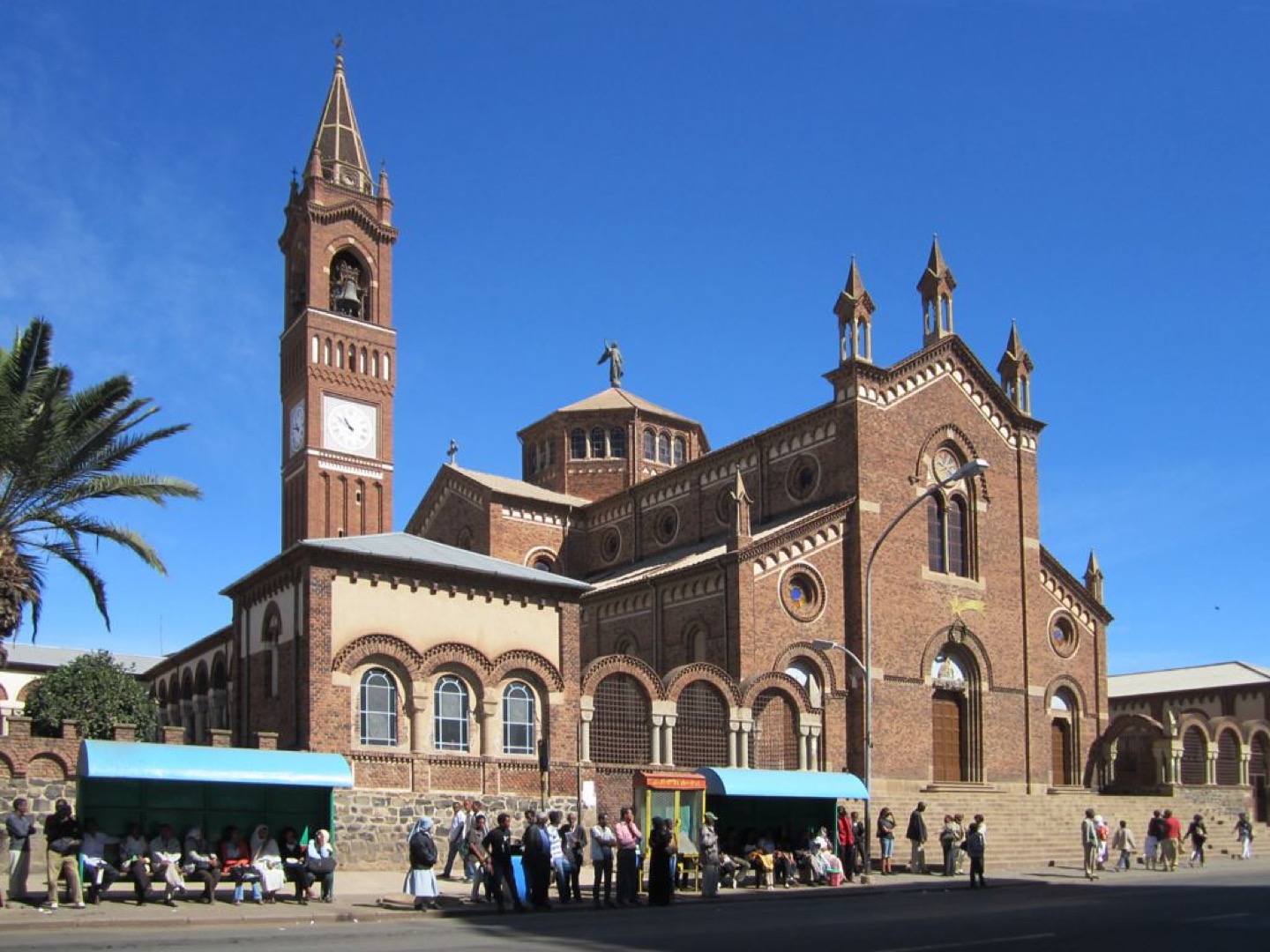
UNESCO inscribed Asmara: A Modernist African City in 2017. The property encompasses an urban ensemble, not every building in the wider capital. Fiat Tagliero’s cantilevered wings, Cinema Impero and the opera house provide different examples of the city’s architecture. Our Lady of the Rosary church and the Great Mosque also form part of Asmara’s religious and urban landscape. Colonial design history includes segregation and unequal power as well as architectural innovation.
Massawa’s old town records Red Sea connections through coral-stone buildings and Ottoman and Egyptian influences. Farther south, Adulis preserves the remains of an ancient trading port near Zula. Qohaito’s plateau and Metera near Senafe add archaeological landscapes of the highlands. These places should not be described as additional inscribed World Heritage properties: Asmara is Eritrea’s sole inscription. The railway between the coast and highlands is a feat of engineering; historic railway photographs do not establish a current passenger service.
People & Society of Eritrea
Many communities, faiths and livelihoods, with families connected across borders.
- Which communities are commonly recognised in Eritrea?
- Tigrinya, Tigre, Saho, Afar, Bilen, Hedareb, Kunama, Nara and Rashaida.
- Does speaking a language determine someone’s religion?
- No. Language, faith and identity overlap in varied ways and should not be equated.
- Why discuss Eritrea’s diaspora?
- Family and cultural connections across borders are important, shaped by migration, conflict, political restrictions and work.
More about Eritrea: people & society
Eritrea commonly recognises nine ethnic communities: Tigrinya, Tigre, Saho, Afar, Bilen, Hedareb, Kunama, Nara and Rashaida. Such labels describe broad histories, not the beliefs or choices of every individual. Christian and Muslim communities form major parts of society, but precise religious and population shares vary by source and should not be presented as fixed census facts. Language, faith and regional identity overlap in different ways.
Highland farming, western agro-pastoral livelihoods, coastal fishing and urban employment support different patterns of daily life. Women participated in the independence struggle in military and civilian roles, while equality in later life remains a separate question. War, political restrictions and economic pressures have shaped migration and exile. Diaspora communities sustain family, cultural and financial connections, and their political views are diverse. No single undated percentage can adequately describe Eritrea’s diaspora.