Facts about Sierra Leone
Explore Sierra Leone from Freetown’s mountainous peninsula to the northern highlands, the diamond country around Koidu and the rainforests of Gola and Tiwai.
- Capital
- Freetown
- Area
- About 72,000 km²
- Currency
- Leone (SLE)
- Official language
- English
- Shared language
- Krio
- Independence
- 27 April 1961
Sierra Leone · 0 of 20 rounds passed
Two timed rounds per topic, 20 seconds a question
Freetown and Waterloo orient the Western Area. Port Loko and Kambia introduce the northwest; Makeni and Kabala lead toward the northern interior. Bo and Kenema anchor the south and east, with Koidu in Kono and Bonthe on Sherbro Island.
Three map games connect four provinces and the Western Area, sixteen cities and towns, and seven rivers. Discover ten historic and natural sights, then read ten illustrated topics with thirty answered reading questions. River geometry continues across national borders.
Geography of Sierra Leone
Atlantic estuaries, inland plateaus and the Loma Mountains.
- Which two countries border Sierra Leone?
- Guinea and Liberia.
- Where is Mount Bintumani?
- In the Loma Mountains in the northeast.
- What are the five first-level divisions?
- Eastern, Northern, North Western and Southern provinces, plus the Western Area.
More about Sierra Leone: geography
Sierra Leone faces the Atlantic Ocean in West Africa, with Guinea to the north and east and Liberia to the southeast. Mangrove-lined estuaries and coastal plains give way to inland plateaus and the Loma and Tingi mountains. Mount Bintumani, in the Loma Mountains, is the country’s highest peak. Heavy seasonal rain links the landscape to farming, river flows and coastal wetlands.
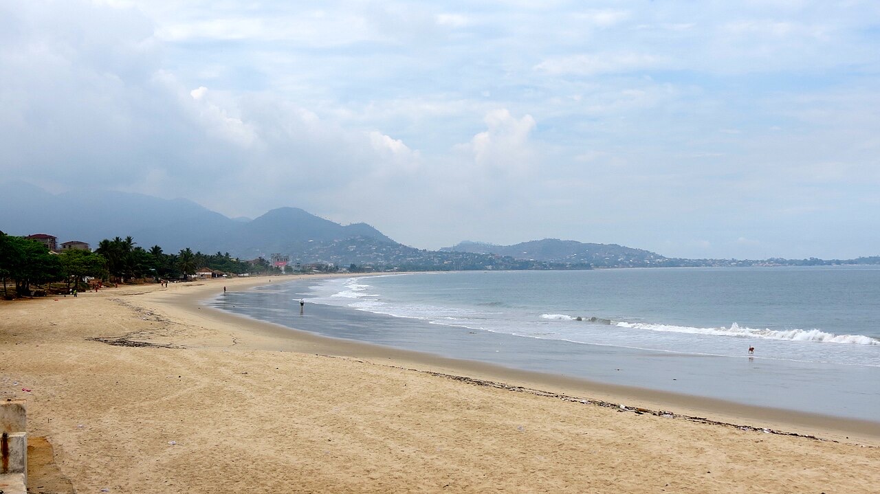
Freetown occupies a mountainous peninsula beside the Sierra Leone River estuary. Bo and Kenema anchor the south and east, Makeni the northern interior, and Koidu the diamond-producing Kono area. Four provinces—Eastern, Northern, North Western and Southern—plus the Western Area form the first administrative level. North Western Province was created in 2017; older maps may show it within Northern Province.
History of Sierra Leone
Coastal trade, Freetown’s settlement and independence.
- When did Sierra Leone become independent?
- 27 April 1961.
- What does Bunce Island document?
- The Atlantic slave trade and the forced transportation of enslaved people.
- When did the civil war end?
- In 2002.
More about Sierra Leone: history
Long before European contact, communities in the region developed farming, ironworking and trade networks. From the fifteenth century, Portuguese and other European traders entered the coast’s commerce. Bunce Island became a major British slave-trading site, connecting the Sierra Leone River with the forced transportation of people across the Atlantic. Its ruins preserve evidence of enslavement rather than a story of peaceful coastal exchange.
Freetown’s settlement history includes the 1787 settlement scheme, Black Loyalists arriving from Nova Scotia in 1792, Jamaican Maroons and Africans freed from intercepted slave ships. Britain established the colony in 1808 and declared a protectorate over the interior in 1896. Sierra Leone became independent on 27 April 1961. The civil war of 1991–2002 caused immense suffering; the postwar period brought disarmament, reconstruction and efforts to establish accountability.
Sierra Leone’s languages
English, Krio and the country’s community languages.
- What is the official language?
- English.
- Which language is widely used between communities?
- Krio.
- Name two major community languages.
- Mende and Temne.
More about Sierra Leone: language
English is Sierra Leone’s official language and is used in education, government and formal documents. Krio, an English-based creole with its own grammar and vocabulary, is widely used as a shared language across communities. It is also the first language of many Krio people. Speaking Krio does not imply a single ethnic identity.
Mende and Temne are major community languages, alongside Limba, Kono, Kuranko, Loko, Susu, Kissi, Sherbro and others. Language use varies between homes, markets, schools and regions; multilingualism is common. Krio should not be reduced to “incorrect English,” and the official language alone does not describe the country’s everyday conversations.
Culture of Sierra Leone
Storytelling, music, weaving and diverse traditions.
- What is country cloth associated with?
- Locally woven textiles, often made from joined strips.
- Why should one ceremony not stand for all the country?
- Communities and cultural practices differ.
- Name a way oral traditions pass on knowledge.
- Storytelling, oral histories or music.
More about Sierra Leone: culture
Oral histories, storytelling, music and dance carry knowledge across generations. Griots and other performers, community celebrations and contemporary popular music all contribute to cultural life. Country cloth, often woven in strips and sewn into larger textiles, connects craft with local identities and trade. Freetown’s music and arts also reflect the city’s Atlantic and regional connections.
Poro and Sande associations have cultural and educational roles in some communities, but practices vary and should not be presented as universal. Some ceremonies involve knowledge that is not public. A photograph of a dance records one place and occasion rather than all Sierra Leonean culture. Literature, film, radio and football provide other ways people express belonging and debate social change.
Economy of Sierra Leone
Farming, fishing, mining and the Freetown port.
- Which crop is central to farming and meals?
- Rice.
- What is Kono especially associated with?
- Diamond mining.
- What is the code of the redenominated leone?
- SLE.
More about Sierra Leone: economy
Agriculture supports many households, with rice central to cultivation and consumption. Cocoa, coffee and oil-palm products connect rural producers with markets, while fishing sustains coastal communities. Roads, reliable power, access to finance and the seasonal weather affect the movement and value of goods. Small businesses and informal trading are important parts of urban livelihoods.
Mining includes diamonds, iron ore, rutile and bauxite. Kono is closely associated with diamond mining, but national life and work extend well beyond this industry. Mineral exports can bring revenue while also creating environmental and governance challenges. The currency is the leone: the redenominated leone, introduced in 2022 and coded SLE, replaced 1,000 old leones with one new leone.
Politics of Sierra Leone
A republic, elected institutions and local government.
- Who is head of state and government?
- The president.
- What is Parliament’s role?
- Making laws and scrutinizing government.
- Are provinces the same as districts?
- No. They are different administrative levels.
More about Sierra Leone: politics
Sierra Leone is a republic with a president who serves as head of state and head of government. Parliament makes laws and scrutinizes government, while courts form the judicial branch. The 1991 constitution provides the central framework, with subsequent amendments and laws shaping how institutions work. Freetown is the national political capital.
Provincial and district administration, local councils and chiefdom institutions operate at different levels. The four provinces and Western Area are first-level divisions; they should not be confused with the sixteen districts. The 2017 changes created North Western Province and the districts of Karene and Falaba. Understanding these layers helps connect local places to national institutions without treating a province as a sovereign state.
Nature & Wildlife of Sierra Leone
Upper Guinean rainforest, chimpanzees and river islands.
- Which river surrounds Tiwai Island?
- The Moa River.
- What does Tacugama focus on?
- Chimpanzee rescue, conservation and environmental education.
- Which property was inscribed by UNESCO in 2025?
- Gola-Tiwai Complex.
More about Sierra Leone: nature & wildlife
Sierra Leone contains part of the Upper Guinean forest region, a centre of biodiversity under pressure from forest clearance, farming and mining. Gola Rainforest National Park in the southeast protects important forest habitat near Liberia. Tiwai Island, in the Moa River, is known for primates and forest research, while the Loma Mountains conserve upland habitats.
Western chimpanzees, pygmy hippopotamuses and many bird species are among the wildlife associated with these forests and rivers. Tacugama Chimpanzee Sanctuary near Freetown combines rescue, conservation and environmental education. In 2025, UNESCO inscribed Gola-Tiwai Complex as a World Heritage property. A park pin on the guide is an approximate learning location, not a boundary or visitor entrance.
Food & Cuisine of Sierra Leone
Rice, cassava leaves, groundnuts and coastal fish.
- What staple accompanies many meals?
- Rice.
- Name a widely used leafy ingredient.
- Cassava leaves or potato leaves.
- How is fish commonly preserved?
- By smoking or drying.
More about Sierra Leone: food & cuisine
Rice is the staple around which many Sierra Leonean meals are built. Cassava-leaf and potato-leaf sauces, groundnut stew, okra and palm-oil dishes offer different combinations of vegetables, fish and meat. Pepper adds heat, but recipes and seasoning vary between households and communities. Cassava leaves require proper preparation and thorough cooking.
Coastal fishing brings fresh, smoked and dried fish to markets and kitchens. Inland farming and trade connect rice, cassava, plantains and groundnuts with urban food stalls. Street foods and shared meals are part of daily social life; a single national dish cannot represent every region or family. The market photograph shows ingredients and commerce rather than a recipe.
Landmarks of Sierra Leone
Bunce Island, the peninsula and a historic tree’s memory.
- What happened to the historic Cotton Tree in 2023?
- It fell in a storm in May.
- Where is Bunce Island?
- In the Sierra Leone River estuary, northeast of Freetown.
- What does a national-park pin represent here?
- An approximate learning location, not the park boundary or entrance.
More about Sierra Leone: landmarks
Bunce Island’s ruins stand in the Sierra Leone River estuary and connect the country’s history with the Atlantic slave trade. The Sierra Leone National Museum in central Freetown introduces heritage through objects and interpretation. The Cotton Tree was a powerful symbol of the capital’s settlement history, but the historic tree fell in a storm in May 2023; the photograph is an earlier view, not its current appearance.
Beyond central Freetown, the peninsula’s hills and beaches, Tacugama, Banana Islands and Bonthe on Sherbro Island show different coastal landscapes. Inland, Tiwai Island, Gola Rainforest and the Loma Mountains connect heritage with biodiversity. Use the sights map to locate these places and distinguish an approximate pin from the full extent of an island, park or mountain range.
People & Society of Sierra Leone
Many communities, shared languages and connected lives.
- Name two of the largest communities.
- Temne and Mende.
- Which two religions are widely practised?
- Islam and Christianity.
- Why is Freetown only one starting point?
- Life and communities extend across many towns, rural areas and the diaspora.
More about Sierra Leone: people & society
Temne and Mende are among Sierra Leone’s largest communities, alongside Limba, Kono, Krio, Kuranko, Loko, Susu, Kissi, Sherbro and many others. These names describe diverse histories and identities rather than fixed ways of living. Migration, intermarriage, urban life and the diaspora connect families across local and national boundaries.
Islam and Christianity are widely practised, alongside traditions with deeper local roots. Interfaith family and community relationships are an important part of social life, though no society is free of disagreement. Schools, markets, football, music and neighbourhood networks bring people together. Freetown, Bo, Kenema and Makeni are useful starting points for understanding these connections without reducing the country to its capital.