Facts about Mozambique
Explore Mozambique from Maputo Bay and the Inhambane coast to the Zambezi valley, northern plateau and Indian Ocean islands. Ten illustrated topics connect landscapes with history, languages, music, food and everyday life.
- Capital
- Maputo
- Area
- About 799,000 km²
- Official language
- Portuguese
- Currency
- Metical (MZN)
- Highest point
- Mount Binga, about 2,436 m
- Independence
- 25 June 1975
Mozambique · 0 of 20 rounds passed
Two timed rounds per topic, 20 seconds a question
Maputo is the southern capital, beside the separate city of Matola. Xai-Xai, Inhambane and Vilankulo orient the southern coast. Beira links the central coast with Chimoio and the western interior; Tete stands on the Zambezi and Quelimane near the central river plains.
Nampula anchors the northern interior, Nacala has a deep-water port, and Lichinga lies on the plateau east of Lake Niassa. Twelve settlement pins and ten heritage and landscape locations introduce the country. These maps show locations rather than administrative boundaries or travel routes.
Geography of Mozambique
Indian Ocean shores, northern uplands and the Zambezi crossing a long country.
- Which ocean borders Mozambique?
- The Indian Ocean. The Mozambique Channel separates its coast from Madagascar.
- Which countries border Mozambique?
- Tanzania, Malawi, Zambia, Zimbabwe, South Africa and Eswatini.
- Are Maputo and Matola the same city?
- No. They are neighbouring cities in the southern metropolitan area; Maputo is the national capital.
More about Mozambique: geography
Mozambique lies on Africa’s southeastern coast, facing Madagascar across the Mozambique Channel, part of the Indian Ocean. Its six land neighbours are Tanzania, Malawi, Zambia, Zimbabwe, South Africa and Eswatini. Maputo, the capital, stands in the far south beside Maputo Bay; nearby Matola is a separate major city. Nampula anchors the northern interior, while Beira connects the central region with the sea. Low coastal plains give way to plateaus and mountains inland.
The Zambezi flows through Cahora Bassa reservoir and across central Mozambique to a broad delta. The Rovuma forms much of the Tanzanian frontier, while the Limpopo reaches the sea in the south. Lake Niassa, also called Lake Malawi or Lake Nyasa, is shared with Malawi and Tanzania. Mount Binga, about 2,436 metres high on the Zimbabwe border, is the highest point. Seasonal rainfall, drought, floods and tropical cyclones shape farming and settlement; conditions differ greatly between the coast and uplands.
History of Mozambique
Indian Ocean trade, Portuguese colonial rule, independence in 1975 and the 1992 peace.
- When did Mozambique become independent?
- On 25 June 1975, following the liberation struggle and Portugal’s 1974 revolution.
- What was Maputo called during colonial rule?
- Lourenço Marques. The city was renamed Maputo in 1976.
- What happened in Rome in 1992?
- The government and RENAMO signed the General Peace Agreement, ending the main civil war.
More about Mozambique: history
Long before Portuguese expansion, communities traded along the coast and through the interior. Swahili ports connected gold, ivory and other goods with wider Indian Ocean networks; African states and settlements shaped those exchanges. Vasco da Gama reached the coast in 1498. Portuguese power developed unevenly over subsequent centuries, through forts, land concessions, companies and military campaigns. Enslavement and colonial forced labour caused lasting harm. The Island of Mozambique served as the colonial capital until the move to Lourenço Marques, now Maputo, in 1898.
FRELIMO formed in 1962 and began an armed independence struggle in 1964. Independence came on 25 June 1975, with Samora Machel as the first president. The civil war between the FRELIMO government and RENAMO devastated communities and infrastructure; Rhodesia and apartheid South Africa supported RENAMO. Machel died in a plane crash in South Africa in 1986, and Joaquim Chissano succeeded him. The Rome General Peace Agreement was signed on 4 October 1992; multiparty elections followed in 1994. Later violence and further peace efforts show that peacebuilding did not end with that agreement.
Portuguese and Mozambique’s languages
Portuguese connects public life alongside Makhuwa, Changana, Sena and many other languages.
- What is Mozambique’s official language?
- Portuguese. Many Mozambicans also use one or more African languages.
- Where is Makhuwa especially associated?
- Northern Mozambique. It is one of the country’s most widely spoken home languages.
- What do the linked Words lessons teach?
- General Portuguese phrases, rather than Makhuwa, Changana or every regional form of Portuguese.
More about Mozambique: language
Portuguese is the official language, used in government, education and much national media. It is a home language for some people and an additional language for many others. Mozambique has a rich landscape of African languages, most belonging to the Bantu family. Emakhuwa, often called Makhuwa, is especially associated with the north; Elomwe and Echuwabo also have many speakers. Cisena and Cindau are important in the centre, while Xichangana, Xitsonga-related varieties, Xirhonga and other languages are spoken in the south.
Language names and spellings vary across sources and communities. Kimwani and other coastal varieties reflect connections with the Swahili-speaking world, especially in the north. A chapa is a shared public-transport vehicle, often a minibus, in everyday Mozambican Portuguese. Bom dia means good morning and obrigado or obrigada means thank you. The linked lessons introduce general Portuguese; they do not teach every Mozambican variety or replace courses in the country’s other languages.
Culture of Mozambique
Timbila orchestras, Mapiko masks, marrabenta and capulana cloth.
- What are timbila?
- Wooden xylophones played in Chopi orchestras, together with singing and dance.
- What is Mapiko?
- A Makonde masked performance tradition; UNESCO inscribed Ingoma Ya Mapiko for urgent safeguarding in 2023.
- What is a capulana?
- Printed cloth used in clothing, carrying, gifting and other everyday or ceremonial settings.
More about Mozambique: culture
Chopi timbila are wooden xylophones played in orchestras, especially in southern Inhambane province. Musicians combine interlocking parts with song and dance; UNESCO recognises the tradition as intangible cultural heritage. Ingoma Ya Mapiko is a Makonde masked performance tradition from the north, inscribed on UNESCO’s Urgent Safeguarding List in 2023. Such traditions belong to particular communities and changing social settings, rather than representing one uniform national culture.
Marrabenta developed as an urban music and dance style in southern Mozambique, combining local rhythms with changing instruments and influences. Pandza is a later popular style. Capulana is printed cloth used as clothing, a wrap, a carrier and a gift, with meanings shaped by context and design. Makonde artists carve human figures and imaginative spirits; Malangatana’s painting and sculpture offer another influential artistic voice. Dhows along the coast recall continuing connections across the Indian Ocean.
Economy of Mozambique
Farming, fishing, transport corridors, hydropower and mineral resources.
- What is Mozambique’s currency?
- The metical, with currency code MZN.
- What does Cahora Bassa produce?
- Hydroelectricity from a dam on the Zambezi River.
- Why do Mozambique’s ports matter beyond its borders?
- Transport corridors link them with neighbouring inland economies, carrying imports and exports.
More about Mozambique: economy
Farming and fishing support livelihoods across Mozambique. Cassava, maize, rice and other crops supply households and markets; cashews, cotton, tobacco and sugar are among commercial crops. Prawns and other seafood connect coastal communities with domestic and export markets. The metical, currency code MZN, is the national currency. Maputo, Beira and Nacala are important ports, with road and rail corridors connecting the sea to neighbouring inland countries.
Cahora Bassa generates hydroelectricity on the Zambezi. Coal around Tete and offshore natural gas in the Rovuma Basin have attracted major investment. The Mozal complex near Maputo has been an important aluminium smelting project; operating conditions and output can change. Large projects do not automatically provide broad employment or reliable services. Debt pressures, uneven infrastructure, conflict, cyclone damage and low agricultural productivity affect opportunities. Economic forecasts and project schedules should be read with their dates rather than treated as permanent facts.
Politics of Mozambique
A presidential republic, a national assembly and a contested political history.
- What is Mozambique’s national legislature called?
- The Assembly of the Republic, or Assembleia da República.
- When did Filipe Nyusi’s presidency end?
- In January 2025. Daniel Chapo was inaugurated on 15 January 2025.
- Why are northern location pins not travel recommendations?
- Parts of northern Mozambique face an insurgency and official travel restrictions. A learning map does not establish safe access.
More about Mozambique: politics
Mozambique is a presidential republic with an elected president and a legislature called the Assembly of the Republic. The Constitution provides for political pluralism; the country moved from one-party government toward multiparty elections in the early 1990s. FRELIMO has held the presidency since independence. RENAMO developed into an opposition party after the civil war. Formal institutions should be distinguished from the quality of competition, accountability and participation in practice.
Filipe Nyusi served as president from January 2015 to January 2025. Daniel Chapo was inaugurated on 15 January 2025 after disputed elections in October 2024, which were followed by protests and deadly violence. An insurgency beginning in Cabo Delgado in 2017 has displaced communities and affected neighbouring areas. Regional security conditions change; the guide’s location pins are for learning, and current official travel advice should be checked separately. Mozambique belongs to the African Union, SADC, the Commonwealth and the Community of Portuguese Language Countries.
Nature & Wildlife of Mozambique
Miombo woodland, recovering wildlife, mangroves, reefs and dugongs.
- Why is Gorongosa well known in conservation?
- For wildlife and habitat restoration after major losses during the civil war, alongside research and community programmes.
- What do dugongs eat?
- Seagrass. Bazaruto’s marine habitats are important for their conservation.
- Are whale sharks whales?
- No. They are large filter-feeding sharks, and therefore fish, unlike whales or dugongs.
More about Mozambique: nature & wildlife
Mozambique contains miombo woodland, savanna, mountain habitats, wetlands and coastal forests. Gorongosa National Park protects a varied landscape around the Lake Urema floodplain. Wildlife populations suffered severely during the civil war; restoration combines conservation, science and work with surrounding communities. Limpopo National Park forms part of the Great Limpopo transfrontier conservation landscape with South Africa and Zimbabwe. Conservation areas are living landscapes with different histories, pressures and access arrangements.
Mangroves shelter coastal margins and estuaries, while seagrass meadows and reefs support marine life. Bazaruto Archipelago National Park is particularly important for dugongs, marine mammals that feed on seagrass. Whale sharks and manta rays occur off the Inhambane coast, including around Tofo; sightings are never guaranteed. Fishing pressure, habitat loss, warming seas and cyclones affect marine ecosystems. In the north, Niassa and the Quirimbas are important conservation landscapes, but their ecological value should not be confused with current visitor safety.
Food & Cuisine of Mozambique
Xima, matapa, piri-piri, seafood and bean fritters.
- What is xima?
- A stiff porridge, commonly made with maize meal, served with other foods.
- What is matapa made from?
- Often cassava leaves, peanuts and coconut milk, with seafood in some recipes; ingredients vary.
- What are badjia?
- Savoury bean fritters, commonly sold as a snack.
More about Mozambique: food & cuisine
Mozambican food reflects local farming, regional exchange and Indian Ocean connections alongside Portuguese influences. Xima is a stiff porridge commonly made from maize meal and eaten with accompaniments. Cassava and rice are also important, with staples varying by region and household. Matapa often combines pounded cassava leaves with ground peanuts and coconut milk, sometimes adding seafood; recipes differ. Cassava leaves require proper preparation and cooking. Piri-piri chilli sauces season chicken, fish and other foods.
Along the coast, fish and camarão, or prawns, feature in markets and meals, although seafood is not equally accessible to everyone. Pãozinho is a small bread roll. Badjia are savoury bean fritters, often sold as street food. Coconut, peanuts and cashews appear in many preparations. Laurentina and 2M are commercial beer brands; fermented grain drinks have local names and methods. No single restaurant dish or drink represents every community or region.
Landmarks of Mozambique
Island heritage, Maputo’s station, Bazaruto’s dunes and the Chimanimani mountains.
- Why is the Island of Mozambique a World Heritage Site?
- Its buildings and urban fabric preserve intertwined local, Swahili, Arab, Indian and Portuguese influences, and a long maritime history.
- Where is Bazaruto?
- Off the Inhambane province coast near Vilankulo, in the Indian Ocean.
- Did Eiffel design Maputo railway station?
- That attribution is widely repeated but unsupported; the guide identifies the station without presenting the rumour as fact.
More about Mozambique: landmarks
The Island of Mozambique, or Ilha de Moçambique, became a UNESCO World Heritage Site in 1991. Its stone-and-lime town and macuti neighbourhoods record African and Indian Ocean histories alongside Portuguese colonial rule. São Sebastião Fortress stands at its northern end. Maputo’s railway station is a major early-twentieth-century landmark; claims that Gustave Eiffel designed it should not be repeated as established fact. The city’s fortress and Municipal Market offer other ways to read its history.
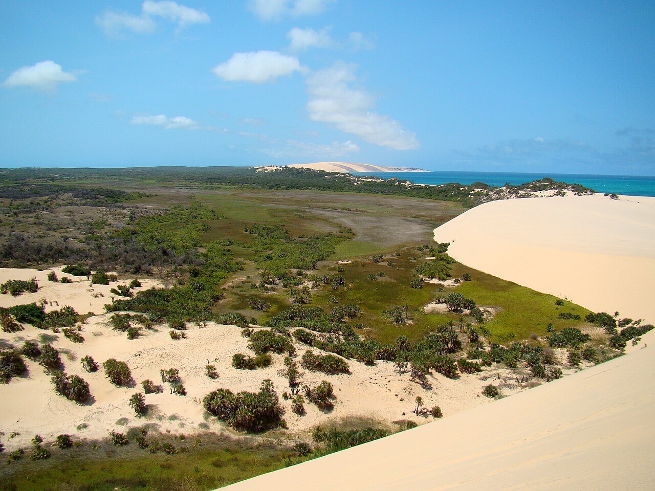
Bazaruto’s dunes and island shores lie offshore from Vilankulo, also written Vilanculos. Tofo is on the Inhambane coast, while Inhaca lies across Maputo Bay. Gorongosa introduces central floodplains and wildlife restoration, and the Chimanimani mountains include Mount Binga on the Zimbabwe border. Ponta do Ouro lies near South Africa in the far south. Pins mark representative learning locations rather than gates or routes; marine conditions, seasonal closures, entry requirements and regional security need separate checks before a visit.
People & Society of Mozambique
Communities across regions, writers, artists and an Olympic champion.
- Who won Mozambique’s first Olympic gold medal?
- Maria de Lurdes Mutola, in the women’s 800 metres at Sydney 2000.
- Who wrote Sleepwalking Land?
- Mia Couto; its Portuguese title is Terra Sonâmbula.
- Why is Paulina Chiziane important in literature?
- Her 1990 book was the first novel by a Mozambican woman; she also won the 2021 Camões Prize.
More about Mozambique: people & society
Mozambican communities have diverse languages, histories, religions and livelihoods. Makhuwa and Lomwe communities are especially associated with the north; Sena and Ndau with parts of the centre; and Changana, Ronga and Chopi with parts of the south. These broad associations are not fixed boundaries: migration, cities and families connect regions. Christianity, Islam and varied ancestral practices are part of social life, sometimes overlapping. Coastal towns also reflect long connections with South Asia and the wider Indian Ocean.
Maria de Lurdes Mutola won the women’s 800 metres at the Sydney Olympics in 2000, Mozambique’s first Olympic gold. Maria Mutola and Lurdes Mutola refer to the same athlete. Mia Couto wrote Terra Sonâmbula, translated as Sleepwalking Land. Paulina Chiziane’s Balada de Amor ao Vento, published in 1990, was the first novel by a Mozambican woman; she received the Camões Prize in 2021. Poet José Craveirinha, artist Malangatana and humanitarian Graça Machel are other influential figures, without exhausting the country’s many public voices.