Facts about Kenya
Kenya crosses the equator from the Indian Ocean coast to the highlands, Rift Valley and dry northern plains. Nairobi is its capital, Mombasa its main port, and Kisumu a gateway to Lake Victoria. Its 47 counties connect many communities whose languages, food, music and histories give each region its own character.
- Capital
- Nairobi
- Population (2019 census)
- 47.6 million
- Currency
- Kenyan shilling (KES)
- Official languages
- Kiswahili and English
- Divisions
- 47 counties
- Highest point
- Mount Kenya, 5,199 m
Kenya · 0 of 20 rounds passed
Two timed rounds per topic, 20 seconds a question
Nairobi sits in the southern highlands, with Mount Kenya to the north and the Rift Valley to the west. Tea grows around Kericho, farms spread across the central and western uplands, and the country becomes drier toward Turkana, Marsabit and the northeast. Kenya borders Uganda, South Sudan, Ethiopia, Somalia and Tanzania. Lake Victoria is shared with Uganda and Tanzania; Lake Turkana reaches into Ethiopia.
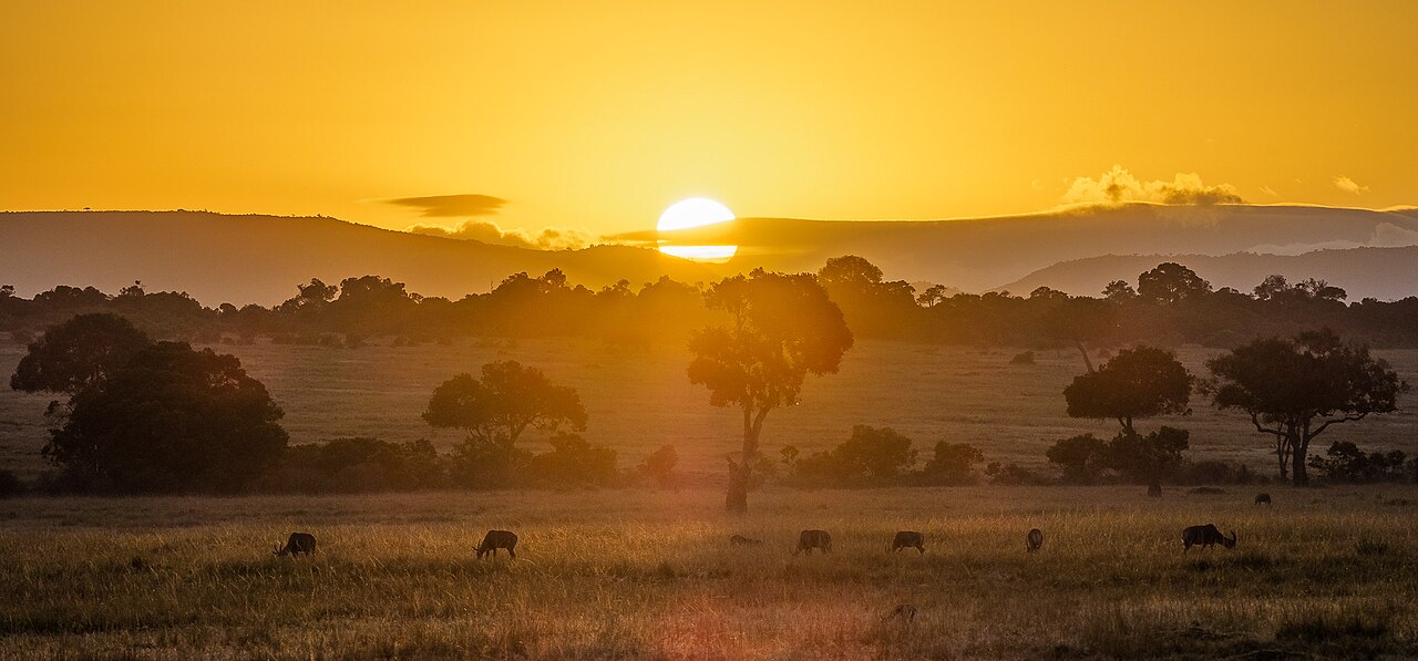
On the coast, Mombasa, Malindi and Lamu tell stories of Swahili urban life and Indian Ocean trade. Inland, the Maasai Mara connects with Tanzania’s Serengeti ecosystem, while Amboseli lies near the Tanzanian border. Kilimanjaro is in Tanzania, even though it is often photographed from Amboseli in Kenya. The country’s wildlife landscapes sit alongside working farms, busy cities and pastoral communities.
Geography of Kenya
The equator, cool highlands, a rift valley and two very different lake shores.
- What is Kenya’s highest mountain?
- Mount Kenya, whose highest peak, Batian, reaches 5,199 metres.
- Why is Nairobi cooler than the coast?
- Nairobi stands at a higher elevation. Altitude lowers temperatures despite Kenya’s equatorial location.
- Which countries share Lake Victoria?
- Kenya, Uganda and Tanzania.
- Where is Lake Turkana?
- In the dry north of Kenya, with its northern end extending into Ethiopia.
More about Kenya: geography
Kenya’s position on the equator does not mean that every place has the same climate. Nairobi and the central highlands are cooler than the coast because they stand at higher elevations. The Indian Ocean coast is warm and humid, while much of the north and east is dry. Rainfall and altitude influence where crops grow and where pastoral livelihoods predominate.
Mount Kenya rises to 5,199 metres at Batian, the country’s highest point and Africa’s second-highest mountain. The Rift Valley cuts through western Kenya, with lakes and volcanic landscapes along its floor. Lake Victoria lies farther west, shared with Uganda and Tanzania. In the north, most of Lake Turkana lies within Kenya, with its northern end in Ethiopia.
History of Kenya
Coastal trade, colonial rule, the Mau Mau uprising and independence in 1963.
- When did Kenya become independent?
- On 12 December 1963. It became a republic in 1964.
- How did Nairobi begin?
- It grew around a railway depot founded in 1899 during British colonial rule.
- What was the Mau Mau uprising?
- An armed struggle against British colonial rule, linked to grievances over land and political rights.
- What changed with the 2010 Constitution?
- It established a new constitutional framework and devolved government to 47 counties.
More about Kenya: history
Swahili towns developed along the coast through connections between African communities and Indian Ocean traders. Lamu and Mombasa preserve traces of that maritime history. Portuguese and Omani influence followed, and Britain established the East Africa Protectorate in 1895. The railway from the coast toward Lake Victoria helped Nairobi grow from a depot founded in 1899 into a colonial administrative centre.
Colonial land policies and restrictions on African political rights produced deep grievances. The Mau Mau uprising and the emergency declared in 1952 brought armed resistance, detention and violence. Kenya became independent on 12 December 1963 and a republic a year later, with Jomo Kenyatta as president. Multiparty politics returned in the 1990s. The 2010 Constitution later changed the structure of government through devolution.
Languages of Kenya
Kiswahili and English connect a country with many community languages.
- What are Kenya’s official languages?
- Kiswahili and English. Kiswahili is also the national language.
- What language family does Swahili belong to?
- Swahili is a Bantu language, despite having vocabulary borrowed from Arabic and other languages.
- What is Sheng?
- An evolving urban speech variety drawing on Swahili, English and other languages.
- Which language can I practise here?
- Everyday Swahili, through ten lessons covering greetings, food, directions and other essentials.
More about Kenya: language
The 2010 Constitution identifies Kiswahili as the national language and makes Kiswahili and English the official languages. Swahili is a Bantu language widely used across East Africa. Its vocabulary reflects longstanding contact with Arabic and other languages, but its grammar and underlying structure are Bantu. English is also used in education, government, business and the media.
Kikuyu, Dholuo, Kamba, Somali and the languages grouped under Luhya and Kalenjin are among Kenya’s many community languages. Sheng is an evolving urban speech variety associated especially with young people, drawing on Swahili, English and other languages. The Words section introduces everyday Swahili. It offers a starting point for communication alongside Kenya’s wider linguistic diversity.
Culture of Kenya
Music, storytelling, literature and a strong tradition of distance running.
- What is benga?
- A Kenyan popular music style associated especially with Luo musical traditions.
- Which Kenyan places are linked with distance running?
- Eldoret and Iten are well-known training centres in the western highlands.
- What craft is the Kisii region known for?
- Carving soapstone into decorative and everyday objects.
- Who was Ngũgĩ wa Thiong’o?
- A Kenyan writer whose work brought Kenyan stories and questions about language to international readers.
More about Kenya: culture
Kenyan cultural life varies across regions and communities. Benga developed especially through Luo musical traditions, while taarab reflects the coast’s Swahili and Indian Ocean connections. Contemporary urban music brings new styles and languages into that mix. Oral storytelling and written literature both matter; Ngũgĩ wa Thiong’o’s work helped bring Kenyan stories and debates about language to an international readership.
Distance running gives Kenya a prominent place in world sport, with training centres around Eldoret and Iten in the western highlands. Football is also widely followed. Beadwork, carved soapstone from the Kisii region and coastal woodcarving express different craft traditions. Nairobi’s cultural scene connects these regional histories with theatre, visual art, film, fashion and music made for new audiences.
Economy of Kenya
Tea and horticulture, a regional port and everyday mobile payments.
- What are some of Kenya’s agricultural exports?
- Tea, coffee and horticultural products, including flowers.
- What is M-Pesa?
- A mobile money service launched in Kenya in 2007, used for transfers and payments.
- Why is Mombasa important to trade?
- Its port serves Kenya and neighbouring inland countries.
- Which sector has the largest share of Kenya’s economy?
- Services, including trade, finance, transport and other activities.
More about Kenya: economy
Tea, coffee and horticulture connect Kenyan farms with overseas markets. Kericho’s tea fields and flower-growing areas around Naivasha show different sides of commercial farming. Small farms also supply food for local markets, while livestock keeping supports many households in drier regions. Rainfall, access to water and the cost of inputs all affect livelihoods.
Services account for the largest share of Kenya’s economy. Nairobi is a regional centre for finance and business, and Mombasa’s port serves Kenya and neighbouring inland countries. Tourism links cities and coastal towns with wildlife landscapes. M-Pesa, launched in Kenya in 2007, helped make mobile money part of everyday payments. Small businesses and informal work remain important sources of income.
Politics of Kenya
A national government and 47 county governments under the 2010 Constitution.
- How many counties does Kenya have?
- 47 counties under the 2010 Constitution.
- What are Kenya’s two parliamentary chambers?
- The National Assembly and the Senate.
- How long is a presidential term?
- Five years, with a constitutional limit of two terms.
- When were the first county elections held?
- In 2013, as the devolved county governments were established.
More about Kenya: politics
Kenya is a republic under the Constitution adopted in 2010. The president is head of state and government, elected for a five-year term and limited to two terms. Parliament has two chambers: the National Assembly and the Senate. The Senate represents the counties and helps protect their interests within the national system.
Devolution brought elected county governors and county assemblies to all 47 counties, with the first county elections in 2013. National and county governments have different responsibilities, including roles in public services and development. Counties replaced the former provinces as the main units in this devolved system. Their boundaries and powers are a useful starting point for understanding how public decisions reach local communities.
Wildlife of Kenya
Savannas, mountain forests, lake habitats and Indian Ocean reefs.
- How are the Maasai Mara and Serengeti connected?
- They form parts of a wider ecosystem across Kenya and Tanzania, used by migrating wildlife.
- Is Kilimanjaro in Kenya?
- Kilimanjaro is in Tanzania. It can be seen from Amboseli in Kenya.
- What makes Nairobi National Park distinctive?
- It protects wildlife habitat directly beside Kenya’s capital.
- Does Kenya have habitats beyond savanna?
- Yes. Its habitats include mountain forests, tropical forest, lakes, mangroves and coral reefs.
More about Kenya: nature & wildlife
The Maasai Mara is part of the larger Mara–Serengeti ecosystem shared with Tanzania. Wildebeest and other grazing animals move through this landscape as grazing and water conditions change. Amboseli is known for elephants and views toward Kilimanjaro across the Tanzanian border. Tsavo’s two national parks protect extensive southeastern landscapes. Nairobi National Park preserves wildlife habitat beside the capital.
Kenya’s biodiversity extends beyond savanna. Mount Kenya and the Aberdares have mountain forests, Kakamega preserves tropical forest habitat, and the coast has mangroves and coral reefs. Conservation depends on connected habitats and on communities living around protected areas. Farming, livestock, roads and settlement can change wildlife routes, while drought and changing rainfall affect both people and ecosystems.
Kenyan cuisine
Ugali and greens, nyama choma, coastal spices and food from the lake.
- What is ugali?
- A firm maize porridge eaten with vegetables, meat, fish or sauces.
- What does nyama choma mean?
- Roasted meat.
- What is githeri?
- A dish combining maize and beans.
- How does coastal cooking differ?
- Coconut, spices and seafood are prominent, with rice dishes such as pilau and biryani.
More about Kenya: food & cuisine
Ugali is a firm maize porridge commonly served with vegetables, meat, fish or a sauce. Sukuma wiki is a dish of cooked leafy greens, and nyama choma means roasted meat. Githeri combines maize and beans. Chapati is widely eaten, showing how food traditions travel and become part of everyday local cooking.
Coastal meals often use coconut, spices and seafood, with pilau and biryani among familiar rice dishes. Around Lake Victoria, fish is an important part of many meals. Tea is widely served, often with milk, and mandazi are fried dough snacks. Ingredients and cooking styles vary by household, region and community, so a handful of well-known dishes can only introduce Kenya’s food traditions.
Landmarks of Kenya
Swahili towns, mountain landscapes and heritage beside the Rift Valley lakes.
- What is Lamu Old Town known for?
- Its preserved Swahili urban heritage, including coral-stone buildings and narrow streets.
- Who built Fort Jesus?
- The Portuguese, in Mombasa in the late sixteenth century.
- Which lakes form the UNESCO-listed Kenya Lake System?
- Bogoria, Nakuru and Elementaita in the Great Rift Valley.
- What is Thimlich Ohinga?
- A historic dry-stone enclosed settlement in western Kenya.
More about Kenya: landmarks
Lamu Old Town preserves a Swahili settlement with coral-stone buildings, carved doors and narrow streets. Fort Jesus in Mombasa was built by the Portuguese in the late sixteenth century and records struggles over the coast’s trade routes. Gede, near Malindi, preserves the remains of another historic Swahili town. These places connect architecture with the Indian Ocean world.
Mount Kenya’s high peaks and surrounding forests form a World Heritage property. Other listed landscapes include the Lake Turkana National Parks and the Kenya Lake System in the Great Rift Valley, comprising lakes Bogoria, Nakuru and Elementaita. Thimlich Ohinga in western Kenya preserves a dry-stone enclosed settlement. The Sacred Mijikenda Kaya Forests connect coastal communities with places of cultural and spiritual importance.
People and society of Kenya
Many communities, growing cities and ties between urban and rural life.
- How many people were counted in Kenya’s 2019 census?
- About 47.6 million. This is a 2019 count, rather than a current estimate.
- Does one community represent all Kenyans?
- Kenya has many communities, with varied languages, histories and ways of life.
- How are cities and rural areas connected?
- Families, work, education, trade and migration link them.
- Are community identity and language the same thing?
- They can overlap, but a community label may cover several languages and does not define each person’s identity.
More about Kenya: people & society
The 2019 census counted about 47.6 million people in Kenya. This is a dated census count, rather than a current population estimate. The country includes Kikuyu, Luhya, Luo, Kalenjin, Kamba, Maasai, Somali, Mijikenda and many other communities. Broad community labels can include several languages and local histories, and they do not describe everyone’s individual identity.
Nairobi brings together people from across Kenya and elsewhere, while Mombasa’s communities reflect a long coastal history. Family, work and education connect cities with rural homes. Farming and pastoral livelihoods remain important alongside urban employment and small businesses. County, language, religion and family history overlap in different ways, making Kenya’s social geography richer than a single map of communities.