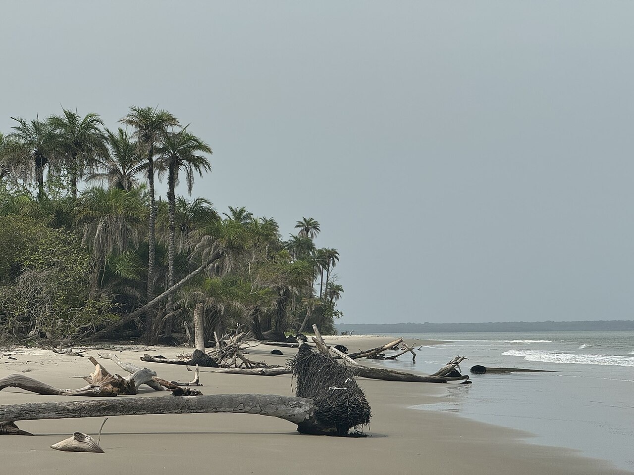
Facts about Guinea-Bissau
Explore Guinea-Bissau from the Geba estuary and Bissau to the eastern towns and the Bijagós islands.
- Capital
- Bissau
- Area
- About 36,100 km² (including waters)
- Currency
- West African CFA franc (XOF)
- Official language
- Portuguese
- Shared spoken language
- Kriol (Guinea-Bissau Creole)
- Independence declared
- 24 September 1973
Guinea-Bissau · 0 of 20 rounds passed
Two timed rounds per topic, 20 seconds a question
Bissau is the capital and principal port. Bafatá and Gabú anchor the east; Cacheu and São Domingos lie in the northwest. Bolama and Bubaque introduce the island world.
Learn eight administrative regions and the autonomous sector of Bissau, sixteen cities and towns, and major rivers and Atlantic waters. Maps use generalized geometry and approximate settlement centres.
Geography of Guinea-Bissau
Low coastal plains, tidal rivers and the Bijagós islands.
- Which countries border Guinea-Bissau?
- Senegal to the north and Guinea to the south and east.
- How many first-level administrative units are there?
- Eight regions plus the autonomous sector of Bissau, making nine units.
- Where are the Bijagós islands?
- Off the Atlantic coast, southwest of Bissau.
More about Guinea-Bissau: geography
Guinea-Bissau lies on West Africa’s Atlantic coast, between Senegal to the north and Guinea to the south and east. The mainland rises gently from mangrove-fringed estuaries toward the eastern interior. The Bijagós archipelago lies offshore, southwest of Bissau. A rainy season and a long dry season shape farming, river flows and transport.
The country has eight regions—Bafatá, Biombo, Bolama, Cacheu, Gabú, Oio, Quinara and Tombali—and the autonomous sector of Bissau. These are administrative regions, rather than federal states. Bissau stands beside the Geba estuary; Bafatá and Gabú anchor the east, while Bolama and Bubaque connect the island world.
History of Guinea-Bissau
Kaabu, Portuguese colonial rule and a liberation struggle.
- What was Kaabu?
- A precolonial state connected to the wider Mandé world.
- Who helped lead the independence movement?
- Amílcar Cabral, a founder and leader of the PAIGC.
- Why do independence accounts mention both 1973 and 1974?
- Independence was declared in 1973 and recognised by Portugal in 1974.
More about Guinea-Bissau: history
The region’s history reaches back through farming communities, coastal trade and the Kaabu state, which developed in the wider Mandé world. Portuguese traders arrived in the fifteenth century, but coastal presence did not mean control of the interior. Colonial conquest, forced labour and resistance changed relationships between communities and the colonial administration.
Amílcar Cabral helped found the PAIGC, which led an armed independence struggle in Portuguese Guinea while also seeking liberation for Cape Verde. Cabral was assassinated in 1973. Guinea-Bissau declared independence on 24 September 1973; Portugal recognised it in September 1974. The 1980 coup ended plans for political union with Cape Verde, and the 1998–99 conflict disrupted the country again.
Languages of Guinea-Bissau
Portuguese is official; Kriol connects everyday conversation.
- Which language is official?
- Portuguese.
- What is Kriol?
- Guinea-Bissau Creole, a distinct language widely used in daily communication.
- Do general Portuguese lessons teach all local languages?
- No. Kriol and community languages have their own histories and structures.
More about Guinea-Bissau: language
Portuguese is the official language of Guinea-Bissau and is used in government and formal education. Guinea-Bissau Creole, usually called Kriol, is widely used as a shared spoken language. Its vocabulary draws heavily on Portuguese, but it is a distinct language with its own grammar and history.
Balanta, Fula, Mandinka, Manjaco, Papel, Bijagó and other community languages also belong to everyday life. Language use varies by place, family, generation and setting. Worldly’s linked Portuguese lessons introduce general Portuguese; they do not teach Kriol or replace the country’s other languages.
Culture of Guinea-Bissau
Gumbe rhythms, carnival and island traditions.
- Which musical tradition is associated with Guinea-Bissau?
- Gumbe.
- What does Bissau’s carnival bring together?
- Neighbourhood groups, costumes, masks, music and dance.
- Why should visitors ask before entering ceremonial places?
- Communities maintain their own rules concerning sacred places, ceremonies and photography.
More about Guinea-Bissau: culture
Gumbe is closely associated with Guinea-Bissau’s popular music and dance. Musicians draw on local rhythms, sung storytelling and modern instruments; musical exchange also links the country to Cape Verde and other West African societies. Bissau’s carnival brings neighbourhood groups, costumes, masks and performance into the streets.
The mainland and islands hold many different ceremonial and artistic traditions. In Bijagó communities, knowledge of land, sea and sacred places is passed through social institutions and generations. A mask or ceremony belongs to a particular community and context: visitors should ask before photographing people or entering places with customary restrictions.
Economy of Guinea-Bissau
Cashews, rice, fisheries and a narrow export base.
- Which export crop is especially important?
- Cashew nuts.
- Why does dependence on raw cashew exports create risk?
- Household incomes and export earnings are exposed to harvest conditions and international prices.
- Which currency is used?
- The West African CFA franc (XOF).
More about Guinea-Bissau: economy
Cashew nuts are central to Guinea-Bissau’s merchandise exports and to income for many farming households. Selling much of the harvest as raw nuts leaves the economy exposed to changes in international prices, harvest conditions and trading arrangements. Local processing could retain more value, but electricity, finance and transport constrain businesses.
Rice cultivation, fishing, livestock and small-scale trade support everyday livelihoods. Mangrove rice fields require careful management of salt water and fresh water. Bissau’s port connects producers with international markets. The country uses the West African CFA franc, shared with other members of the West African monetary union.
Politics of Guinea-Bissau
Civilian institutions, military intervention and local administration.
- What is the national legislature called?
- The National People’s Assembly.
- Why distinguish constitutional offices from current authorities?
- Military interventions and political transitions can interrupt the normal constitutional framework.
- Are the regions federal states?
- No. They are administrative regions, alongside the autonomous sector of Bissau.
More about Guinea-Bissau: politics
Guinea-Bissau’s constitutional framework provides for a president, a government led by a prime minister and a National People’s Assembly. Its post-independence politics have repeatedly been disrupted by coups, military intervention and disputes between institutions. Constitutional offices and the authorities exercising power at a particular moment must be distinguished. After the November 2025 elections, soldiers seized power before results were announced and suspended the electoral process, as documented in the World Bank’s 2026 country overview.
The eight regions and Bissau’s autonomous sector form the first level of administration; regions are divided into sectors. Public services, accountable civilian government and economic security are recurring concerns. This guide explains the institutional framework and historical patterns rather than presenting a changing list of officeholders.
Nature & Wildlife of Guinea-Bissau
Mangroves, turtle beaches and a World Heritage seascape.
- Which habitats make the coast important for wildlife?
- Mangroves, tidal flats, shallow marine waters and nesting beaches.
- When was the Bijagós coastal and marine property inscribed by UNESCO?
- In 2025.
- Does the World Heritage listing cover the whole country?
- No. It covers the defined Coastal and Marine Ecosystems of the Bijagós Archipelago – Omatí Minhô property.
More about Guinea-Bissau: nature & wildlife
The Bijagós islands, tidal flats, mangroves and shallow waters support fisheries, migratory birds and marine turtles. Orango is known for a coastal population of hippopotamuses, while João Vieira and Poilão include important turtle nesting habitat. Conservation depends on island communities and the customary knowledge and livelihoods connected with these ecosystems.
UNESCO inscribed the Coastal and Marine Ecosystems of the Bijagós Archipelago – Omatí Minhô on the World Heritage List in 2025. This is a defined marine and island property, not a claim that every island or the whole country is listed. Mainland protected landscapes include the Cacheu mangroves, Cantanhez forests and Cufada lagoons.
Food & Cuisine of Guinea-Bissau
Rice, fish, groundnut sauces and market produce.
- Which staple commonly accompanies a meal?
- Rice.
- What gives caldo de mancarra its characteristic base?
- Groundnuts, also called peanuts.
- What does a cashew tree provide besides nuts?
- Cashew apples, which can be eaten or used in drinks.
More about Guinea-Bissau: food & cuisine
Rice is a staple in Guinea-Bissau, served with fish, vegetables or meat and different sauces. Groundnuts, palm products, okra and leafy greens appear in regional cooking. Coastal communities draw on fish and shellfish, while inland farming and seasonal markets supply other ingredients.
Caldo de mancarra is a groundnut-based sauce or stew, often served with rice and prepared with different proteins or vegetables. Cashew trees provide both nuts and fleshy cashew apples, which are also used in drinks. Recipes vary between households and communities; one dish cannot represent all the country’s food traditions.
Landmarks of Guinea-Bissau
Bissau, Cacheu, Bolama and protected island landscapes.
- Which town preceded Bissau as the colonial capital?
- Bolama.
- What history should accompany discussion of Cacheu’s fort?
- Atlantic trade and the slave trade, including their violence and human consequences.
- What do the sight pins represent?
- Approximate learning locations, not access permissions, routes or entrances.
More about Guinea-Bissau: landmarks
Bissau Velho, Amura Fortress and the cathedral introduce the capital’s colonial and post-independence histories. Amura is associated with the memory of Amílcar Cabral and also has a military role; it is not an unrestricted visitor site. Cacheu’s fort and river setting speak to Atlantic trade and the violence of the slave trade.
Bolama was the colonial capital before Bissau and retains buildings from that period. Bubaque is an island settlement and transport centre in the Bijagós. Beyond towns, Orango, the João Vieira–Poilão islands, Cufada and Cantanhez illustrate the connections between heritage, habitat and community life. Map pins indicate approximate learning locations, not landing points, entrances or routes.
People & Society of Guinea-Bissau
Many communities linked by families, markets and migration.
- Can one language or community stand for everyone in Guinea-Bissau?
- No. The country includes many communities and overlapping identities.
- What links rural settlements, islands and Bissau?
- Family ties, markets, schooling, transport and migration.
- Who was José Carlos Schwarz?
- A musician and poet associated with Guinea-Bissau’s modern cultural history.
More about Guinea-Bissau: people & society
Balanta, Fula, Mandinka, Manjaco, Papel and Bijagó are among Guinea-Bissau’s many communities. Identities, language and religion overlap in ways that cannot be reduced to a single national stereotype. Muslim, Christian and local religious traditions are present, and practice varies between families and places.
Bissau draws people from across the country, while farming settlements and island communities maintain strong local ties. Trade, schooling and migration connect these places with one another and with diasporas abroad. Amílcar Cabral’s writing and activism and the music of José Carlos Schwarz are important parts of the country’s wider intellectual and cultural legacy.