Facts about Myanmar
Explore Myanmar through the Ayeyarwady valley, Bagan’s temple plains, Shan uplands and the long Andaman coast. Discover the histories, languages and food traditions behind the maps, from Yangon and Mandalay to the ancient Pyu cities and the Myeik Archipelago.
- Capital
- Nay Pyi Taw
- Currency
- Kyat (MMK)
- Administrative areas
- 7 states, 7 regions, 1 union territory
- Official language
- Burmese
- Independence
- 4 January 1948
- UNESCO World Heritage
- 2 properties
Myanmar · 0 of 20 rounds passed
Two timed rounds per topic, 20 seconds a question
Myanmar, also known as Burma, lies between South and Southeast Asia. Bangladesh and India border the west, China the north and northeast, and Laos and Thailand the east. The Bay of Bengal and Andaman Sea open to the Indian Ocean. Nay Pyi Taw is the capital; Yangon is the former capital and a major commercial centre. Mandalay stands beside the Ayeyarwady in the central dry zone.
Seven states, seven regions and Nay Pyi Taw Union Territory form the fifteen first-level areas in this guide. Their reference boundaries do not show military control or ethnic homelands. Conflict since the February 2021 coup, mass displacement and the March 2025 earthquake have profoundly affected communities and heritage. The maps, descriptions and older photographs support learning; they do not establish present conditions or safe visitor access.
Geography of Myanmar
A great river valley connects northern mountains, a central dry zone and a broad delta.
- How many first-level administrative areas are shown?
- Fifteen: seven states, seven regions and Nay Pyi Taw Union Territory. They are reference areas, not a map of current control.
- Are Ayeyarwady and Irrawaddy different rivers?
- They are names for the same river. Its central valley and delta connect a large part of Myanmar.
- Why is central Myanmar called the dry zone?
- Western mountains intercept monsoon moisture, leaving the central interior drier than exposed coastal areas.
History of Myanmar
Pyu cities, Bagan and later kingdoms precede colonial rule and independence in 1948.
- Which three cities form the Pyu World Heritage property?
- Beikthano, Halin and Sri Ksetra. They represent early urban societies in the Ayeyarwady basin.
- When did Myanmar become independent?
- On 4 January 1948, following British colonial rule and the Second World War.
- Did Aung San live to see independence?
- No. He helped negotiate independence but was assassinated in 1947, before independence in 1948.
Burmese and Myanmar’s other languages
Burmese connects many communities, alongside Shan, Karen, Kachin, Chin, Mon and other languages.
- What does the linked language course teach?
- Burmese, the official language and a widely used shared language. Myanmar has many other languages.
- Are Shan and Mon varieties of Burmese?
- No. Shan is a Tai language and Mon is Austroasiatic; Burmese belongs to the Sino-Tibetan family.
- Do Kachin and Chin each describe only one language?
- No. These community labels can encompass several distinct languages. They should not be treated as single uniform speech communities.
Culture of Myanmar
Thingyan, lacquerware, longyi and many regional performance traditions.
- What does Thingyan celebrate?
- The traditional New Year, with water-related celebrations, charitable acts and religious observances that vary by community.
- What is a longyi?
- A length of cloth worn around the waist, with different styles and ways of tying it.
- What is the saung?
- A curved harp associated with Myanmar’s musical traditions. It is different from the drums and gongs used in ensembles.
Economy of Myanmar
Rice farming, garment production, natural gas and border trade depend on fragile connections.
- What is Myanmar’s currency?
- The kyat, abbreviated MMK. The guide does not give a fixed exchange rate.
- Which crops connect the delta and dry zone with markets?
- Rice is especially associated with the delta, while pulses, beans and sesame are important dry-zone crops.
- Why is Yangon economically important?
- It is a major commercial and port centre. Trade and manufacturing depend on transport, power and financial connections.
Politics of Myanmar
The 2021 coup intensified a long struggle over military power, representation and federalism.
- What happened on 1 February 2021?
- The military seized power and detained civilian leaders, interrupting the elected government and intensifying conflict.
- Did all armed conflict begin in 2021?
- No. Ethnic armed organisations and struggles over autonomy and federalism long predate the coup.
- Does the administrative map show who controls each place?
- No. It shows reference boundaries and does not establish front lines, current authorities or safe movement.
Nature & Wildlife of Myanmar
High mountains, freshwater wetlands, mangroves and island habitats support varied wildlife.
- Where are Indawgyi and Inle lakes?
- Indawgyi is in Kachin State, and Inle is in Shan State. Both are important freshwater landscapes.
- Which dolphin has a river population in the Ayeyarwady?
- The Irrawaddy dolphin. Habitat and fishing pressures affect this river population.
- What major natural disaster struck in March 2025?
- A destructive earthquake on 28 March affected central Myanmar, including Mandalay and Sagaing.
Food & Cuisine of Myanmar
Mohinga, fermented tea-leaf salad and noodle dishes reflect a varied regional kitchen.
- What is mohinga?
- Rice noodles in a fish-based broth, with ingredients and accompaniments varying by cook. It is often a breakfast dish.
- What is the central ingredient of lahpet thoke?
- Fermented tea leaves, combined with crunchy additions and other salad ingredients.
- What is ngapi?
- A fermented fish or shrimp paste, used in different forms and regional recipes.
Landmarks of Myanmar
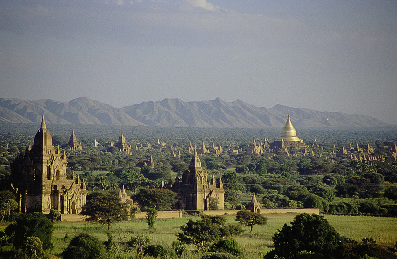
Bagan and the three Pyu ancient cities form two World Heritage inscriptions.
- How many World Heritage properties does Myanmar have?
- Two: Bagan and the Pyu Ancient Cities. Components of a serial property are not separate inscriptions.
- When was Bagan inscribed on the World Heritage List?
- In 2019. Its eight components form a single property and a continuing religious landscape.
- Are all sights on this map World Heritage properties?
- No. The selection also includes other religious, archaeological and natural landscapes. Pins do not confirm safe access.
People & Society of Myanmar
Many communities, overlapping identities and a diaspora shaped by work, study and forced displacement.
- Are all people from Myanmar Bamar?
- No. Bamar names a particular majority community, while Myanmar includes many different communities and identities.
- Where did many Rohingya seek refuge in 2017?
- In neighbouring Bangladesh, after persecution and violence drove mass forced displacement from Myanmar.
- Why avoid precise current ethnic percentages?
- Identities overlap, census coverage is limited and mass displacement makes older estimates unreliable as current population shares.