Facts about Papua New Guinea
Explore Papua New Guinea through Highland gardens, Sepik river communities, island societies and the languages and histories that connect them.
- Capital
- Port Moresby
- Currency
- Kina (PGK); 100 toea
- Languages
- 800+; Tok Pisin widely used
- Government
- Parliamentary constitutional monarchy
- Highest point
- Mount Wilhelm, about 4,509 m
- Independence
- 16 September 1975
Papua New Guinea · 0 of 20 rounds passed
Two timed rounds per topic, 20 seconds a question
Start with Port Moresby on the southern mainland, then cross the Owen Stanley Range to Popondetta and Lae. The Highlands Highway connects Lae with Goroka, Kundiawa, Mount Hagen and the western Highland towns. Madang, Wewak and Vanimo face the north coast. The Sepik and Fly drain very different lowland landscapes, while Alotau looks towards the islands of Milne Bay.
Beyond the mainland, find Kokopo and Rabaul on New Britain, Kavieng on New Ireland and Lorengau on Manus. Buka and Arawa belong to the Autonomous Region of Bougainville. A map game covers twenty cities and towns, while sixteen sight pins introduce archaeology, wartime memory, islands and mountain landscapes. Ten illustrated topics share their reading with the facts course. PNG’s many languages are discussed here; a dedicated language course is not currently available.
A mountainous mainland and far-reaching islands
Follow the Highlands, Sepik and Fly, then cross to New Britain, New Ireland, Manus and Bougainville.
- Is Papua New Guinea the whole island of New Guinea?
- No. Papua New Guinea occupies the eastern part and includes offshore islands. The western part of New Guinea belongs to Indonesia.
- Why is flying important within Papua New Guinea?
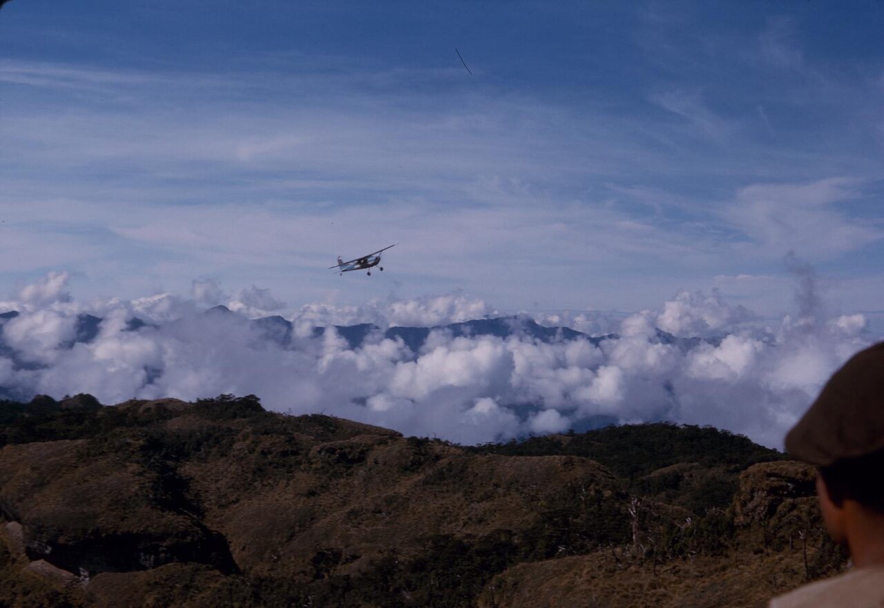
- Mountains, rivers and scattered islands make transport difficult. Port Moresby has no continuous road connection to the Highlands–Lae highway network.
- Where is Mount Wilhelm?
- In the central Highlands, near the meeting of Simbu, Jiwaka and Madang provinces. At about 4,509 metres it is PNG’s highest mountain, rather than the highest on the whole island of New Guinea.
More about Papua New Guinea: geography
Papua New Guinea occupies the eastern part of New Guinea, sharing a land border with Indonesia, and includes many islands to the north and east. Port Moresby stands on the southern coast beside the Gulf of Papua. Across the Owen Stanley Range, Lae faces the Huon Gulf on the northern side of the mainland. Roads connect the Highlands with Lae, but the capital is not linked to that network by a continuous highway. Air and sea transport therefore connect places that can look deceptively close on a map.
The Sepik winds through the northern lowlands, while the Fly drains towards the southern coast. Mount Wilhelm, about 4,509 metres high, is the country’s highest mountain; higher peaks stand in Indonesian New Guinea. New Britain and New Ireland form the largest islands of the Bismarck Archipelago. Manus lies farther north. Bougainville and Buka belong geographically to the Solomon Islands archipelago but politically to Papua New Guinea. The independent country called Solomon Islands is a different state.
Ancient gardens and a young independent state
Kuk’s agricultural landscape predates colonial borders by thousands of years.
- When did Papua New Guinea become independent?
- On 16 September 1975. It became independent from Australia, with Michael Somare as its first prime minister.
- What does Kuk reveal about early history?
- Kuk preserves evidence of long-term wetland cultivation and drainage in the Highlands. It demonstrates an early independent agricultural tradition, thousands of years before colonial rule.
- Why is the Kokoda Track historically important?
- It was the setting of a major 1942 campaign between Japanese and Allied forces. Papua New Guinean carriers, guides and other workers played essential roles, often under very harsh conditions.
More about Papua New Guinea: history
People have lived in New Guinea for tens of thousands of years. At Kuk, in the Wahgi Valley, archaeological evidence records wetland use, cultivation and changing drainage systems over millennia. The site documents an early, independent development of agriculture, including evidence associated with banana cultivation. Communities elsewhere developed their own farming, fishing, trading and seafaring traditions. These histories are much older than the national border or the first European descriptions of the island.
In the late nineteenth century, Germany claimed northeastern New Guinea and nearby islands, while Britain established control over southeastern Papua, later administered by Australia. Australia occupied German New Guinea during the First World War and subsequently administered it under international mandates and trusteeship arrangements. The Second World War brought devastating fighting, including the 1942 Kokoda campaign and battles around Buna, Gona and Lae. The territories were brought under a joint postwar administration. Papua New Guinea became independent from Australia on 16 September 1975, with Michael Somare as its first prime minister.
Hundreds of languages, and bridges between them
Tok Pisin connects many communities, alongside English, Hiri Motu, sign language and local languages.
- Is Tok Pisin simply English with a different accent?
- No. It has its own grammar and history as a contact language. Much of its vocabulary comes from English, but speaking English does not mean someone already speaks Tok Pisin.
- Is Papuan one language family?
- No. It is a broad term for New Guinea’s non-Austronesian languages, which belong to many different families and include isolates.
- What does tenkyu mean?
- It means thank you in Tok Pisin. PNG also has hundreds of local languages, so greetings and everyday expressions vary between communities.
More about Papua New Guinea: language
More than 800 living languages are commonly reported for Papua New Guinea, although counts depend on how languages and varieties are classified. Both Austronesian and numerous non-Austronesian languages are spoken. “Papuan” is a broad label for the latter, not the name of one language or a single language family. Local languages carry knowledge about land, kinship, stories and ecological relationships; small speaker numbers do not make that knowledge less complex.
Tok Pisin is widely used between communities and has its own grammar, despite much of its vocabulary having English origins. English has major roles in government and education. Hiri Motu developed in southern coastal networks and is distinct from the Motu language from which it draws. Papua New Guinean Sign Language received official recognition in 2015. Tok Pisin expressions such as tenkyu, meaning thank you, are useful introductions, but no single spoken language represents every household. Worldly does not currently offer a dedicated Tok Pisin or Hiri Motu course.
Bilum, singsing and knowledge carried by communities
Distinctive performances and everyday craft link creativity with place and relationships.
- What is a bilum?
- A looped bag used to carry belongings, food and other loads. Its making, patterns and use can also express identity, creativity and economic independence.
- What is a singsing?
- A gathering involving performance through music, dance and dress. Communities bring distinct traditions, so a festival should not be treated as a single dance shared by everyone.
- What was hiri trade?
- Voyaging networks in which Motu communities on the southern coast exchanged pottery for sago and other goods with Gulf communities. The journeys linked specialised skills and local economies.
More about Papua New Guinea: culture
A singsing brings people together through singing, dance and distinctive dress. Large gatherings such as the Goroka and Mount Hagen shows present performances from different communities, but they do not represent one uniform national tradition. Designs, songs and ceremonial objects can have specific owners and meanings. Sepik carving includes masks, figures and decorated houses associated with particular communities; an object displayed in a museum may have a different role from one used at home.
Bilum are looped bags made with natural or manufactured fibres. They carry food, belongings and sometimes babies, while their patterns and making also express skill, identity and livelihood. Tapa barkcloth traditions are particularly associated with places such as Oro Province. Along the southern coast, hiri trading voyages historically exchanged Motu pottery for sago and other goods. Contemporary artists, musicians and designers build on these local histories in towns, villages and overseas. Permission and context matter when photographing ceremonies or entering culturally significant places.
Gardens, markets and major resource exports
Household farming and local trade sit beside mining, liquefied natural gas and formal services.
- What currency does Papua New Guinea use?
- The kina, abbreviated PGK. One kina is divided into 100 toea.
- Does everyone work in mining or gas?
- No. Farming, fishing, local trade, public services and many other activities support livelihoods. Resource exports are important nationally but do not describe every household’s work.
- Why is Lae an important economic centre?
- Its port and industries connect the northern coast with the Highlands Highway. The city helps move agricultural produce, imports and other goods between inland communities and overseas markets.
More about Papua New Guinea: economy
Many households depend on smallholder farming, fishing and local markets as well as paid work. Sweet potato gardens are central in much of the Highlands, while cocoa, coffee, coconut products and palm oil connect growers with commercial supply chains. Coffee is strongly associated with the uplands; cocoa is important in several coastal and island regions. Markets bring growers and traders together, and income can depend on road conditions, shipping, storage and access to buyers.
Gold, copper and liquefied natural gas are important exports. Large resource projects generate revenue, employment and disputes over environmental damage, land rights and how benefits are shared. Export earnings do not automatically translate into reliable health care, schools or roads for every community. Port Moresby is a government and business centre, while Lae is a major port and industrial hub. The national currency is the kina, abbreviated PGK, divided into 100 toea. The Bank of Papua New Guinea is the central bank.
Parliamentary government and an autonomous region
The prime minister leads government; Bougainville has its own peace-agreement framework.
- Is Papua New Guinea a republic?
- It is a constitutional monarchy with a parliamentary system. The governor-general represents the monarch, and the prime minister heads the government.
- Is Bougainville part of the independent country Solomon Islands?
- No. Bougainville is an autonomous region of PNG, although geographically it belongs to the Solomon Islands archipelago. That archipelago extends beyond the independent state of Solomon Islands.
- Did the 2019 referendum automatically make Bougainville independent?
- No. Voters strongly supported independence, but the peace agreement also provides for government consultation and ratification by PNG’s National Parliament.
More about Papua New Guinea: politics
Papua New Guinea is a parliamentary democracy and constitutional monarchy. The monarch is head of state, represented by a governor-general, while the prime minister leads the government. The National Parliament has one chamber. Elections and parliamentary coalitions shape who forms a government; national institutions coexist with customary authority and local forms of leadership. Administrative structures include twenty provinces, the National Capital District and the Autonomous Region of Bougainville.
The Bougainville conflict caused severe loss of life and lasting social and economic damage. The 2001 Bougainville Peace Agreement established a framework involving autonomy, weapons disposal and a referendum. In the 2019 referendum, a large majority chose independence. The agreement provides for consultation between the governments and ratification by PNG’s National Parliament; the referendum itself did not automatically create an independent state. Bougainville’s autonomous government and the continuing political process should be distinguished from both an ordinary province and a completed change of sovereignty.
Birds-of-paradise, cloud forests and coral seas
Elevation and island isolation create habitats that differ sharply across the country.
- Are tree kangaroos found in Papua New Guinea?
- Yes. Several tree-kangaroo species inhabit New Guinea’s forests. Their ranges and conservation needs differ, and they are not the same as Australia’s familiar ground-dwelling kangaroos.
- Which bird appears on PNG’s flag?
- A bird-of-paradise, alongside the Southern Cross. Birds-of-paradise are associated with New Guinea’s forests and have important cultural meanings in different communities.
- Does PNG have coral reefs as well as mountains?
- Yes. Its mainland coasts and islands include reefs, mangroves and seagrass habitats, while the Highlands rise through forest into very different upland environments.
More about Papua New Guinea: nature & wildlife
Lowland rainforest, mountain forest, alpine grassland, mangroves and coral reefs support different wildlife communities. Birds-of-paradise are famous for elaborate displays, while cassowaries disperse forest seeds and tree kangaroos inhabit some forest regions. Many species have restricted ranges, but New Guinea’s biodiversity crosses the Indonesian border: a species associated with the island is not necessarily found only within PNG. The national flag shows a bird-of-paradise alongside the Southern Cross.
The Bismarck and Solomon seas connect reef, seagrass and open-water habitats. Community knowledge and customary tenure are important to conservation, including local rules for fishing and forest use. Logging, mining impacts, habitat clearance and warming seas create pressures that differ by place. Earthquakes, tsunamis, landslides and volcanic eruptions also shape the landscape. Tavurvur near Rabaul is an active volcano; an image or map pin is a learning reference, not evidence that a site is safe to approach.
Mumu, kaukau, sago and food from the sea
Meals reflect different gardens, river systems, island environments and family traditions.
- What is kaukau?
- Sweet potato. It is especially important in many Highland food systems, although its role varies between places and households.
- What is a mumu?
- A way of cooking with heated stones, often using leaves and a covering to retain heat. Ingredients and arrangements vary between communities and occasions.
- Is sago a type of rice?
- No. Sago is a starch extracted from the pith of certain palms. It is particularly important in some lowland and river communities.
More about Papua New Guinea: food & cuisine
Kaukau, or sweet potato, is an important staple in much of the Highlands. Taro, yams, bananas and leafy vegetables also feature in local diets. Sago, a starch processed from the pith of certain palms, is particularly important in some lowland communities. Coastal and island meals often include fish and coconut. These patterns overlap through trade and migration; one plate cannot represent every part of the country.
A mumu is a method of cooking with heated stones, often using leaves to cover or wrap vegetables, meat and other ingredients. It can bring people together for a shared meal, with preparations varying by place and occasion. Aibika is a leafy vegetable, distinct from the starchy crops beside it. Town markets sell seasonal produce alongside imported rice, tinned foods and other goods. The market photograph shows food trading in Gerehu, Port Moresby, rather than a single finished national dish.
Kuk’s gardens, Kokoda’s memory and Rabaul’s volcanoes
Archaeology, living culture and wartime remembrance give places different kinds of significance.
- What is PNG’s UNESCO World Heritage site?
- Kuk Early Agricultural Site, inscribed in 2008. Its wetland landscape preserves evidence of early cultivation and agricultural drainage systems.
- Are Rabaul and Kokopo the same town?
- No. They are separate towns in East New Britain. After the destructive 1994 eruptions around Rabaul, Kokopo became the provincial capital.
- Where is Bomana War Cemetery?
- Near Port Moresby. It commemorates Commonwealth service personnel who died in the Second World War and is distinct from Lae War Cemetery on the northern mainland.
More about Papua New Guinea: landmarks
Kuk Early Agricultural Site in the Wahgi Valley was inscribed on the UNESCO World Heritage List in 2008. It is an agricultural and archaeological landscape, not a monumental temple complex. Near Port Moresby, the National Museum and Art Gallery introduces cultural and historical collections, while Parliament House draws on architectural forms associated with traditional buildings, including Sepik ceremonial houses. Bomana War Cemetery commemorates Commonwealth service personnel who died during the Second World War.
The Kokoda Track crosses the Owen Stanley Range and links wartime history with the homelands and livelihoods of communities along it. Lae War Cemetery preserves another part of that history. Around Rabaul, volcanic landforms and the effects of the 1994 eruptions are central to the landscape; nearby Kokopo became the provincial capital. Elsewhere, the Sepik’s settlements, the Trobriand Islands and Milne Bay’s coasts offer distinct cultural and geographic contexts. These are learning locations, with local landholders, permissions and changing access conditions.
Many communities, shared citizenship
Wantok ties, urban life, creative work and local identities connect people in different ways.
- What does wantok mean?
- Literally associated with “one talk”, it refers to shared-language connections and more broadly to networks of belonging, support and responsibility.
- What are the Kumuls?
- Papua New Guinea’s men’s national rugby league team. Rugby league has a strong following across many parts of the country.
- Do Papua New Guineans share one local identity?
- They share nationality while having many local, linguistic, religious and regional identities. Urban life and movement between communities create further connections.
More about Papua New Guinea: people & society
Papua New Guineans share citizenship while belonging to many language communities, islands, regions and family networks. Wantok comes from “one talk” and can describe people connected by a shared language, extending more broadly to relationships of belonging and mutual support. Such networks help with care, accommodation and opportunities, while also bringing obligations. They are changing social relationships, rather than a simple explanation for every political or economic event.
Many people move between village homes, provincial centres and cities for education, work and family responsibilities. Churches, schools, markets, sport and music connect different generations. Rugby league has a large following, including support for the national team, the Kumuls. Writers and artists such as Vincent Eri and poet, scholar and public figure Nora Vagi Brash helped shape national cultural expression. Women’s market work, craft and community leadership are important alongside continuing debates over representation and equal opportunity.
More countries in Oceania